Blackbutt North

Last updated

Blackbutt North
Queensland
Australia Queensland location map.svg
Red pog.svg
Blackbutt North
Coordinates 26°51′54″S152°06′54″E / 26.865°S 152.115°E / -26.865; 152.115
Population451 (2021 census) [1]
 • Density36.67/km2 (95.0/sq mi)
Postcode(s) 4314
Area12.3 km2 (4.7 sq mi)
Time zone AEST (UTC+10:00)
Location
LGA(s) South Burnett Region
State electorate(s) Nanango
Federal division(s) Maranoa
Suburbs around Blackbutt North:
Taromeo Taromeo Taromeo
Nukku Blackbutt North Benarkin North
Blackbutt Blackbutt Benarkin

Blackbutt North is a rural locality in the South Burnett Region, Queensland, Australia. [2] In the 2021 census, Blackbutt North had a population of 451 people. [1]

Contents

Geography

The land use is predominantly rural residential, extending from the town of Blackbutt to the south. [3]

History

On 1 February 2018, Blackbutt North's postcode changed from 4306 to 4314. [4]

Demographics

In the 2016 census, Blackbutt North had a population of 438 people. [5]

In the 2021 census, Blackbutt North had a population of 451 people. [1]

Education

There are no schools in Blackbutt North. The nearest government primary schools are Blackbutt State School in neighbouring Blackbutt to the south and Benarkin State School in neighbouring Benarkin to the south-east. The nearest government secondary schools are Yarraman State School (to Year 9) in Yarraman to the west and Nanango State High School (to Year 12) in Nanango to the north-west. [6]

Related Research Articles

<span class="mw-page-title-main">Yarraman, Queensland</span> Town in Queensland, Australia

Yarraman is a rural town and locality in the Toowoomba Region, Queensland, Australia. In the 2021 census, the locality of Yarraman had a population of 1,127 people.
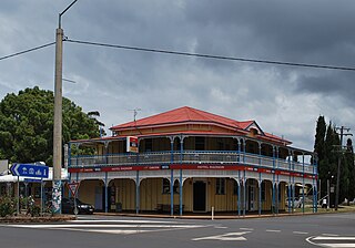
<span class="mw-page-title-main">Blackbutt, Queensland</span> Town in Queensland, Australia

Blackbutt is a rural town and locality in the South Burnett Region, Queensland, Australia. In the 2021 census, the locality of Blackbutt had a population of 799 people.

<span class="mw-page-title-main">Moore, Queensland</span> Town in Queensland, Australia

Moore is a rural town and locality in the Somerset Region, Queensland, Australia. In the 2021 census, the locality of Moore had a population of 286 people.

<span class="mw-page-title-main">Benarkin</span> Town in Queensland, Australia

Benarkin is a rural town and locality in the South Burnett Region, Queensland, Australia. The nearby town of Blackbutt is the origin of the town and the two towns are often referred to as the joint entity Blackbutt-Benarkin. In the 2021 census, the locality of Benarkin had a population of 61 people.
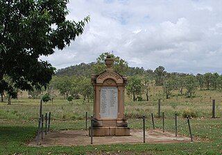
<span class="mw-page-title-main">Colinton, Queensland</span> Suburb of Somerset Region, Queensland, Australia

Colinton is a rural locality in the Somerset Region, Queensland, Australia. In the 2021 census, Colinton had a population of 60 people.
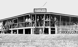
<span class="mw-page-title-main">Upper Yarraman, Queensland</span> Suburb of Toowoomba Region, Queensland, Australia

Upper Yarraman is a rural locality in the Toowoomba Region, Queensland, Australia. In the 2021 census, Upper Yarraman had a population of 80 people.

Pimpimbudgee is a rural locality in the South Burnett Region, Queensland, Australia. In the 2021 census, Pimpimbudgee had a population of 61 people.

Nukku is a rural locality in the South Burnett Region, Queensland, Australia. In the 2021 census, Nukku had a population of 40 people.

<span class="mw-page-title-main">Wengenville</span> Suburb of South Burnett Region, Queensland, Australia

Wengenville is a rural locality in the South Burnett Region, Queensland, Australia. In the 2021 census, Wengenville had a population of 54 people.

Benarkin North is a rural locality in the South Burnett Region, Queensland, Australia. In the 2021 census, Benarkin North had a population of 341 people.

Mount Stanley is a rural locality in the Somerset Region, Queensland, Australia. In the 2021 census, Mount Stanley had a population of 11 people.

Blackbutt South is a rural locality in the South Burnett Region, Queensland, Australia. In the 2021 census, Blackbutt South had a population of 160 people.

Gilla is a rural locality in the Toowoomba Region, Queensland, Australia. In the 2021 census, Gilla had a population of 61 people.

Googa Creek is a rural locality in the Toowoomba Region, Queensland, Australia. In the 2021 census, Googa Creek had a population of 54 people.

South Nanango is a rural locality in the South Burnett Region, Queensland, Australia. In the 2021 census, South Nanango had a population of 893 people.

Eskdale is a rural locality in the Somerset Region, Queensland, Australia. In the 2021 census, Eskdale had a population of 34 people.

<span class="mw-page-title-main">East Nanango, Queensland</span> Suburb of South Burnett Region, Queensland, Australia

East Nanango is a rural locality in the South Burnett Region, Queensland, Australia. In the 2021 census, East Nanango had a population of 273 people.

Glan Devon is a rural locality in the South Burnett Region, Queensland, Australia. In the 2021 census, Glan Devon had a population of 219 people.

East Cooyar is a rural locality in the Toowoomba Region, Queensland, Australia. In the 2021 census, East Cooyar had a population of 27 people.

Emu Creek is a rural locality in the Toowoomba Region, Queensland, Australia. In the 2021 census, Emu Creek had a population of 113 people.

References

  1. 1 2 3 Australian Bureau of Statistics (28 June 2022). "Blackbutt North (SAL)". 2021 Census QuickStats. Retrieved 28 February 2023. OOjs UI icon edit-ltr-progressive.svg
  2. "Blackbutt North – locality in South Burnett Region (entry 50239)". Queensland Place Names. Queensland Government . Retrieved 27 January 2020.
  3. "Queensland Globe". State of Queensland . Retrieved 18 February 2020.
  4. "Blackbutt To Get New Postcode". southburnett.com.au. 17 November 2017. Archived from the original on 17 May 2018. Retrieved 5 July 2021.
  5. Australian Bureau of Statistics (27 June 2017). "Blackbutt North (SSC)". 2016 Census QuickStats. Retrieved 20 October 2018. OOjs UI icon edit-ltr-progressive.svg
  6. "Layers: Locality; Schools and school catchments". Queensland Globe. Queensland Government . Retrieved 30 June 2024.