
The Shire of Wondai was a local government area located in the South Burnett region of Queensland, Australia, about 140 kilometres (87 mi) northwest of the capital, Brisbane. The shire covered an area of 3,577.6 square kilometres (1,381.3 sq mi), and existed as a local government entity from 1910 until 2008, when it amalgamated with several other councils in the South Burnett area to form the South Burnett Region.

Murgon is a rural town and locality in the South Burnett Region, Queensland, Australia. In the 2021 census, the locality of Murgon had a population of 2,220 people.

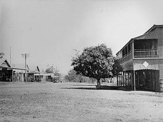
Wondai is a rural town and locality in the South Burnett Region, Queensland, Australia. In the 2021 census, the locality of Wondai had a population of 1,975 people.
Hivesville is a rural town and locality in the South Burnett Region, Queensland, Australia. In the 2021 census, the locality of Hivesville had a population of 173 people.

Tingoora is a rural town and a locality in the South Burnett Region, Queensland, Australia. In the 2021 census, the locality of Tingoora had a population of 272 people.

Durong is a rural locality in the South Burnett Region, Queensland, Australia. In the 2021 census, Durong had a population of 219 people.
Barlil is a rural locality in the South Burnett Region, Queensland, Australia. In the 2021 census, Barlil had a population of 46 people.

Abbeywood is a rural locality in the South Burnett Region, Queensland, Australia. In the 2021 census, Abbeywood had a population of 38 people.
Chelmsford is a rural locality in the South Burnett Region, Queensland, Australia. In the 2021 census, Chelmsford had a population of 100 people.
Cushnie is a rural locality in the South Burnett Region, Queensland, Australia. In the 2021 census, Cushnie had a population of 145 people.
Fairdale is a rural locality in the South Burnett Region, Queensland, Australia. In the 2021 census, Fairdale had a population of 48 people.
Keysland is a rural locality in the South Burnett Region, Queensland, Australia. In the 2021 census, Keysland had a population of 19 people.

Kinleymore is a rural locality in the South Burnett Region, Queensland, Australia. In the 2021 census, Kinleymore had a population of 69 people.
Merlwood is a rural locality in the South Burnett Region, Queensland, Australia. In the 2021 census, Merlwood had a population of 104 people.

Mondure is a rural town and locality in the South Burnett Region, Queensland, Australia. In the 2021 census, the locality of Mondure had a population of 102 people.
Silverleaf is a rural locality in the South Burnett Region, Queensland, Australia. In the 2021 census, Silverleaf had a population of 73 people.

Stonelands is a rural locality in the South Burnett Region, Queensland, Australia. In the 2021 census, Stonelands had a population of 34 people.
Stalworth is a rural locality in the South Burnett Region, Queensland, Australia. In the 2021 census, Stalworth had a population of 37 people.
Byee is a rural locality in the South Burnett Region, Queensland, Australia. In the 2021 census, Byee had a population of 39 people.
Ficks Crossing is a rural locality in the South Burnett Region, Queensland, Australia. In the 2021 census, Ficks Crossing had a population of 39 people.

