
Murgon is a rural town and locality in the South Burnett Region, Queensland, Australia. In the 2021 census, the locality of Murgon had a population of 2,220 people.

Wondai is a rural town and locality in the South Burnett Region, Queensland, Australia. In the 2021 census, the locality of Wondai had a population of 1,975 people.
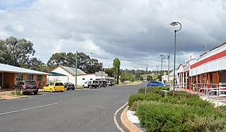
Proston is a rural town and locality in the South Burnett Region, Queensland, Australia.

The South Burnett Region is a local government area in the South Burnett district of Queensland, Australia.

Tingoora is a rural town and a locality in the South Burnett Region, Queensland, Australia.

Durong is a rural locality in the South Burnett Region, Queensland, Australia. In the 2021 census, Durong had a population of 219 people.
Okeden is a rural locality in the South Burnett Region, Queensland, Australia. In the 2021 census, Okeden had a population of 53 people.

Abbeywood is a rural locality in the South Burnett Region, Queensland, Australia. In the 2021 census, Abbeywood had a population of 38 people.
Brigooda is a rural locality in the South Burnett Region, Queensland, Australia. In the 2021 census, Brigooda had a population of 25 people.

Cinnabar is a rural locality in the Gympie Region, Queensland, Australia. In the 2021 census, Cinnabar had a population of 83 people.
Cushnie is a rural locality in the South Burnett Region, Queensland, Australia. In the 2021 census, Cushnie had a population of 145 people.
Keysland is a rural locality in the South Burnett Region, Queensland, Australia. In the 2021 census, Keysland had a population of 19 people.

Kinbombi is a rural town and locality in the Gympie Region, Queensland, Australia. In the 2021 census, the locality of Kinbombi had a population of 34 people.
Leafdale is a rural locality in the South Burnett Region, Queensland, Australia. In the 2021 census, Leafdale had a population of 12 people.

Mondure is a rural town and locality in the South Burnett Region, Queensland, Australia. In the 2021 census, the locality of Mondure had a population of 102 people.

Stonelands is a rural locality in the South Burnett Region, Queensland, Australia. In the 2021 census, Stonelands had a population of 34 people.
Charlestown is a locality in the South Burnett Region, Queensland, Australia. In the 2021 census, Charlestown had a population of 79 people.
Byee is a rural locality in the South Burnett Region, Queensland, Australia. In the 2021 census, Byee had a population of 39 people.
Kawl Kawl is a rural locality in the South Burnett Region, Queensland, Australia. In the 2021 census, Kawl Kawl had a population of 24 people.
Moondooner is a rural locality in the South Burnett Region, Queensland, Australia. In the 2021 census, Moondooner had a population of 45 people.

