Tarong is a rural locality in the South Burnett Region, Queensland, Australia. The area is known for the Tarong Power Station which is located next to the Meandu Mine. In the 2021 census, Tarong had a population of 193 people.

Booie is a rural locality in the South Burnett Region, Queensland, Australia. In the 2021 census, Booie had a population of 1,094 people.
Coolabunia is a rural locality in the South Burnett Region, Queensland, Australia. In the 2021 census, Coolabunia had a population of 173 people.
Taabinga is a rural town and locality in the South Burnett Region, Queensland, Australia. In the 2021 census, the locality of Taabinga had a population of 601 people.

Brooklands is a rural locality in the South Burnett Region, Queensland, Australia. In the 2021 census, Brooklands had a population of 324 people.
Bullcamp is a rural locality in the South Burnett Region, Queensland, Australia. In the 2021 census, Bullcamp had a population of 58 people.

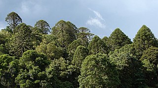
Bunya Mountains is a locality split between the Western Downs Region and the South Burnett Region, Queensland, Australia. The town of Mount Mowbullan is located on the boundary of Bunya Mountains and the enclosed locality of Mowbullan. In the 2021 census, Bunya Mountains had a population of 110 people.
Ellesmere is a rural locality in the South Burnett Region, Queensland, Australia. In the 2021 census, Ellesmere had a population of 334 people.
Goodger is a rural locality in the South Burnett Region, Queensland, Australia. In the 2021 census, Goodger had a population of 176 people.
Hodgleigh is a rural locality in the South Burnett Region, Queensland, Australia. In the 2021 census, Hodgleigh had a population of 134 people.
Wattle Camp is a rural locality in the South Burnett Region, Queensland, Australia. In the 2021 census, Wattle Camp had a population of 543 people.

Kinbombi is a rural town and locality in the Gympie Region, Queensland, Australia. In the 2021 census, the locality of Kinbombi had a population of 34 people.
Runnymede is a rural locality in the South Burnett Region, Queensland, Australia. In the 2021 census, Runnymede had a population of 192 people.
Barker Creek Flat is a rural locality in the South Burnett Region, Queensland, Australia. In the 2021 census, Barker Creek Flat had a population of 61 people.
Taromeo is a rural locality in the South Burnett Region, Queensland, Australia. In the 2021 census, Taromeo had a population of 373 people.
South Nanango is a rural locality in the South Burnett Region, Queensland, Australia. In the 2021 census, South Nanango had a population of 893 people.
Charlestown is a rural locality in the South Burnett Region, Queensland, Australia. In the 2021 census, Charlestown had a population of 79 people.
Glan Devon is a rural locality in the South Burnett Region, Queensland, Australia. In the 2021 census, Glan Devon had a population of 219 people.

South East Nanango is a rural locality in the South Burnett Region, Queensland, Australia. In the 2021 census, South East Nanango had a population of 344 people.

Mowbullan is a rural locality in the Western Downs Region, Queensland, Australia. In the 2021 census, Mowbullan had a population of 12 people.


