Taromeo

Last updated

Taromeo
Queensland
Australia Queensland location map.svg
Red pog.svg
Taromeo
Coordinates 26°49′04″S152°07′59″E / 26.8177°S 152.1330°E / -26.8177; 152.1330 (Taromeo (centre of locality))
Population373 (2021 census) [1]
 • Density4.278/km2 (11.079/sq mi)
Established1877
Postcode(s) 4314
Area87.2 km2 (33.7 sq mi)
Time zone AEST (UTC+10:00)
Location
LGA(s) South Burnett Region
State electorate(s) Nanango
Federal division(s) Maranoa
Suburbs around Taromeo:
Teelah East Nanango Avoca Vale
Yarraman Taromeo Linville
Nukku
Blackbutt North
Benarkin North Moore

Taromeo is a rural locality in the South Burnett Region, Queensland, Australia. [2] In the 2021 census, Taromeo had a population of 373 people. [1]

Contents

History

The locality presumably takes its name from the surrounding parish of Tarameo, which in turn takes its name from the Taromeo pastoral station which was named in 1842 by Simon Scott. It is probably a corruption of the Waka language word tarum meaning wild lime tree. [3]

Taromeo was opened for selection on 17 April 1877; 14,500 acres (5,900 ha) were available. [4]

Taromeo State School opened on 18 October 1909 on a 5-acre (2.0 ha) site. [5] [6] [7] In 1924, it had an enrolment of 26 students. [8] It closed on 1 February 1942 as there was no accommodation for the teacher. [9] [10] It was on the eastern side of Old Esk Road (approx 26°50′35″S152°09′50″E / 26.8431°S 152.16379°E / -26.8431; 152.16379 (Taromeo State School (former)) ). [11] [12]

Taromeo Soldiers' Settlement State School opened in November 1934. It closed on 19 March 1944. [9] [13] Despite its name, the school was on the northern side of Greenwood Creek Road in present-day East Nanango (approx 26°41′38″S152°02′06″E / 26.69400°S 152.03489°E / -26.69400; 152.03489 (Taromeo Soldiers' Settlement State School (former)) ). [14] [15]

On 1 February 2018, Taromeo's postcode changed from 4306 to 4314. [16]

Demographics

In the 2016 census, Taromeo had a population of 335 people. [17]

In the 2021 census, Taromeo had a population of 373 people. [1]

Education

There are no schools in Taromeo. The nearest government primary schools are Blackbutt State School in Blackbutt to the south, Benarkin State School in Benarkin to the south, and Nanango State School in Nanango to the north-west. The nearest government secondary schools are Yarraman State School (to Year 9) in neighbouring Yarraman to the west and Nanango State High School (to Year 12) in Nanango. [18]

Related Research Articles

<span class="mw-page-title-main">Yarraman, Queensland</span> Town in Queensland, Australia

Yarraman is a rural town and locality in the Toowoomba Region, Queensland, Australia. In the 2021 census, the locality of Yarraman had a population of 1,127 people.

<span class="mw-page-title-main">Nanango</span> Town in Queensland, Australia

Nanango is a rural town and locality in the South Burnett Region, Queensland, Australia. In the 2021 census, the locality of Nanango had a population of 3,679 people.
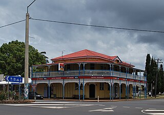
<span class="mw-page-title-main">Blackbutt, Queensland</span> Town in Queensland, Australia

Blackbutt is a rural town and locality in the South Burnett Region, Queensland, Australia. In the 2021 census, the locality of Blackbutt had a population of 799 people.

<span class="mw-page-title-main">Brisbane Valley railway line</span>

The Brisbane Valley railway line was a railway connection in Queensland, Australia connecting Ipswich, west of Brisbane, to the upper Brisbane River valley. Progressively opened between 1884 and 1913, the railway provided a vital transport link between Ipswich and Yarraman and forged development and prosperity along its path. The line acquired its serpentine reputation because it did not take a straight course when faced with a hill or gully.

<span class="mw-page-title-main">Moore, Queensland</span> Town in Queensland, Australia

Moore is a rural town and locality in the Somerset Region, Queensland, Australia. In the 2021 census, the locality of Moore had a population of 286 people.

<span class="mw-page-title-main">Benarkin</span> Town in Queensland, Australia

Benarkin is a rural town and locality in the South Burnett Region, Queensland, Australia. The nearby town of Blackbutt is the origin of the town and the two towns are often referred to as the joint entity Blackbutt-Benarkin. In the 2021 census, the locality of Benarkin had a population of 61 people.
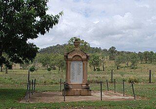
<span class="mw-page-title-main">Colinton, Queensland</span> Suburb of Somerset Region, Queensland, Australia

Colinton is a rural locality in the Somerset Region, Queensland, Australia. In the 2021 census, Colinton had a population of 60 people.
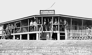
<span class="mw-page-title-main">Upper Yarraman, Queensland</span> Suburb of Toowoomba Region, Queensland, Australia

Upper Yarraman is a rural locality in the Toowoomba Region, Queensland, Australia. In the 2021 census, Upper Yarraman had a population of 80 people.

Nukku is a rural locality in the South Burnett Region, Queensland, Australia. In the 2021 census, Nukku had a population of 40 people.

Benarkin North is a rural locality in the South Burnett Region, Queensland, Australia. In the 2021 census, Benarkin North had a population of 341 people.

Mount Stanley is a rural locality in the Somerset Region, Queensland, Australia. In the 2021 census, Mount Stanley had a population of 11 people.

Blackbutt North is a rural locality in the South Burnett Region, Queensland, Australia. In the 2021 census, Blackbutt North had a population of 451 people.

<span class="mw-page-title-main">Blackbutt South</span> Suburb of South Burnett Region, Queensland, Australia

Blackbutt South is a rural locality in the South Burnett Region, Queensland, Australia. In the 2021 census, Blackbutt South had a population of 160 people.

Gilla is a rural locality in the Toowoomba Region, Queensland, Australia. In the 2021 census, Gilla had a population of 61 people.

Googa Creek is a rural locality in the Toowoomba Region, Queensland, Australia. In the 2021 census, Googa Creek had a population of 54 people.

South Nanango is a rural locality in the South Burnett Region, Queensland, Australia. In the 2021 census, South Nanango had a population of 893 people.

<span class="mw-page-title-main">East Nanango, Queensland</span> Suburb of South Burnett Region, Queensland, Australia

East Nanango is a rural locality in the South Burnett Region, Queensland, Australia. In the 2021 census, East Nanango had a population of 273 people.

Glan Devon is a rural locality in the South Burnett Region, Queensland, Australia. In the 2021 census, Glan Devon had a population of 219 people.

<span class="mw-page-title-main">South East Nanango, Queensland</span> Suburb of South Burnett Region, Queensland, Australia

South East Nanango is a rural locality in the South Burnett Region, Queensland, Australia. In the 2021 census, South East Nanango had a population of 344 people.

Emu Creek is a rural locality in the Toowoomba Region, Queensland, Australia. In the 2021 census, Emu Creek had a population of 113 people.

References

  1. 1 2 3 Australian Bureau of Statistics (28 June 2022). "Taromeo (SAL)". 2021 Census QuickStats. Retrieved 28 February 2023. OOjs UI icon edit-ltr-progressive.svg
  2. "Taromeo – locality in South Burnett Region (entry 46270)". Queensland Place Names. Queensland Government . Retrieved 29 December 2020.
  3. "Tarameo – parish in the South Burnett Region (entry 33375)". Queensland Place Names. Queensland Government . Retrieved 19 February 2020.
  4. "Proclamations under the New Land Acts". The Brisbane Courier . Queensland, Australia. 2 March 1877. p. 3. Retrieved 19 February 2020 via Trove.
  5. "Advertising". The Telegraph . No. 11, 368. Queensland, Australia. 24 April 1909. p. 13 (SECOND EDITION). Retrieved 5 November 2024 via National Library of Australia.
  6. "CROWN LANDS". The Brisbane Courier . Vol. LXV, no. 16, 018. Queensland, Australia. 14 May 1909. p. 3. Retrieved 5 November 2024 via National Library of Australia.
  7. "NEW SCHOOLS—TENDERS ACCEPTED". Darling Downs Gazette . Vol. LI, no. 8, 638. Queensland, Australia. 19 May 1909. p. 5. Retrieved 5 November 2024 via National Library of Australia.
  8. "FOR THE MAN ON THE LAND". The Brisbane Courier . No. 20, 626. Queensland, Australia. 1 March 1924. p. 15. Retrieved 5 November 2024 via National Library of Australia.
  9. 1 2 Queensland Family History Society (2010), Queensland schools past and present (Version 1.01 ed.), Queensland Family History Society, ISBN   978-1-921171-26-0
  10. "Agency ID 10854, Taromeo State School". Queensland State Archives . Retrieved 5 November 2024.
  11. "Blackbutt" (Map). Queensland Government. 1944. Retrieved 5 November 2024.
  12. "Two Mile series sheet 2m77" (Map). Queensland Government. 1939. Retrieved 5 November 2024.
  13. "Agency ID 9236, Taromeo Soldiers' Settlement State School". Queensland State Archives . Retrieved 5 November 2024.
  14. "Nanango" (Map). Queensland Government. 1944. Retrieved 5 November 2024.
  15. "Queensland Two Mile series sheet 2m79" (Map). Queensland Government. 1941. Retrieved 5 November 2024.
  16. "Blackbutt To Get New Postcode". southburnett.com.au. 17 November 2017. Archived from the original on 17 May 2018. Retrieved 5 July 2021.
  17. Australian Bureau of Statistics (27 June 2017). "Taromeo (SSC)". 2016 Census QuickStats. Retrieved 20 October 2018. OOjs UI icon edit-ltr-progressive.svg
  18. "Layers: Locality; Schools and school catchments". Queensland Globe. Queensland Government . Retrieved 4 November 2024.