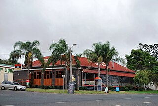
Kingaroy is a rural town and locality in the South Burnett Region, Queensland, Australia. The town is situated on the junction of the D'Aguilar and the Bunya Highways, 218 kilometres (135 mi) north-west of the state capital Brisbane and 141 kilometres (88 mi) south west of Gympie. In the 2021 census, the locality of Kingaroy had a population of 10,266 people.

Tingoora is a rural town and a locality in the South Burnett Region, Queensland, Australia.

Wooroolin is a rural town and a locality in the South Burnett Region, Queensland, Australia.

Booie is a rural locality in the South Burnett Region, Queensland, Australia. In the 2021 census, Booie had a population of 1,094 people.

Ironpot is a rural locality in the South Burnett Region, Queensland, Australia. In the 2021 census, the locality of Ironpot had a population of 44 people.

Durong is a rural locality in the South Burnett Region, Queensland, Australia. In the 2021 census, Durong had a population of 219 people.
Gordonbrook is a rural locality in the South Burnett Region, Queensland, Australia. In the 2021 census, Gordonbrook had a population of 184 people.

Haly Creek is a rural locality in the South Burnett Region, Queensland, Australia. In the 2021 census, Haly Creek had a population of 124 people.
Alice Creek is a rural locality in the South Burnett Region, Queensland, Australia. In the 2021 census, Alice Creek had a population of 50 people.

Crawford is a locality in the South Burnett Region, Queensland, Australia. In the 2021 census, Crawford had a population of 182 people.
Taabinga is a rural town and locality in the South Burnett Region, Queensland, Australia. In the 2021 census, the locality of Taabinga had a population of 601 people.
Benair is a rural locality in the South Burnett Region, Queensland, Australia. In the 2021 census, Benair had a population of 151 people.

Boyneside is a rural locality in the South Burnett Region, Queensland, Australia. In the 2021 census, Boyneside had a population of 67 people.

Brooklands is a rural locality in the South Burnett Region, Queensland, Australia. In the 2021 census, Brooklands had a population of 324 people.
Cushnie is a rural locality in the South Burnett Region, Queensland, Australia. In the 2021 census, Cushnie had a population of 145 people.
Goodger is a rural locality in the South Burnett Region, Queensland, Australia. In the 2021 census, Goodger had a population of 176 people.
Hodgleigh is a rural locality in the South Burnett Region, Queensland, Australia. In the 2021 census, Hodgleigh had a population of 134 people.
Inverlaw is a rural locality in the South Burnett Region, Queensland, Australia. In the 2021 census, Inverlaw had a population of 190 people.
Gilla is a rural locality in the Toowoomba Region, Queensland, Australia. In the 2021 census, Gilla had a population of 61 people.
South Nanango is a rural locality in the South Burnett Region, Queensland, Australia. In the 2021 census, South Nanango had a population of 893 people.


