The City of Thuringowa was a city and local government area in North Queensland, Australia covering the northern and western parts of what is now Townsville. The suburb of Thuringowa Central is the main business centre in this area.

The Townsville Ring Road is a motorway in Townsville, Queensland, Australia. The road has been constructed as the new A1/M1 route that bypasses the inner metro area of Townsville. The road was built in 5 stages with the first stage, the Douglas Arterial Road, opened in April 2005 and the most recent section opened in October 2023. Stage 5 commenced construction in July 2021 which included the duplication of the remaining 6-kilometre 2-lane undivided section between Vickers Bridge and Shaw Road in Thuringowa. There is no toll for the use of this motorway.

The Ross River is a river in North Queensland, Australia. The 49-kilometre (30 mi) long river flows through the city of Townsville and empties into the Coral Sea. It is the major waterway flowing through Townsville and the city's main source of drinking water.

Thuringowa Central is a suburb of Townsville in the City of Townsville, Queensland, Australia. In the 2016 census Thuringowa Central had a population of 2,023 people.

Bushland Beach is a coastal suburb in the northern beaches area of Townsville in the City of Townsville, Queensland, Australia. In the 2016 census Bushland Beach had a population of 6,181 people.
Condon is a suburb of Townsville in the City of Townsville, Queensland, Australia. In the 2016 census, Condon had a population of 5,779 people.

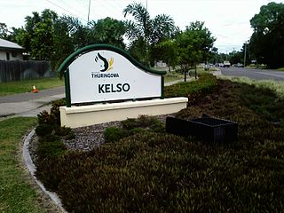
Kelso is a suburb in the City of Townsville, Queensland, Australia. In the 2021 census, Kelso had a population of 10,599 people.

This article is a list of the suburbs that used to make up the City of Thuringowa in Queensland, Australia, before the March 2008 amalgamation, which saw the City of Townsville merge with Thuringowa to form the new city of Townsville. Also listed are the former suburbs that became part of Townsville due to other boundary changes that have taken place over the years. The suburbs are listed below in order of postcode and order of years the boundaries were changed:
Saunders Beach is a coastal town and suburb of Townsville in the City of Townsville, Queensland, Australia. In the 2016 census, the suburb of Saunders Beach had a population of 409 people.
Toolakea is a coastal town and suburb in the City of Townsville, Queensland, Australia. In the 2016 census, Toolakea had a population of 205 people.

Balgal Beach is a coastal suburb and a beach in the City of Townsville, Queensland, Australia. The town of Balgal is within the locality. In the 2021 census, Balgal Beach had a population of 998 people.
Toomulla is a coastal town and suburb in the City of Townsville, Queensland, Australia. In the 2021 census, the suburb of Toomulla had a population of 193 people.

Bohle Plains is a locality in Townsville in the City of Townsville, Queensland, Australia. In the 2016 census Bohle Plains had a population of 3,205 people.
The Black River is a river in North Queensland, Australia.
The Haughton River is a river in North Queensland, Australia.

Burdell is a suburb of Townsville in the City of Townsville, Queensland, Australia. In the 2021 census, Burdell had a population of 7,171 people.
Granite Vale is a rural locality in the City of Townsville, Queensland, Australia. In the 2016 census, Granite Vale had a population of 0 people.
Gumlow is a peri-urban locality in the City of Townsville, Queensland, Australia. In the 2021 census, Gumlow had a population of 142 people.
Hervey Range Developmental Road is a continuous 125-kilometre (78 mi) road route in the Townsville and Charters Towers local government areas of Queensland, Australia. It is designated as State Route 72. It is a state-controlled regional road.
Townsville road network is a group of roads that provide access to the urban areas of Townsville in Queensland, Australia, and enable travel between the communities. Most of the roads retain their original road or street names, and are not well known by their official names.


