
Sarina is a rural town and coastal locality in the Mackay Region, Queensland, Australia. In the 2016 census, Sarina had a population of 5,522 people.

Weipa is a coastal mining town in the local government area of Weipa Town in Queensland, Australia. It is the largest town on the Cape York Peninsula. It exists because of the enormous bauxite deposits along the coast. The Port of Weipa is mainly involved in exports of bauxite. There are also shipments of live cattle from the port.
Tolga is a rural town and locality in the Tablelands Region, Queensland, Australia. In the 2016 census, Tolga had a population of 2,718 people.

Mount Perry is a small town and locality in the North Burnett Region in southeastern Queensland, Australia. In the 2016 census, Mount Perry had a population of 538 people. The neighbourhood of Drummers Creek is in the locality.

Mapoon is a coastal town in the Aboriginal Shire of Mapoon and a locality split between the Aboriginal Shire of Mapoon and the Shire of Cook in Queensland, Australia.

Napranum is a town in the locality of Mission River in the Aboriginal Shire of Napranum, Queensland, Australia.

Calen is a small town and a coastal locality in the Mackay Region, Queensland, Australia. In the 2016 census, Calen had a population of 390 people.

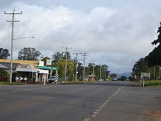
Jambin is a town and locality in the Shire of Banana, Queensland, Australia.
Nanum is a coastal locality in Weipa Town in Far North Queensland, Australia.

Rosedale is a rural town and locality split between the Gladstone Region and the Bundaberg Region in central Queensland, Australia.

Abercorn is a rural town and locality in the North Burnett Region, Queensland, Australia. In the 2016 census the locality of Abercorn had a population of 46 people.

The Mission River is a river located in Far North Queensland, Australia.

Weipa Town is a local government area in Far North Queensland, Australia. It covers the town of Weipa on the western coast of the Cape York Peninsula, including the localities of Rocky Point, Trunding, Nanum, Evans Landing, and Weipa Airport. It is an unusual local government area as it is not governed and managed by a council elected by residents but rather by the company Rio Tinto Aluminium through a governing body called the Weipa Town Authority. In June 2018, Weipa Town had a population of 4,240.

The Aboriginal Shire of Napranum is a local government area in Far North Queensland, Australia. It is on the western side of the Cape York Peninsula around Weipa.
Mission River is a coastal locality split between the Shire of Cook and the Aboriginal Shire of Napranum in Queensland, Australia.
Rocky Point is a coastal locality in the Weipa Town, Queensland, Australia. In the 2016 census, Rocky Point had a population of 1957 people.
Evans Landing is a rural locality in the Weipa Town, Queensland, Australia. In the 2016 census Evans Landing had a population of 62 people.
Weipa Airport is a locality in Weipa Town, Queensland, Australia.
Rules Beach is a coastal town and a locality in the Gladstone Region, Queensland, Australia. In the 2016 census, Rules Beach had a population of 86 people.

Albatross Bay is a bay on the eastern shores of the Gulf of Carpentaria, Queensland, Australia.
