
Chillagoe is a rural town and locality in the Shire of Mareeba, Queensland, Australia. In the 2021 census, the locality of Chillagoe had a population of 214 people.
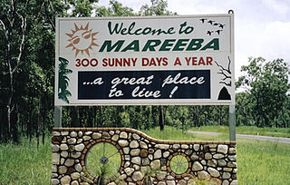
Mareeba is a rural town and locality in the Shire of Mareeba in Far North Queensland, Australia. Between 2008 and 2013, it was within the Tablelands Region. The town's name is derived from an Aboriginal word meaning meeting of the waters. In the 2021 census, the locality of Mareeba had a population of 11,825 people.
Mount Mulligan is a former mining town and now a rural locality in the Shire of Mareeba, Queensland, Australia. In the 2021 census, the locality of Mount Mulligan had "no people or a very low population".

Mount Molloy is a rural town and locality in the Shire of Mareeba, Queensland, Australia. It is a historic mining and timber town, 55 kilometres (34 mi) north of Cairns. The dominant industry in the area is cattle grazing; the town itself consists of a few shops and an old hotel. In the 2021 census, the locality of Mount Molloy had a population of 266 people.

Mount Carbine is a rural town and locality in the Shire of Mareeba, Queensland, Australia. In the 2021 census, the locality of Mount Carbine had a population of 94 people.

Watsonville is a rural town and locality in the Shire of Mareeba, Queensland, Australia. In the 2021 census, the locality of Watsonville had a population of 176 people.

Thornborough is a rural town and locality in the Shire of Mareeba, Queensland, Australia. In the 2021 census, the locality of Thornborough had a population of 21 people.

Palmer is a rural locality in the Shire of Cook, Queensland, Australia. In the 2021 census, Palmer had a population of 46 people.

Anglo Saxon Mine is a heritage-listed mining camp at Groganville, Shire of Mareeba, Queensland, Australia. It was built from 1886 to 1897. It is also known as Groganville Township and Limestone Cemetery. It was added to the Queensland Heritage Register on 3 October 2003.
Bellevue is a rural locality in the Shire of Mareeba, Queensland, Australia. In the 2021 census, Bellevue had "no people or a very low population".
Crystalbrook is a rural locality in the Shire of Mareeba, Queensland, Australia. In the 2021 census, Crystalbrook had "no people or a very low population".
Rookwood is a rural locality in the Shire of Mareeba, Queensland, Australia. In the 2021 census, Rookwood had a population of 9 people.
Nychum is a rural locality in the Shire of Mareeba, Queensland, Australia. In the 2021 census, Nychum had "no people or a very low population".
Lyndside is a rural locality in the Shire of Mareeba, Queensland, Australia. In the 2021 census, Lyndside had "no people or a very low population".
Staaten is a rural locality in the Shire of Mareeba, Queensland, Australia. In the 2021 census, Staaten had "no people or a very low population".
Barwidgi is a rural locality in the Shire of Mareeba, Queensland, Australia. In the 2021 census, Barwidgi had "no people or a very low population".
Munderra is a rural locality in the Shire of Mareeba, Queensland, Australia. In the 2021 census, Munderra had "no people or a very low population".
Ravensworth is a rural locality in the Shire of Mareeba, Queensland, Australia. In the 2021 census, Ravensworth had "no people or a very low population".
Red River is a rural locality in the Shire of Mareeba, Queensland, Australia. In the 2021 census, Red River had "no people or a very low population".
Bulleringa is a rural locality in the Shire of Mareeba, Queensland, Australia. In the 2021 census, Bulleringa had "no people or a very low population".
