
The Eyre Peninsula is a triangular peninsula in South Australia. It is bounded on the east by Spencer Gulf, the west by the Great Australian Bight, and the north by the Gawler Ranges.

Kimba is a rural service town on the Eyre Highway at the top of Eyre Peninsula in the Australian state of South Australia. At the 2006 census, Kimba had a population of 636 and it has an annual rainfall of 348 millimetres (13.7 in). There is an 8-metre (26 ft) tall statue of a galah beside the highway, marking halfway between the east and west coasts of Australia. The Gawler Ranges are north of the highway near the town.

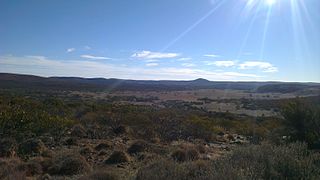
Buckleboo is a locality in the Australian state of South Australia on the Eyre Peninsula located about 313 kilometres (194 mi) northwest of the state capital of Adelaide and about 31 kilometres (19 mi) northwest of the municipal seat of Kimba.

Lake Gilles Conservation Park is a protected area in the Australian state of South Australia located in the north of the Eyre Peninsula about 20 kilometres (12 mi) east of Kimba in the gazetted locality of Lake Gilles.
In South Australia, one of the states of Australia, there are many areas which are commonly known by regional names. Regions are areas that share similar characteristics. These characteristics may be natural such as the Murray River, the coastline, desert or mountains. Alternatively, the characteristics may be cultural, such as common land use. South Australia is divided by numerous sets of regional boundaries, based on different characteristics. In many cases boundaries defined by different agencies are coterminous.
Whyalla Barson is a suburb in South Australia located on the northern side of the city of Whyalla in the north east corner of Eyre Peninsula. It is named after Thomas Leonard Barson, superintendent of the Broken Hill Proprietary Company Limited in Whyalla from 1933 to 1938. The suburb was first established in 2011 with revisions to boundaries occurring both in 2013 and 2014.
False Bay is a locality in South Australia on the north east corner of Eyre Peninsula located north of the city of Whyalla overlooking the bay in Spencer Gulf known as False Bay.

Mullaquana is a locality in the Australian state of South Australia located immediately adjoining the southern side of the city of Whyalla in the north east corner of Eyre Peninsula. The locality is bounded by Lincoln Highway to its northern side, the suburb of Whyalla to the east and by and the Spencer Gulf coastline to the south east.
Yellabinna is a locality in the Australian state of South Australia located to the north of the town of Ceduna in the western part of the state.
Secret Rocks is a locality in the Australian state of South Australia located on the Eyre Peninsula about 36 kilometres to the east of the town of Kimba and about 227 kilometres north west of the state capital of Adelaide.
Middleback Range is a locality in the Australian state of South Australia located in the north east corner of Eyre Peninsula to the south-west of the city of Whyalla and extending from the coastline of Spencer Gulf in the east to the west side of the southern end of the Middleback Range in the west.
Gawler Ranges is a locality in the Australian state of South Australia located on Eyre Peninsula about 380 kilometres north-west of the Adelaide city centre and about 48 kilometres north of the town centre of Wudinna and which is associated with the protected area known as the Gawler Ranges National Park.

Lincoln National Park is a locality located on the Jussieu Peninsula at the southern tip of the Eyre Peninsula in the Australian state of South Australia about 250 kilometres west of the state capital of Adelaide and about 13 kilometres south of the city of Port Lincoln.

Lake Eyre is a locality in the Australian state of South Australia located about 718 kilometres north of the state capital of Adelaide and 134 kilometres north of the town of Marree and which is associated with the occasional body of water known as Lake Eyre.
County of Hore-Ruthven is a cadastral unit in the Australian state of South Australia that covers land both in the north of the Eyre Peninsula and to the peninsula's north. It was proclaimed in 1933 and was named after Alexander Hore-Ruthven, the Governor of South Australia from 1928 to 1934.
Pureba is a locality in the Australian state of South Australia located on the west coast of Eyre Peninsula and on land to the immediate north of the peninsula about 528 kilometres north-west of the state capital of Adelaide and about 52 kilometres north-east and 90 kilometres north respectively of the municipal seats of Ceduna and Streaky Bay.
Mount Willoughby is a locality in the Australian state of South Australia located about 837 kilometres north-west of the capital city of Adelaide and about 84 kilometres north-west of the town of Coober Pedy.
County of Buxton is a cadastral unit located in the Australian state of South Australia that covers land located in the centre of Eyre Peninsula. It was proclaimed in 1896 and named after Thomas Buxton who was the Governor of South Australia from 29 October 1895 to 29 March 1899. It has been divided into thirteen sub-divisions known as hundreds, with the most recent being created in 1928.
Brooker is a locality in the Australian state of South Australia located in the state’s west on Eyre Peninsula about 266 kilometres (165 mi) west of the state capital of Adelaide and about 38 kilometres (24 mi) north-west of the municipal seat in Tumby Bay.
Kelly is a locality in the Australian state of South Australia located on the Eyre Peninsula about 270 kilometres (170 mi) north-west of the state capital of Adelaide and about 13 kilometres (8.1 mi) south-east of the municipal seat in Kimba.

