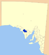
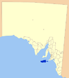
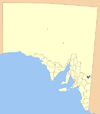
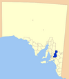
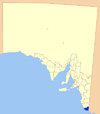
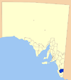
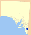
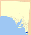
Local government areas of South Australia

Last updated

Local government in the Australian state of South Australia describes the organisations and processes by which towns and districts can manage their own affairs to the extent permitted by section 64A of Constitution Act 1934 (SA) . [1]

Contents

LGAs sorted by region

The organisations, often called local government areas (LGAs) are constituted and managed in accordance with the Local Government Act 1999 (South Australia). They are grouped below by region, as defined by the Local Government Association of South Australia. [2] Maralinga Tjarutja and Anangu Pitjantjatjara Yankunytjatjara aboriginal councils both located in the remote north of the state are by far the largest South Australian LGAs, both exceeding 100,000 km2. [3] Coorong District Council and Loxton Waikerie are the next largest LGAs. [3] The smallest LGAs are Walkerville and then Prospect, both occupying less than 10 km2 each. [3]

The area with the largest population growth was Playford in Adealide's northern suburbs with a net increase of 2,847 people from June 2021 to June 2022. [3] Port Pirie had the largest net reduction in population of 106. [3] The fastest growth of an LGA in South Australia was in Adelaide Plains at 4.9 percent. [3] Coober Pedy was the fastest shrinking LGA, at -3.0 percent. [3]

Metropolitan Adelaide

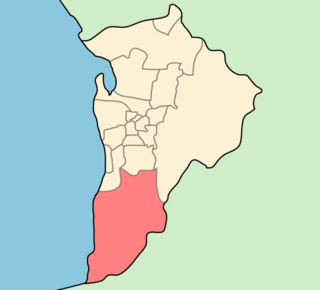
This group of areas are found around Metropolitan Adelaide along a 70 km stretch of the Gulf St Vincent coast and up to 50 km inland.

Local government areaCouncil seatYear est.Land areaPopulation [3] NotesMap
km2 sq mi Density (2022) [3] 20212022
City of Adelaide Adelaide 1840166167725,55126,120Capital city of South Australia
1840 Established as Adelaide Corporation
1843 Managed by the Colonial government, and then a commission
1852 Re-established
1919 Office of Mayor raised to Lord Mayor
Adelaide-LGA-Adelaide-MJC.png
Adelaide Hills Council Woodside 19977953075241,25041,448Amalgamation of District Councils of East Torrens, Gumeracha, Onkaparinga and Stirling Adelaide-LGA-Adelaide Hills-MJC.png
City of Burnside Tusmore 185628111,69746,44446,6921856 gazetted as District Council of Burnside
1935 became the Municipality of Burnside
1943 proclaimed the City of Burnside
Adelaide-LGA-Burnside-MJC.png
City of Campbelltown Rostrevor 18542492,30155,47556,0131854 established as the District Council of Payneham
1867 District Council of Stepney (later itself called Payneham) seceded
1868 renamed to District Council of Campbelltown
1946 became the Town of Campbelltown
1960 proclaimed the City of Campbelltown
Adelaide-LGA-Campbelltown-MJC.png
City of Charles Sturt Woodville 199755212,280123,146124,906Amalgamation of City of Hindmarsh Woodville and the City of Henley and Grange Adelaide-LGA-Charles Sturt-MJC.png
Town of Gawler Gawler 1857411663525,30426,123Established as the Corporation of the Town of Gawler in 1857 following resident dissatisfaction at being governed by three different district councils Adelaide-LGA-Gawler-MJC.png
City of Holdfast Bay Brighton 19971452,76837,86838,061Amalgamation of Glenelg and Brighton city councils Adelaide-LGA-Holdfast Bay-MJC.png
City of Marion Sturt 185356221,73795,65096,6581853 established as the District Council of Brighton
1886 renamed to the District Council of Marion
1944 gazetted as the municipality, City of Marion
Adelaide-LGA-Marion-MJC.png
City of Mitcham Torrens Park 1853762990568,18068,403First LGA formally founded after the City of Adelaide Adelaide-LGA-Mitcham-MJC.png
City of Norwood Payneham & St Peters Norwood 19971562,51637,85038,001Amalgamation of the City of Kensington and Norwood, the City of Payneham and the Town of St Peters. Adelaide-LGA-Norwood-MJC.png
City of Onkaparinga Noarlunga Centre 1997518200345176,628178,546Amalgamation of Cities of Happy Valley and Noarlunga with part of the District Council of Willunga Adelaide-LGA-Onkaparinga-MJC.png
City of Playford Elizabeth 1997345133300100,573103,420Amalgamation of the cities of Elizabeth and Munno Para Adelaide-LGA-Playford-MJC.png
City of Port Adelaide Enfield Port Adelaide 199792361,480134,202135,844Amalgamation of the cities of Port Adelaide and Enfield Adelaide-LGA-Port Adelaide-MJC.png
City of Prospect Prospect 1872832,91922,49722,741Separated from District Council of Yatala South Adelaide-LGA-Prospect-MJC.png
City of Salisbury Salisbury 193316062926147,602148,003Amalgamation of District Council of Yatala North and large part of District Council of Munno Para West Adelaide-LGA-Salisbury-MJC.png
City of Tea Tree Gully Modbury 185895371,078102,067102,6661858 established by separation from District Council of Highercombe
1935 reunited with Highercombe under current name
Adelaide-LGA-Tea Tree Gully-MJC.png
City of Unley Unley 18711452,73939,08239,085Separated from District Council of Mitcham as the Corporate Town of Unley Adelaide-LGA-Unley-MJC.png
Town of Walkerville Gilberton 1855422,3178,0918,179Separated from District Council of Yatala Adelaide-LGA-Walkerville-MJC.png
City of West Torrens Hilton 185637141,70262,46963,1051856 established as the District Council of West Torrens
1944 became a municipal corporation, the Corporate Town of West Torrens
1950 gained city status as the City of West Torrens
1997 annexed the Town of Thebarton
Adelaide-LGA-West Torrens-MJC.png

Regional South Australia

Eyre Peninsula

Local government areaCouncil seatYear est.Land areaPopulation [3] NotesMap
km2 sq mi Density (2022) [3] 20212022
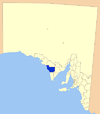
District Council of Ceduna Ceduna 18965,4272,0950.73,6513,650 Ceduna LGA.png
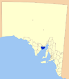
District Council of Cleve Cleve 19114,5071,7400.41,7761,765Separated from Franklin Harbour Cleve LGA.png
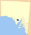
District Council of Elliston Elliston 18876,5002,5100.21,0381,037Boundary changes in 1989 Elliston LGA.png
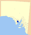
District Council of Franklin Harbour Cowell 18883,5831,3830.51,3231,323 Franklin Harbour LGA.png
District Council of Kimba Kimba 19243,9861,5390.21,0531,057 Kimba LGA.png
District Council of Lower Eyre Peninsula Cummins 19214,7711,8421.36,0606,100Part of District Council of Port Lincoln (proclaimed 1880). District Council of Tumby Bay separated in 1906. Corporation of Port Lincoln separated in 1921. Remainder named District Council of Lincoln. Renamed Lower Eyre Peninsula in 1988. Lower Eyre Peninsula LGA.png
City of Port Augusta Port Augusta 19641,15344512.514,45314,456 Port Augusta LGA.png
City of Port Lincoln Port Lincoln 19213012492.214,88014,947Separated from District Council of Port Lincoln in 1921. Proclaimed a city in 1971. Port Lincoln LGA.png
District Council of Streaky Bay Streaky Bay 18876,2322,4060.42,2412,254 Streaky Bay LGA.png
District Council of Tumby Bay Tumby Bay 19062,6161,0101.12,8752,889Separated from District Council of Port Lincoln Tumby Bay LGA.png
City of Whyalla Whyalla 19701,03339920.421,96021,894 Whallya LGA.png
Wudinna District Council Wudinna 19255,3942,0830.21,1631,164Established as the District Council of Minnipa. Later renamed as District Council of Le Hunte. Given present name in 2008. Le Hunte LGA.png

Central region

Local government areaCouncil seatYear est.Land areaPopulation [3] NotesMap
km2 sq mi Density (2022) [3] 20212022
Adelaide Plains Council Mallala 193593336011.29,97710,461Amalgamation of the district councils of Grace, Dublin and Port Gawler Mallala LGA.png
Barossa Council Angaston 199689434529.025,56925,878Amalgamation of district councils of Angaston, Barossa, Tanunda and, since 1997, part of Mount Pleasant Barossa LGA.png
District Council of Barunga West Port Broughton 19971,5906141.72,6762,676Amalgamation of the District Council of Bute and the District Council of Port Broughton Barunga West LGA.png
District Council of Clare and Gilbert Valleys Clare 19971,8927315.09,3669,393Amalgamation of the district councils of Clare, Riverton and Saddleworth and Auburn Clare and Gilbert Valleys LGA.png
Copper Coast Council Kadina 199777329820.315,33615,652Amalgamation of the District Council of Northern Yorke Peninsula and Corporate Town of Wallaroo Copper Coast LGA.png
Flinders Range Council Quorn 19974,0711,5720.41,6861,682Amalgamation of the District Council of Kanyaka-Quorn and the District Council of Hawker Flinders Ranges LGA.png
Regional Council of Goyder Burra 19976,7152,5930.64,1384,134Amalgamation of the district councils of Burra Burra Eudunda, Hallet and Robertstown. Goyder LGA.png
Light Regional Council Kapunda 19961,27749312.816,08316,332Amalgamation of the District Council of Light (1977–1996) and the District Council of Kapunda Light LGA.png
District Council of Mount Remarkable Melrose 19803,4231,3220.92,9212,915Amalgamation of District Council of Port Germein and District Council of Wilmington Mt Remarkable LGA.png
Northern Areas Council Jamestown 19972,9861,1531.64,6594,671Amalgamation of the district councils of Rocky River, Spalding, and Jamestown Northern Areas LGA.png
District Council of Orroroo Carrieton Orroroo 19973,3221,2830.3891890Amalgamation of the District Council of Orroroo and District Council of Carrieton Orroroo Carierton LGA.png
District Council of Peterborough Peterborough 19353,0201,1660.61,6691,670
Port Pirie Regional Council Port Pirie 19971,76168010.017,75417,648Amalgamation of the City of Port Pirie and the District Council of Crystal Brook-Redhill Port Pirie LGA.png
Wakefield Regional Council Balaklava 19973,4691,3392.06,9266,958Amalgamation of the District Council of Blyth-Snowtown and District Council of Wakefield Plains Wakefield LGA.png
Yorke Peninsula Council Maitland 19975,9002,2782.011,82811,922Established as the District Council of Yorke Peninsula in 1997 by amalgamation of the district councils of Central Yorke Peninsula, Minlaton, Warooka and Yorketown.
Renamed in 2013.
Yorke Peninsula LGA.png

Southern and Hills region

Local government areaCouncil seatYear est.Land areaPopulation [3] NotesMap
km2 sq mi Density (2022) [3] 20212022
Alexandrina Council Goolwa 19971,82770516.329,25729,780Amalgamation of the District Council of Strathalbyn, the District Council of Port Elliot and Goolwa, and a portion of the District Council of Willunga. Alexandrina LGA.png
Kangaroo Island Council Kingscote 19964,4011,6991.24,9995,084Amalgamation of the District Council of Kingscote and the District Council of Dudley. Kangaroo Island LGA.png
District Council of Mount Barker Mount Barker 185359523069.039,62741,059 Mount Barker LGA.png
City of Victor Harbor Victor Harbor 197538514943.516,42716,720Amalgamation of District Council of Encounter Bay and the Corporation of Victor Harbor in 1975. Formerly a district council, became a city in 2000.
District Council of Yankalilla Yankalilla 18547512908.05,9285,998 Yankalilla LGA.png

Murray Mallee region

Local government areaCouncil seatYear est.Land areaPopulation [3] NotesMap
km2 sq mi Density (2022) [3] 20212022
Berri Barmera Council Berri 199647618422.510,74710,713Amalgamation of district councils of Barmera and Berri. Berri Barmera LGA.png
Coorong District Council Meningie 19958,8333,4100.65,5995,569Amalgamation of District Council of Coonalpyn Downs, Peake District Council and Meningie District Council. Coorong LGA.png
District Council of Karoonda East Murray Karoonda 19794,4161,7050.21,0251,028Amalgamation of District Council of Karoonda and District Council of East Murray. Karoonda East Murray LGA.png
District Council of Loxton Waikerie Loxton 19977,7642,9981.511,92211,928Amalgamation of district councils of Loxton, Waikerie and Browns Well. Loxton Waikerie LGA.png
Mid Murray Council Mannum 19976,2722,4221.59,3559,415Amalgamation of district councils of Mannum, Morgan, Ridley-Truro and part of the District Council of Mount Pleasant. Mid Murray LGA.png
Rural City of Murray Bridge Murray Bridge 19771,83270712.322,34822,554 Murray Bridge LGA.png
Renmark Paringa Council Renmark 199691635411.010,00910,044Amalgamation of Town of Renmark and the District Council of Paringa. Renmark Paringa LGA.png
Southern Mallee District Council Pinnaroo 19975,7022,2020.42,0292,013 Southern Mallee LGA.png

Southeast region

Local government areaCouncil seatYear est.Land areaPopulation [3] NotesMap
km2 sq mi Density (2022) [3] 20212022
District Council of Grant Mount Gambier 19961,8987334.78,8628,925Amalgamation of District Councils of Mount Gambier and Port MacDonnell. Grant LGA.png
Kingston District Council Kingston SE 18733,3401,2900.72,3752,389Renamed from Lacepede District Council in 2000. Kingston LGA.png
City of Mount Gambier Mount Gambier 18763413819.427,64227,771 Mt Gambier LGA.png
Naracoorte Lucindale Council Naracoorte 19934,5201,7452.08,8968,928Amalgamation of District Council of Naracoorte, District Council of Lucindale and the Corporate Township of Naracoorte. Naracoorte Lucindale LGA.png
District Council of Robe Robe 18691,0924221.51,5681,583 Robe LGA.png
Tatiara District Council Bordertown 18766,5272,5201.17,0727,040 Tiatara LGA.png
Wattle Range Council Millicent 19973,9261,5163.112,12712,163Amalgamation of district councils of Beachport, Millicent and Penola. Wattle Range LGA.png

Outback

Local government areaCouncil seatYear est.Land areaPopulation [3] NotesMap
km2 sq mi Density (2022) [3] 20212022
Aṉangu Pitjantjatjara Yankunytjatjara Umuwa 1981102,35339,5190.02,5542,595 APY LGA.png
District Council of Coober Pedy Coober Pedy 1987783020.31,6241,576 Coober Pedy LGA.png
Maralinga Tjarutja Ceduna 2006102,70439,6540.0102102 MT LGA.png
Roxby Council Roxby Downs 19821114337.24,1154,105 Roxby Downs LGA.png

Maps

See also

Related Research Articles

<span class="mw-page-title-main">South Australia</span> State of Australia

South Australia is a state in the southern central part of Australia. It covers some of the most arid parts of the country. With a total land area of 984,321 square kilometres (380,048 sq mi), it is the fourth-largest of Australia's states and territories by area, and second smallest state by population. It has a total of 1.8 million people. Its population is the second most highly centralised in Australia, after Western Australia, with more than 77 percent of South Australians living in the capital Adelaide, or its environs. Other population centres in the state are relatively small; Mount Gambier, the second-largest centre, has a population of 26,878.

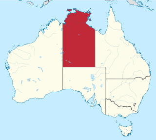
<span class="mw-page-title-main">Local government areas of the Northern Territory</span> Federal Australian territory in north-central Australia

The Northern Territory is a federal Australian territory in north-central Australia. It is the third largest Australian federal division with an area of 1,348,094.3 square kilometres (520,502 sq mi) but the least populous with 245,929 inhabitants as at June 2019. The Northern Territory is divided administratively into 17 Local government areas (LGAs) generally known as Councils who are responsible for providing local government services.

<span class="mw-page-title-main">City of Port Adelaide Enfield</span> Local government area in South Australia

The City of Port Adelaide Enfield (PAE), located across inner north and north-western suburbs of Adelaide, is one of the largest metropolitan councils within South Australia. It was established on 26 March 1996 by the amalgamation of the City of Port Adelaide and the City of Enfield.

Local government is the second-level of government in Australia, administered with limited autonomy under the states and territories, and in turn beneath the federal government. Local government is not mentioned in the Constitution of Australia, and two referendums in 1974 and 1988 to alter the Constitution relating to local government were unsuccessful. Every state/territory government recognises local government in its own respective constitution. Unlike the two-tier local government system in Canada or the United States, there is only one tier of local government in each Australian state/territory, with no distinction between counties and cities.

<span class="mw-page-title-main">City of Playford</span> Local government area in South Australia

The City of Playford is a local government area of South Australia in Adelaide's northern suburbs. It was named in recognition of Sir Thomas Playford, who played a part in the development of the area, and was South Australia's premier from 1938–1965. The city covers an area of 345 km2 (133 sq mi), and is home to over 90,000 residents. Playford was the fastest growing local government area in South Australia in the 2010s.

<span class="mw-page-title-main">Parliament of South Australia</span> Bicameral legislature of the Australian state of South Australia

The Parliament of South Australia is the bicameral legislature of the Australian state of South Australia. It consists of the 47-seat House of Assembly and the 22-seat Legislative Council. General elections are held every 4 years, with all of the lower house and half of the upper house filled at each election. It follows a Westminster system of parliamentary government with the executive branch required to both sit in parliament and hold the confidence of the House of Assembly. The parliament is based at Parliament House on North Terrace in the state capital of Adelaide.

<span class="mw-page-title-main">City of Port Lincoln</span> Local government area in South Australia

The City of Port Lincoln is a local government area located on the southern tip of the Eyre Peninsula in South Australia. It consists of one suburb - Port Lincoln. It is surrounded on land by the District Council of Lower Eyre Peninsula, which also has offices in Port Lincoln.

<span class="mw-page-title-main">City of Onkaparinga</span> Local government area in South Australia

The City of Onkaparinga is a local government area (LGA) located on the southern fringe of Adelaide, South Australia. It is named after the Onkaparinga River, whose name comes from Ngangkiparinga, a Kaurna word meaning women's river. It is the largest LGA in South Australia, with a population of over 170,000 people in both urban and rural communities and is also geographically expansive, encompassing an area of 518.3 km2. The council is headquartered in the Noarlunga Centre with area offices situated in Aberfoyle Park, Woodcroft and Willunga.

<span class="mw-page-title-main">Roxby Downs, South Australia</span> Town in South Australia

Roxby Downs is a town and locality in the Australian state of South Australia about 511 kilometres (318 mi) north of the state capital of Adelaide. The town has a highly transient population of around 4,000 people.

<span class="mw-page-title-main">City of Charles Sturt</span> Local government area in South Australia

The City of Charles Sturt is a local government area in the western suburbs of Adelaide, South Australia, stretching to the coast.

<span class="mw-page-title-main">Coonalpyn, South Australia</span> Town in South Australia

Coonalpyn is a town and a locality in the Australian state of South Australia located about 143 kilometres (89 mi) south-east of the state capital of Adelaide and about 61 kilometres (38 mi) south-east of the municipal seat in Tailem Bend. It is situated in the local government area of the Coorong District Council and is in the State electoratal district of MacKillop and the Federal division of Barker.

<span class="mw-page-title-main">District Council of Streaky Bay</span> Local government area in South Australia

The District Council of Streaky Bay is a local government area in South Australia located on the Eyre Peninsula. Streaky Bay is the main population centre of about 1,200 people serving an agricultural district based on farming wheat and other cereal crops, sheep, supplemented by fishing and tourism industries. The district covers an area of 6,251.1 square kilometres with a population of 2,074 people in 2016, according to the Australian Bureau of Statistics. Mayor of Streaky Bay is Travis Barber.

<span class="mw-page-title-main">Yalata, South Australia</span> Aboriginal community in western South Australia

Yalata is an Aboriginal community located 200 kilometres (120 mi) west of Ceduna and 140 km (87 mi) south of Ooldea on the edge of the Nullarbor Plain in South Australia. It lies on the traditional lands of the Wirangu people, but the settlement began as Yalata Mission in the early 1950s when Pila Nguru people were moved from Ooldea Mission when that closed, after previously being moved from their land in the Great Victoria Desert owing to nuclear testing by the British Government.

<span class="mw-page-title-main">Glen Osmond Road</span> Road in Adelaide, South Australia

Glen Osmond Road is a major section of the Princes Highway in the city of Adelaide, South Australia. Connecting the Adelaide city centre with the Adelaide Hills via the South Eastern Freeway; Glen Osmond Road carries half of Adelaide's freight traffic and is the major commuter route from the southern Adelaide Hills. It is designated part of route A1.

<span class="mw-page-title-main">Orana (New South Wales)</span> Region in New South Wales, Australia

Orana is a vast region in central-northern New South Wales, Australia. As of June 2015 it had an estimated population of 113,824 people. It has an area of 198,561 square kilometres (76,665 sq mi) and is the largest region in New South Wales, comprising approximately 25% of that state. The major localities include Dubbo and Cobar. This region corresponds approximately with the Australian Bureau of Statistics North Western Statistical Division.

<span class="mw-page-title-main">District Council of Ceduna</span> Local government area in South Australia

The District Council of Ceduna is a local government area located on the far west coast of the Eyre Peninsula in South Australia. The district has a diverse business and industry with an estimated 240,000 tourists passing through every year. The township of Ceduna is the focal point of the district.

In the state of New South Wales, Australia, there are many areas which are commonly known by regional names. Regions are areas that share similar characteristics. These characteristics may be natural such as the Murray River, the coastline, or the Snowy Mountains. Alternatively, the characteristics may be cultural, such as a viticulture land use. New South Wales is divided by numerous regional boundaries, based on different characteristics. In many cases boundaries defined by different agencies are coterminous.

<span class="mw-page-title-main">Outback (region)</span>

The Outback Region is one of seven regions used by the Local Government Association of South Australia to describe the territories used by its regional groupings of local government areas.

<span class="mw-page-title-main">Local government in Victoria</span> Third tier of government in Victoria, Australia

Local government in the Australian state of Victoria consists of 79 local government areas (LGAs). Also referred to as municipalities, Victorian LGAs are classified as cities (34), shires (38), rural cities (6) and boroughs (1). In general, an urban or suburban LGA is called a city and is governed by a City Council, while a rural LGA covering a larger rural area is usually called a shire and is governed by a Shire Council. Local councils have the same administrative functions and similar political structures, regardless of their classification.

In South Australia, one of the states of Australia, there are many areas which are commonly known by regional names. Regions are areas that share similar characteristics. These characteristics may be natural such as the Murray River, the coastline, desert or mountains. Alternatively, the characteristics may be cultural, such as common land use. South Australia is divided by numerous sets of regional boundaries, based on different characteristics. In many cases boundaries defined by different agencies are coterminous.

References

  1. "Constitution Act 1934 – Section 64A". Australasian Legal Information Institute. Government of South Australia. 1934. Retrieved 24 June 2013.
  2. "Council Maps". LGASA Official Site. Local Government Association of South Australia. Retrieved 5 May 2019.
  3. 1 2 3 4 5 6 7 8 9 10 11 12 13 14 15 16 17 18 19 20 21 "Regional population, 2021-22 financial year | Australian Bureau of Statistics". www.abs.gov.au. 20 April 2023. Retrieved 25 June 2023.

Further reading