District Council of Munno Para East was proclaimed on 10 November 1853 and expanded on 22 June 1933 by the amalgamation of the existing District Council of Munno Para East with a severed central portion of the District Council of Munno Para West.The first meeting of the expanded District Council was held at Uley on Monday 3 July 1933. On 6 November 1958 eventually 'East' was dropped from the name following some further boundary changes in the west with the District Council of Salisbury in 1954.[2][1][3] The District Council bounded approximated an area known as the northern Para Plains, so called due to the proximity of the North Para, South Para and Little Para rivers.
Council Chambers and Office
The District Council of Munno Para East used the old Chapel on Uley Road at Uleybury as it Council Chamber. During the 1950s the Council Office was at 34 Murray Street Gawler until it moved to new building adjacent the Shopping Centre on Crittenden Road, Smithfield Plains.[4]
Prior to the 1950s, most of the area surrounding the township of Smithfield was farming estates. In the post-war boom the Adelaide satellite city of Elizabeth was established about 4 kilometres (2.5mi) south of the Smithfield Township (subdivided by John Smith in 1853), boosting the population and urbanising the latter.[1]
On 13 December 1984, The District Council of Munno Para passed the population threshold for City status and was renamed to City of Munno Para.[citation needed]. The Council Offices relocated from Smithfield Plains into a new Building and adjacent Library located on Warooka Drive, Smithfield next to Smith's Creek.[5]
Mayors City of Munno Para
After being granted City status, the Chairperson role for the District Council became an Elected Mayor role.
John Joseph McVeity became the first Mayor of the City of Munno Para on 13 December 1984.[6]
Jospehine (Jo) Gapper OAM became The City of Munno Para’s first elected Mayor in 1985. She served in successive terms until her retirement in 1995.[7]
Martin Lindsell was elected Mayor in 1995 and served until the City of Munno Para merged with the City of Playford in 1997.
One Tree Hill is a town on the outskirts of Adelaide, South Australia. It is located in the City of Playford.
The City of Playford is a local government area of South Australia in Adelaide's northern suburbs. It was named in recognition of Sir Thomas Playford, who played a part in the development of the area, and was South Australia's premier from 1938–1965. The city covers an area of 345 km2 (133 sq mi), and is home to over 90,000 residents. Playford was the fastest growing local government area in South Australia in the 2010s.
Elizabeth is an outer northern suburb of the Adelaide metropolitan area, South Australia, 24 km north of the Adelaide city centre. It is located in the City of Playford. At the 2016 census, Elizabeth had a population of 1,024.
The Town of Gawler is a local government area located north of Adelaide city centre in South Australia containing Gawler and its suburbs. The corporate town was established in 1857 due to the township's residents' dissatisfaction at being governed by three different district councils.
The City of Salisbury is a local government area (LGA) located in the northern suburbs of Adelaide, South Australia. Its neighbours are the City of Playford, City of Tea Tree Gully and City of Port Adelaide Enfield.
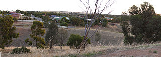
Uleybury is a rural locality near Adelaide, South Australia. It is located at the eastern side of the City of Playford local government area, just north of One Tree Hill along Gawler-One Tree Hill Road.
Taylor is a single-member electoral district for the South Australian House of Assembly. This district is named after Doris Irene Taylor MBE, a leading force in the founding of Meals on Wheels, and Labor activist. Taylor is a 246.2 km2 semi-urban electorate in Adelaide's outer northern suburbs and market gardens on the Adelaide Northern plains. A large portion of the district lives in the western half of the City of Playford and it is regarded as a safe Labor seat. It now includes the suburbs and townships of Andrews Farm, Angle Vale, Bolivar, Buckland Park, Davoren Park, Edinburgh, Edinburgh North, Elizabeth North, Eyre, Macdonald Park, Munno Para West, Penfield, Penfield Gardens, Riverlea Park, Smithfield, Smithfield Plains, St Kilda, Virginia, and Waterloo Corner.
Playford International College is a high school in Elizabeth, a northern suburb of Adelaide, South Australia. It is an amalgamation of three secondary schools in Elizabeth: Playford High School, Fremont High School, and Elizabeth City High School.
The City of Playford Library Service is the public library service of the City of Playford which is located in the northern suburbs of Adelaide, South Australia.
Craigmore is a large suburb north of Adelaide, South Australia. It is in the City of Playford local government area, just east of Elizabeth and south of Gawler.
Smithfield is a suburb in the northern outskirts of Adelaide, South Australia. It is in the City of Playford.
The City of Elizabeth was a local government area located in the northern suburbs of Adelaide and seated at Elizabeth from 1964 to 1997.
Munno Para is a northern suburb of Adelaide, South Australia. It is located in the City of Playford.
Andrews Farm is a northern suburb of Adelaide, South Australia. It is located in the City of Playford.
Blakeview is a northern suburb of Adelaide, South Australia. It is located in the City of Playford. Blakeview is predominantly a residential suburb, but also has two commercial areas and two education areas.
Smithfield Plains is a northern suburb of Adelaide, South Australia in the City of Playford.
The District Council of Yatala was a local government area of South Australia established in 1853 and abolished in 1868.
The Hundred of Munno Para is a cadastral unit of hundred covering the outer northern suburbs of Adelaide north of the Little Para River and the flanking semi-rural areas in South Australia. It is one of the eleven hundreds of the County of Adelaide. It was named in 1846 by Governor Frederick Robe, Munno Para being a term from a local Kaurna Aboriginal people meaning golden wattle creek. This name refers to either the Gawler River or the Little Para River.
The District Council of Munno Para East was a local government area of South Australia from 1853 to 1958, seated at Uleybury.
The District Council of Munno Mara West was a local government area of South Australia on the central Adelaide Plains from 1854 to 1933.
This page is based on this Wikipedia article Text is available under the CC BY-SA 4.0 license; additional terms may apply. Images, videos and audio are available under their respective licenses.