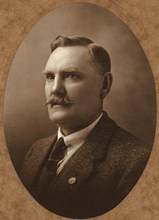
Maurice Collins was an Australian politician. He was a Country Party member of the Australian House of Representatives from 1928 to 1929, representing the electorate of Wakefield. He was reported to be "one of the best known personalities in the pastoral industry" in South Australia.

The Morgan railway line or North-West Bend railway was a railway line on the South Australian Railways network.
South Australian Mining Association was a no-liability company which established several mines in South Australia, notably the "Grey Wheal", or north mine at Burra, which made a fortune for its promoters, the "Snobs", while the adjacent southern claim, by the Princess Royal Company ("Nobs") proved worthless.

The District Council of Burra Burra was a local government area in South Australia from 1935 to 1997.
Apoinga is a rural locality in the Mid North region of South Australia, situated in the Regional Council of Goyder.
The District Council of Robertstown was a local government area in South Australia from 1932 to 1997. The central town and council seat was Robertstown.

The District Council of Eudunda was a local government area in South Australia from 1932 to 1997. The central town and council seat was Eudunda. It was established on 12 May 1932 with the amalgamation of the District Council of Julia and the District Council of Neales. By 1936, it was divided up into four wards: Brownlow, Eudunda and Neales and Julia. It met at the District Hall at Eudunda, which had formerly been owned by the Neales council, until 1963. The council existed until 1997, when it amalgamated with the District Council of Burra Burra, the District Council of Hallett and the District Council of Robertstown to form the Regional Council of Goyder.
The District Council of Hallett was a local government area in South Australia from 1877 to 1997.
The District Council of Neales was a local government area in South Australia from 1878 to 1932. The main town and council seat was Eudunda.
The District Council of Julia was a local government area in South Australia from 1874 to 1932. The council seat was located at Hampden.
The District Council of Mount Bryan was a local government area in South Australia from 1874 to 1935.
The District Council of English was a local government area in South Australia from 1878 to 1932.
The District Council of Hanson was a local government area in South Australia from 1878 to 1935.
Baldina is a rural locality in the Mid North region of South Australia, situated in the Regional Council of Goyder. It was established in August 2000, when boundaries were formalised for the "long established local name".
Emu Downs is a rural locality in the Mid North region of South Australia, situated in the Regional Council of Goyder.
Ngapala is a rural locality in the Mid North region of South Australia, situated in the Regional Council of Goyder. It was established in August 2000, when boundaries were formalised for the "long established local name". It is divided between the cadastral Hundreds of English and Julia Creek.
Porter Lagoon is a rural locality in the Mid North region of South Australia, situated in the Regional Council of Goyder. It was established in August 2000, when boundaries were formalised for the "long established local name". Most of the locality lies in the cadastral Hundred of Hanson; a small strip along the eastern side lies in the Hundred of Apoinga.
Koonoona is a rural locality in the Mid North region of South Australia, situated in the Regional Council of Goyder. It was established in August 2000, when boundaries were formalised for the "long established local name". It occupies the north-western corner of the cadastral Hundred of Apoinga.
Gum Creek is a rural locality in the Mid North region of South Australia, situated in the Regional Council of Goyder. It was established in August 2000, when boundaries were formalised for the "long established local name". It is named for the Gum Creek pastoral property, which originally extended from Farrell Flat to Mount Bryan, with the homestead being located in the Gum Creek locality. The property was owned by a number of notable figures, with Sir John Duncan succeeding Sir Walter Hughes as owner.
Leighton is a rural locality in the Mid North region of South Australia, situated in the Regional Council of Goyder. It was established in August 2000, when boundaries were formalised for the "long established local name".


