The City of Port Adelaide Enfield, located across inner north and north-western suburbs of Adelaide, is one of the largest metropolitan councils within South Australia. It was established on 26 March 1996 by the amalgamation of the City of Port Adelaide and the City of Enfield.
The City of Prospect is an inner urban local government area (LGA) in Adelaide, South Australia. The council seat is the unusually-large suburb of Prospect, which makes up almost two thirds of the tiny council area which is less than 8km2. Established in 1872, it is one of the oldest local government bodies in South Australia.

The Corporation of the Town of Walkerville is a small local government area in the central suburbs of Adelaide, South Australia.

The City of Enfield was a local government area of South Australia from 1868 to 1996. It was known as Yatala South up until 1933, which was named for its local government area predecessor, the District Council of Yatala, and known as Enfield thereafter.
Grand Junction Road is the longest east–west thoroughfare in the Adelaide metropolitan area, and is located approximately 8 kilometres north of the Adelaide city centre. Travelling from the Port Adelaide region, it is mostly a double-lane sealed road running 21 kilometres to the base of the Adelaide Hills. The western end at the intersection of Old Port Road, 300 metres east of a causeway which separates the Port River from West Lakes. The 2.4 kilometre section of road that continues west of Old Port Road to Semaphore South is named Bower Road. The eastern end of Grand Junction Road is in the suburb of Hope Valley, at the intersection of Hancock Road and Lower North East Road, just before the latter proceeds into the Adelaide Hills, past Anstey Hill Recreation Park and on towards the towns of Houghton and Inglewood.
Yatala Vale is an outer northeastern rural suburb of Adelaide, South Australia. It is located in the City of Tea Tree Gully local government area, and is adjacent to Golden Grove and Fairview Park, as well as the rural districts of Upper Hermitage and Gould Creek.

Upper Hermitage is an outer northeastern rural suburb of Adelaide, South Australia. It is located in the City of Tea Tree Gully and Adelaide Hills Council local government areas, and is adjacent to the rural districts of Yatala Vale and Gould Creek.
Yatala may refer to any of the following items. For all Australian places named Yatala, the etymology at Hundred of Yatala applies.
Devon Park is an inner northern suburb of Adelaide, South Australia. It is located in the cities of Port Adelaide Enfield and Charles Sturt beside the Gawler railway line near, but not meeting, the intersection of Torrens Road and Churchill Road.
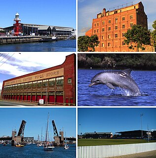
The City of Port Adelaide was a local government area of South Australia centred at the port of Adelaide from 1855 to 1996.
The District Council of Yatala was a local government area of South Australia established in 1853 and abolished in 1868.
The District Council of Glanville was a local government area in South Australia from 1864 to 1888.

The Hundred of Yatala is a cadastral unit of hundred in South Australia covering much of the Adelaide metropolitan area north of the River Torrens. It is one of the eleven hundreds of the County of Adelaide stretching from the Torrens in the south to the Little Para River in the north; and spanning from the coast in the west to the Adelaide foothills in the east. It is roughly bisected from east to west by Dry Creek. It was named in 1846 by Governor Frederick Robe, Yatala being likely derived from 'yartala', an indigenous word referring to the flooded state of the plain either side of Dry Creek after heavy rain.
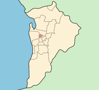
The District Council of Yatala North was a local government area of South Australia on the central Adelaide Plains from 1868 to 1933. It was split from the abolished District Council of Yatala on 18 June 1868. The council area ranged approximately from Dry Creek in the south to the Little Para River in the north.

The Hundred of Port Adelaide is a cadastral hundred covering the vicinity of Port Adelaide, Lefevre Peninsula and the coast of the central Adelaide Plains south of Gawler River and west of Port Wakefield Road. It is one of the eleven hundreds of the County of Adelaide and was named in 1846 by Governor Frederick Robe.
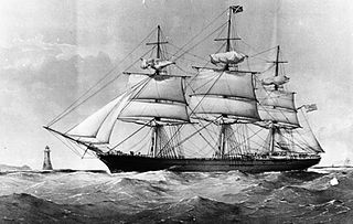
Yatala, 1,127 tons, was a clipper ship built in 1865 for the Orient Line. She traded to South Australia from London for seven years until she was wrecked on 27 March 1872, near Cape Grisnez, France. Until the advent of Torrens, she was arguably the fastest on the route. Her only master was Captain John Legoe, previously of Celestial and The Murray.
The District Council of Hindmarsh was a local government area in South Australia from 1853 to 1875, seated at the inner north west Adelaide suburb of Hindmarsh.

The City of Woodville was a local government area in South Australia from 1875 to 1993, seated at the inner north west Adelaide suburb of Woodville.
The District Council of Queenstown and Alberton was a local government area of South Australia established in 1864 and abolished in 1898.
This page is based on this
Wikipedia article Text is available under the
CC BY-SA 4.0 license; additional terms may apply.
Images, videos and audio are available under their respective licenses.