District Council of Minlaton

Last updated

District Council of Minlaton
South Australia
Australia South Australia location map.svg
Red pog.svg
District Council of Minlaton
Coordinates 34°45′0″S137°39′24″E / 34.75000°S 137.65667°E / -34.75000; 137.65667 Coordinates: 34°45′0″S137°39′24″E / 34.75000°S 137.65667°E / -34.75000; 137.65667
Established1888
Abolished1997
LGAs around District Council of Minlaton:
Spencer Gulf Yorke Peninsula (1888–1969)
Central Yorke Peninsula (1969–1997)
Gulf St Vincent
Spencer Gulf District Council of Minlaton Gulf St Vincent
Melville (1888–1932)
Yorketown (1932–1997)
Warooka (1888–1997)
Dalrymple (1888–1932)
Melville (1888–1932)
Yorketown (1932–1997)
Gulf St Vincent

The District Council of Minlaton was a local government area in South Australia from 1888 to 1997 seated at Minlaton on the Yorke Peninsula.

Local government in the Australian state of South Australia describes the organisations and processes by which towns and districts can manage their own affairs to the extent permitted by section 64A of Constitution Act 1934 (SA).

South Australia State of Australia

South Australia is a state in the southern central part of Australia. It covers some of the most arid parts of the country. With a total land area of 983,482 square kilometres (379,725 sq mi), it is the fourth-largest of Australia's states and territories by area, and fifth largest by population. It has a total of 1.7 million people, and its population is the second most highly centralised in Australia, after Western Australia, with more than 77 percent of South Australians living in the capital, Adelaide, or its environs. Other population centres in the state are relatively small; Mount Gambier, the second largest centre, has a population of 28,684.

Minlaton, South Australia Town in South Australia

Minlaton is a town in central Yorke Peninsula, South Australia. At the 2016 census, Minlaton had a population of 800. It is known as the "Barley capital of the world", due to the rich Barley production in the region.

Contents

History

The District Council of Minlaton was officially proclaimed on 5 January 1888 by the District Councils Act 1887 as constituting the Hundreds of Curramulka, Koolywurtie and Minlacowie, and the unincorporated portion of the Hundred of Ramsay. [1] This cluster of adjacent hundreds spanned the entire width of the peninsula at Minlaton for about 29 kilometres (18 mi) north to south.

The District Councils Act 1887 was an act of the Parliament of South Australia. It received assent on 9 December 1887, and its provisions came into effect when proclaimed by Governor William C. F. Robinson on 5 January 1888.

The Hundred of Koolywurtie is a hundred in the county of County of Fergusson in South Australia. Proclaimed on 31 December 1874, it covers an area of 320 square kilometres (123 sq mi). Its name is thought to be derived from the place known as "Koolywurtie or Black Point." The first local government body within the hundred was the District Council of Minlaton.

The first council meeting was held on 13 February 1888 and John C Tonkin was elected chairman. Prior to 1920 council meetings were held in the Minlaton Institute or in other rented rooms. [2]

In November 1907 the council annexed portions of the hundreds of Muloowurtie and Wauraltee from the Yorke Peninsula council. [2]

The District Council of Yorke Peninsula was a local government area on the Yorke Peninsula of South Australia from 1888 to 1969.

In June 1908 portions of the Hundred of Ramsay were severed from the council and annexed by the District Council of Dalrymple. [2]

In 1920 the first council chambers were built in Minlaton. Then in 1939 the council seat was moved to the new town hall of Minlaton. [2]

The council ceased to exist in 1997 when it was amalgamated with the councils of Central Yorke Peninsula, Warooka and Yorketown to form the second iteration of the District Council of Yorke Peninsula. [2]

Neighbouring local government

The following adjacent local government bodies co-existed with the Minlaton council:

Related Research Articles

Yorke Peninsula Region in South Australia

The Yorke Peninsula is a peninsula located north-west and west of Adelaide in South Australia, between Spencer Gulf on the west and Gulf St Vincent on the east. The peninsula is separated from Kangaroo Island to the south by Investigator Strait. The most populous town in the region is Kadina.

Yorke Peninsula Council Local government area in South Australia

The Yorke Peninsula Council is a local government area in South Australia. Its boundaries include most of the Yorke Peninsula. The council seat is at Maitland; the council also maintains branch offices at Minlaton, Warooka and Yorketown.

Yorketown, South Australia Town in South Australia

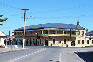
Yorketown is a town and a locality in the Australian state of South Australia located in the southern Yorke Peninsula about 91 kilometres (57 mi) west of the state capital of Adelaide and about 70 kilometres (43 mi) south of the municipal seat of Maitland. At the 2016 census, the locality had a population of 969 of which 642 lived in its town centre.

The Yorke Peninsula Football League (YPFL) is an Australian rules football competition based in the Yorke Peninsula region of South Australia, Australia. It is an affiliated member of the South Australian National Football League. The league was known as the Yorke Valley Football League until 1996, having previously absorbed the Yorke Peninsula Football Association in 1961, and the Southern Yorke Peninsula Football League in 1994.

Stansbury, South Australia Town in South Australia

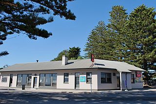
Stansbury is a small town, located in the southern east coast of Yorke Peninsula, South Australia. At the 2016 census, Stansbury had a population of 648 people. It is located 25 kilometres (16 mi) south of Minlaton and 22 kilometres (14 mi) east of Yorketown. It faces the Gulf St Vincent across Oyster Bay, where shellfish were originally harvested in the 19th century. The town has also been a port used in the export of wheat and barley to Adelaide.

Curramulka Town in South Australia

Curramulka is a town in the Australian state of South Australia on the Yorke Peninsula. Curramulka is within easy driving distance of the coastal resort towns of Port Victoria and Port Vincent and is 15 kilometres (9.3 mi) north-east of Minlaton. At the 2016 census, Curramulka had a population of 305.

Ramsay Conservation Park Protected area in South Australia

Ramsay Conservation Park is a protected area in the Australian state of South Australia located in the Yorke Peninsula in the locality of Ramsay about 6.5 kilometres west-northwest of the town of Port Vincent.

District Council of Bute Local government area in South Australia

The District Council of Bute was a local government area in South Australia from 1885 to 1997.

District Council of Central Yorke Peninsula

The District Council of Central Yorke Peninsula was a local government area in South Australia from 1969 to 1997. The council seat was at Maitland.

County of Fergusson Cadastral in South Australia

County of Fergusson is a cadastral unit located in the Australian state of South Australia which spans Yorke Peninsula south of Price. It was proclaimed in 1869 by Governor Fergusson after whom the county was named.

Hundred of Dalrymple Cadastral in South Australia

The Hundred of Dalrymple is a cadastral unit of hundred in South Australia on the southern Yorke Peninsula. It is one of the 16 hundreds of the County of Fergusson. Proclaimed on 20 June 1872, it is officially thought to be named after Dalrymple, East Ayrshire, Scotland.

Hundred of Melville Cadastral in South Australia

The Hundred of Melville is a cadastral unit of hundred in South Australia on the southern Yorke Peninsula. It is one of the 16 hundreds of the County of Fergusson. Proclaimed on 18 February June 1869, it was named after Lord Melville, First Lord of the Admiralty in the 1810s and 1820s.

District Council of Snowtown Local government area in South Australia

The District Council of Snowtown was a local government area in South Australia from 1888 to 1987.

District Council of Blyth Local government area in South Australia

The District Council of Blyth was a local government area in South Australia from 1872 to 1987 seated at Blyth in the Mid North.

District Council of Port Wakefield Local government area in South Australia

The District Council of Port Wakefield was a local government area seated at Port Wakefield in South Australia from 1878 to 1983.

District Council of Balaklava Local government area in South Australia

The District Council of Balaklava was a local government area seated at Balaklava in South Australia from 1877 to 1983.

Hundred of Tiparra Cadastral in South Australia

The Hundred of Tiparra is a cadastral unit of hundred located in the Mid North of South Australia. It is one of the 16 hundreds of the County of Daly and was proclaimed by Governor Dominick Daly in 1862.

County of Frome Cadastral in South Australia

The County of Frome is one of the 49 cadastral counties of South Australia in straddling the Mid North and Flinders Ranges regions. It was proclaimed in 1851 by Governor Henry Young and was named for the former Surveyor-General of South Australia, Edward Charles Frome. The iconic Mount Remarkable in the Hundred of Gregory is at the centre of the county.

References

  1. The District Councils Act 1887 (No. 419 of 50 and 51 Vic, 1887) (SA) "DISTRICT OF MINLATON.—Comprising the Hundreds of Curramulka, Koolywurtie, and Minlacowie, and that portion of the Hundred of Ramsay not heretofore included in the District of Dalrymple."
  2. 1 2 3 4 5 "Minlaton". SA Memory. State Library of South Australia. Retrieved 3 July 2017.