
Peterborough is a town in the mid north of South Australia, in wheat country, just off the Barrier Highway. It was originally named Petersburg after the landowner, Peter Doecke, who sold land to create the town. It was one of 69 places in South Australia renamed in 1917 due to anti-German sentiments during World War I.
Light Regional Council is a local government area north of Adelaide in South Australia. It is based in the town of Kapunda, and includes the towns of Freeling, Greenock, Hansborough, Hewett, Roseworthy and Wasleys.

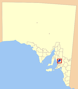
The District Council of Peterborough is a local government area in the Yorke and Mid North region of South Australia. The principal town and council seat is Peterborough; it also includes the localities of Cavenagh, Dawson, Hardy, Minvalara, Nackara, Oodla Wirra, Paratoo, Parnaroo, Sunnybrae, Ucolta and Yongala.
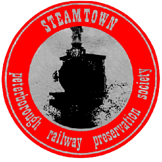
The Steamtown Peterborough Railway Preservation Society Inc. was a not-for-profit incorporated society that operated a heritage steam railway from Peterborough, South Australia, north along a section of the Peterborough to Quorn railway line, between 1977 and 2002. The society based its operations on the former South Australian Railways roundhouse at Peterborough and purpose-built sheds and yard at Peterborough West.
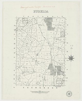
Eurelia is a town and locality in the Australian state of South Australia located on the east side of the Flinders Ranges about 264 kilometres (164 mi) north of the state capital of Adelaide and about 20 kilometres (12 mi) from the municipal seat of Orroroo.
The City of Port Adelaide was a local government area of South Australia centred at the port of Adelaide from 1855 to 1996.
Burra Burra was an electoral district of the House of Assembly in the Australian state of South Australia from 1902 to 1938.
The Times and Northern Advertiser was a weekly newspaper published in Peterborough, South Australia from August 1887 to 1970.
The District Council of Hawker was a local government area in South Australia from 1888 to 1997, centred on the town of Hawker. At its creation it was the northernmost local government area in the state.
The District Council of Yongala was a local government area in South Australia from 1883 to 1935, seated at Yongala.
The District Council of Caltowie was a local government area in South Australia, centred on the town of Caltowie and surrounding cadastral Hundred of Caltowie. It came into operation on 28 February 1878, with the first five councillors appointed by proclamation. The town and hundred had both been laid out in 1872. The council initially met in local hotels, leased private offices for a period, and met at Hornsdale Station for a year, before constructing purpose-built council offices in Charles Street, Caltowie, in 1896.
The Corporate Town of Gladstone was a local government area in South Australia, centred on the town of Gladstone. It was proclaimed on 8 March 1883, separating the township from the surrounding District Council of Gladstone. It was divided into three wards at its inception, each represented by two councillors. In 1923, it covered an area of 2,243 acres, with a capital value of £137,740. In 1924, it transferred ownership of the Town Hall and the Soldiers' Memorial to the Gladstone Institute. It ceased to exist on 15 May 1933 when it merged back into the District Council. It was expressed at the time that there was local regret at the loss of the distinct town council, but that a decline in rates and reductions in state government expenditure had made it a necessity.
The District Council of Pirie was a local government area in South Australia from 1892 to 1996. It surrounded, but did not include, the city of Port Pirie, which had its own municipal government as the City of Port Pirie.
The City of Port Pirie was a local government area in South Australia from 1876 to 1997, centred on the city of Port Pirie.
The Corporate Town of Moonta was a local government area in South Australia from 1872 to 1984, centred on the town of Moonta.
The District Council of Port Gawler was a local government area in South Australia from 1856 to 1935. It was proclaimed on 11 September 1856 after being severed from the District Council of Mudla Wirra.

The District Council of Terowie was a local government area in South Australia from 1888 to 1935, centring on the town of Terowie.
The Corporate Town of Burra was a local government area in South Australia from 1876 to 1969.
The Corporate Town of Kadina was a local government area in South Australia from 1872 to 1977, based in the town of Kadina.
The County of Dalhousie is one of the 49 cadastral counties of South Australia in straddling the Mid North and Flinders Ranges regions. It was proclaimed in 1871 by Governor James Fergusson and was named for Fergusson's father-in-law James Broun-Ramsay, 1st Marquess of Dalhousie.
