District Council of Rocky River

Last updated

District Council of Rocky River
South Australia
Australia South Australia location map.svg
Red pog.svg
District Council of Rocky River
Coordinates 33°16′0″S138°21′0″E / 33.26667°S 138.35000°E / -33.26667; 138.35000 Coordinates: 33°16′0″S138°21′0″E / 33.26667°S 138.35000°E / -33.26667; 138.35000
Established 1988
Abolished 1997
Council seat Gladstone
LGAs around District Council of Rocky River:
Port Germein
Mount Remarkable
Port Germein
Mount Remarkable
Jamestown
Crystal Brook-Redhill District Council of Rocky River Jamestown
Spalding
Blyth-Snowtown Blyth-Snowtown Clare

The District Council of Rocky River was a local government area in South Australia from 1988 to 1997, seated at Gladstone.

Local government in the Australian state of South Australia describes the organisations and processes by which towns and districts can manage their own affairs to the extent permitted by section 64A of Constitution Act 1934 (SA).

South Australia State of Australia

South Australia is a state in the southern central part of Australia. It covers some of the most arid parts of the country. With a total land area of 983,482 square kilometres (379,725 sq mi), it is the fourth-largest of Australia's states and territories by area, and fifth largest by population. It has a total of 1.7 million people, and its population is the second most highly centralised in Australia, after Western Australia, with more than 77 percent of South Australians living in the capital, Adelaide, or its environs. Other population centres in the state are relatively small; Mount Gambier, the second largest centre, has a population of 28,684.

Gladstone, South Australia Town in South Australia

Gladstone is a small rural town in the Mid North of South Australia in the approach to the lower Flinders Ranges. At the 2006 census, Gladstone had a population of 629.

Contents

History

The council came into existence on 1 May 1988 with the amalgamation of the District Council of Georgetown, District Council of Gladstone and District Council of Laura. It had nine members divided amongst three wards (Georgetown, Gladstone and Laura), each returning three councillors. [1] It was relatively short-lived, as on 3 May 1997 it merged with the District Council of Jamestown and the District Council of Spalding to create the Northern Areas Council. [2] [3] Its principal office was located in Gladstone. [4]

The District Council of Georgetown was a local government area in South Australia, centred on the town of Georgetown.

The District Council of Gladstone was a local government area in South Australia. It was proclaimed on 10 August 1876 as the District Council of Yangya, named for the cadastral Hundred of Yangya, but was renamed Gladstone after its main town on 14 August 1879. Gladstone had been built as a private township very close to the hundred boundary, and the adjacent government township of Booyoolie, built not long after, was in the adjacent Hundred of Booyoolie, and formed as the separate District Council of Booyoolie, dividing the twin towns into two separate municipalities based on their respective hundreds. It gained the Booyoolie township from that council in 1879, and acquired the remainder of what had been the southern portion of the Booyoolie council on 12 August 1880. It then gained the remainder of the Hundred of Yangya under the District Councils Act 1887.

The District Council of Laura was a local government area in South Australia. It was created on 1 May 1932 with the amalgamation of the Corporate Town of Laura and the District Council of Booyoolie. It reunited the whole cadastral Hundred of Booyoolie within the same district council, as had previously been the case when the Booyoolie council was first proclaimed in 1876. The Laura merger had occurred after a much broader 1931 merger proposal, which would have seen the Corporate Town of Laura, District Council of Gladstone, Corporate Town of Gladstone and District Council of Caltowie merge into a drastically enlarged District Council of Booyoolie, was abandoned after meeting strong opposition from both the Laura and Gladstone communities.

See also

Related Research Articles

Mid Murray Council Local government area in South Australia

The Mid Murray Council is a local government area in South Australia in the Murray and Mallee region of South Australia. The council spans the area from the Riverland through the Murraylands to the eastern slopes of the Mount Lofty Ranges. It includes 220 km of the Murray River. The council seat is at Mannum; it also maintains secondary offices at Cambrai and Morgan.

Northern Areas Council Local government area in South Australia

Northern Areas Council is a local government area in the Yorke and Mid North region of South Australia. The council seat and main council offices are at Jamestown, while the council also maintains district offices at Gladstone and Spalding.

Laura, South Australia Town in South Australia

Laura is a rural town in the Mid North region of South Australia, 12 km north of Gladstone on the Horrocks Highway and 40 km east of Port Pirie. The first European to explore the district was Thomas Burr in September 1842. His promising reports soon led to occupation of the district by pastoralists, one of whom was Herbert Bristow Hughes. When the present town was surveyed he named it for his wife, Laura née White.

Copper Coast Council Local government area in South Australia

The Copper Coast Council is a local government area in the Australian state of South Australia located at the northern end of the Yorke Peninsula. It was established in 1997 and its seat is in Kadina.

Georgetown, South Australia Town in South Australia

Georgetown is a town in the Mid North region of South Australia. The town is in the Northern Areas Council, 196 kilometres (122 mi) north of the state capital, Adelaide on the Horrocks Highway. At the 2006 census, Georgetown had a population of 119.

Wirrabara, South Australia Town in South Australia

Wirrabara is a town and a locality in South Australia. Wirrabara is located in the Southern Flinders Ranges in the Mid North of South Australia, along the Rocky River. The Horrocks Highway passes through the town.

Rocky River was an electoral district of the House of Assembly in the Australian state of South Australia from March 1938 to December 1985.

District Council of Spalding

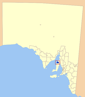
The District Council of Spalding was a local government area in South Australia, centred on the town of Spalding. It was proclaimed on 30 July 1885 by Governor William C. F. Robinson, comprising the Hundreds of Reynolds and Andrews as far south as the northern boundary of Euromina. It followed significant agitation by residents for a local municipality, with the boundaries having been the subject of some dispute.

The District Council of Hutt and Hill Rivers was a local government area in South Australia. It was established on 30 July 1885 and included the entirety of the Hundred of Milne as well as the south half of the Hundred of Andrews. It gained the Hundred of Hart in January 1888 following the passage of the District Councils Act 1887. The municipality had no township within its boundaries, so a council chambers was built at Bungaree; the building survives today and is used for tourist accommodation. In 1909, a section was severed and added to the District Council of Snowtown. It was abolished in 1935 following a Local Government Commission report that advocated cutting the number of municipalities in South Australia from 196 to 142, with Hutt and Hill Rivers being divided between the adjacent District Council of Spalding, District Council of Clare and the remainder to the District Council of Blyth.

Narridy is a locality in the Mid North region of South Australia, situated within the Northern Areas Council.

District Council of Light (1977–1996) Local government area in South Australia

The District Council of Light was a local government area in South Australia from 1977 to 1996, seated at Freeling.

The District Council of Crystal Brook was a local government area in South Australia from 1882 until 1988, seated at Crystal Brook.

District Council of Crystal Brook-Redhill former local government area of Australia

The District Council of Crystal Brook-Redhill was a local government area in South Australia.

District Council of Booyoolie

The District Council of Booyoolie was a local government area in South Australia. It was proclaimed on 2 March 1876 and comprised the entire cadastral Hundred of Booyoolie. It included at its inception the government town of Booyoolie, North Gladstone, Laura and Stone Hut. It was divided into five wards, each electing one councillor. In September 1876, the council decided to construct a council office and chamber at Laura.

The Corporate Town of Gladstone was a local government area in South Australia, centred on the town of Gladstone. It was proclaimed on 8 March 1883, separating the township from the surrounding District Council of Gladstone. It was divided into three wards at its inception, each represented by two councillors. In 1923, it covered an area of 2,243 acres, with a capital value of £137,740. In 1924, it transferred ownership of the Town Hall and the Soldiers' Memorial to the Gladstone Institute. It ceased to exist on 15 May 1933 when it merged back into the District Council. It was expressed at the time that there was local regret at the loss of the distinct town council, but that a decline in rates and reductions in state government expenditure had made it a necessity.

District Council of Northern Yorke Peninsula former local government area of Australia

The District Council of Northern Yorke Peninsula was a local government area in South Australia from 1984 to 1997. The council seat was at Kadina.

Hundred of Yackamoorundie Cadastral in South Australia

The Hundred of Yackamoorundie is a cadastral unit of hundred in the County of Stanley, South Australia.

References

  1. "Thursday, 27 August, 1987" (PDF). South Australian Government Gazette . Government of South Australia . Retrieved 20 November 2016.
  2. "Gladstone". Northern Areas Council. Retrieved 18 March 2016.
  3. "Laura". Northern Areas Council. Retrieved 18 March 2016.
  4. "District Council of Rocky River, Periodical Election" (PDF). South Australian Government Gazette . Government of South Australia: 775. 25 February 1993. Retrieved 19 October 2016.