Related Research Articles
The Mount Barker District Council is a local government area, centred on the Adelaide hills town of Mount Barker, just outside the Adelaide metropolitan area in South Australia.

The City of Onkaparinga is a local government area (LGA) located on the southern fringe of Adelaide, South Australia. It is named after the Onkaparinga River, whose name comes from Ngangkiparinga, a Kaurna word meaning women's river. It is the largest LGA in South Australia, with a population of over 170,000 people in both urban and rural communities and is also geographically expansive, encompassing an area of 518.3 km². The council is headquartered in the Noarlunga Centre with area offices situated in Aberfoyle Park, Woodcroft and Willunga.
Happy Valley is a metropolitan suburb of Adelaide, South Australia. It is located 20 km south of the Central Business District of Adelaide.

The City of Glenelg was a local government area in South Australia seated at the Adelaide sea-side township of Glenelg from 1855 until 1997.

The Southern Argus is a newspaper first published from March 1866 in Port Elliot, South Australia, and then in Strathalbyn from 1868 to the present. It is published on Thursdays.
The District Council of Laura was a local government area in South Australia. It was created on 1 May 1932 with the amalgamation of the Corporate Town of Laura and the District Council of Booyoolie. It reunited the whole cadastral Hundred of Booyoolie within the same district council, as had previously been the case when the Booyoolie council was first proclaimed in 1876. The Laura merger had occurred after a much broader 1931 merger proposal, which would have seen the Corporate Town of Laura, District Council of Gladstone, Corporate Town of Gladstone and District Council of Caltowie merge into a drastically enlarged District Council of Booyoolie, was abandoned after meeting strong opposition from both the Laura and Gladstone communities.
The District Council of Hallett was a local government area in South Australia from 1877 to 1997.
The District Council of Burra was a local government area in South Australia from 1872 to 1935.
The District Council of Mount Pleasant was a local government area in South Australia from 1935 to 1997. The council seat was located at Mount Pleasant.

The Hundred of Kondoparinga is a cadastral unit of hundred in South Australia. It was proclaimed on 29 October 1846 and covers an area of 210 square kilometres (80 sq mi). It is one of the eleven hundreds of the County of Hindmarsh.
The District Council of Willunga, was a local government area in South Australia seated at Willunga from 1853 until 1997.

The Hundred of Willunga is a cadastral unit of hundred covering the extreme south suburbs of the Adelaide metropolitan area. It is one of the eleven hundreds of the County of Adelaide. It was named in 1846 by Governor Frederick Robe probably deriving from a Kaurna/Ngarrindjeri place label willannga, meaning place of green trees.
The Hundred of Kuitpo is a cadastral unit of hundred in the Adelaide Hills. It is one of the 11 hundreds of the County of Adelaide. It was named in 1846 by Governor Frederick Robe and is presumed to be derived from an indigenous term ku-it-po, meaning reeds and referring to Blackfellow Creek in the contemporary locality of Yundi.
The Local Government Areas (Re-arrangement) Acts 1929 and 1931 were acts of the Parliament of South Australia. The application of the acts, via recommendations of the commission of the same name, led to the statewide re-arrangement of local government areas, effected from 1932 to 1935.

The Hundred of Noarlunga is a cadastral unit of hundred in South Australia covering the far south-western Adelaide metropolitan area south and west of the Sturt River and north and west of the Onkaparinga River. It is one of the eleven hundreds of the County of Adelaide stretching from Glenelg in the northwest to Port Noarlunga in the southwest; and spanning inland between the Sturt and Onkaparinga to Bridgewater in the Adelaide foothills. It was named in 1846 by Governor Frederick Robe, Noarlunga being likely derived from 'nurlongga', an indigenous word referring to the curvature in the Onkaparinga River at Old Noarlunga, dubbed Horseshoe Bend by European settlers.
The City of Noarlunga, formerly the District Council of Noarlunga, was a local government area in South Australia from 1856 until 1997.
The District Council of Stirling was a local government area of South Australia from 1883 to 1997, seated at Stirling.
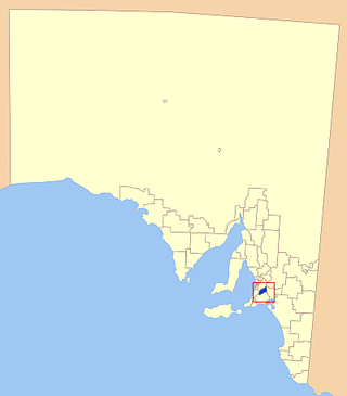
The District Council of Kondoparinga was a local government area in South Australia from 1853 until 1935, at which point the council lands and resources formed the heart of the new District Council of Meadows.
The District Council of Strathalbyn was a local government area in South Australia centred on the town of Strathalbyn from 1854 until 1997. From 1868 the township itself was locally governed by the Corporation of Strathalbyn but that entity was amalgamated back into the district council in 1976.
The District Council of Nairne was a local government area in South Australia seated at Nairne from 1853 to 1935.
References
- 1 2 "LOCAL GOVERNMENT AREAS (RE-ARRANGEMENT) ACTS, 1929 AND 1931" (PDF). South Australian Government Gazette (13 ed.). 1935: 835–849. 21 March 1935. Retrieved 13 December 2017.
- ↑ Hosking, P.; Universal Publicity Company (1936), The Official civic record of South Australia : centenary year, 1936, Universal Publicity Company, p. 682, retrieved 21 July 2017
- 1 2 Marsden, Susan (2012). "A History of South Australian Councils to 1936" (PDF). Local Government Association of South Australia. Archived from the original (PDF) on 17 March 2016. Retrieved 30 May 2016.
- ↑ "LOCAL GOVERNMENT ACT, 1934: SECTION 48—NAME OF 'THE CITY OF HAPPY VALLEY' ASSIGNED TO CORPORATE TOWN OF MEADOWS" (PDF). South Australian Government Gazette (48 ed.). 1983: 1277. 3 November 1983. Retrieved 15 December 2017.
- Paul B. Stark, B.Arch. (July 1983). "Meadows Heritage" (PDF). District Council of Meadows. pp. 155–200. ISBN 0 9591205 0 5 . Retrieved 30 October 2018– via Environment SA.
35°11′0″S138°45′0″E / 35.18333°S 138.75000°E
| | This Australian government-related article is a stub. You can help Wikipedia by expanding it. |
| | This article about Adelaide is a stub. You can help Wikipedia by expanding it. |