
The Mid Murray Council is a local government area in South Australia in the Murray and Mallee region of South Australia. The council spans the area from the Riverland through the Murraylands to the eastern slopes of the Mount Lofty Ranges. It includes 220 km of the Murray River. The council seat is at Mannum; it also maintains secondary offices at Cambrai and Morgan.
The District Council of Waikerie was a local government area in South Australia from 1914 to 1997, centring on the town of Waikerie.

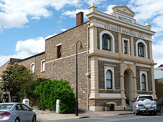
Sedan is a rural town in South Australia. It is located about 100 kilometres east of Adelaide and about 20 kilometres west of the Murray River. It is located on the dry eastern side of the Mount Lofty Ranges.

The Hundred of Bagot is a cadastral hundred in the County of Eyre in South Australia. It is located between the Mount Lofty Ranges on the west and the Murray River further to the east. The Hundred of Bagot is almost exactly spans the boundaries of the contemporary town of Sedan.

The County of Eyre is one of the 49 cadastral counties of South Australia. It was proclaimed by Governor George Grey in 1842 and named for the explorer Edward John Eyre. It covers a portion of the state between the Adelaide Hills in the west and the Murray River in the east from Robertstown and Mannum on the northern boundary to Sedan and Swan Reach on the southern boundary.
The District Council of Ridley-Truro was a local government area in South Australia from 1991 to 1997.
The District Council of Ridley was a local government area in South Australia from 1976 to 1991.
The District Council of Truro was a local government area in South Australia from 1876 to 1991.
The Hundred of Jellicoe is a cadastral hundred in the County of Eyre in South Australia. It is located on the east Mount Lofty Ranges foothills. The Hundred of North Rhine was proclaimed in 1851 but the name was changed in 1918 to the current, after Admiral John Jellicoe, as part of a process to remove "names of enemy origin" at the time of World War I.
The District Council of Snowtown was a local government area in South Australia from 1888 to 1987.
The District Council of Hall was a local government area in South Australia from 1878 to 1935.
The District Council of Blyth was a local government area in South Australia from 1872 to 1987 seated at Blyth in the Mid North.
The District Council of Balaklava was a local government area seated at Balaklava in South Australia from 1877 to 1983.
The Local Government Areas (Re-arrangement) Acts 1929 and 1931 were acts of the Parliament of South Australia. The application of the acts, via recommendations of the commission of the same name, led to the statewide re-arrangement of local government areas, effected from 1932 to 1935.
The City of Happy Valley, formerly the District Council of Meadows, was a local government area in South Australia from 1935 until 1997.
The City of Noarlunga, formerly the District Council of Noarlunga, was a local government area in South Australia from 1856 until 1997.
The District Council of Swan Reach was a local government area in the Murraylands of South Australia from 1888 to 1933.

The County of Albert is one of the 49 cadastral counties of South Australia on the east banks of the River Murray. It was proclaimed by Governor Richard MacDonnell in 1860 and named for Albert, Prince Consort of Queen Victoria.
The District Council of Strathalbyn was a local government area in South Australia centred on the town of Strathalbyn from 1854 until 1997. From 1868 the township itself was locally governed by the Corporation of Strathalbyn but that entity was amalgamated back into the district council in 1976.
The District Council of Kapunda was a local government area in South Australia from 1866 to 1996. The Kapunda town corporation was formed a year earlier in 1865 and ultimately amalgamated into the district council.
