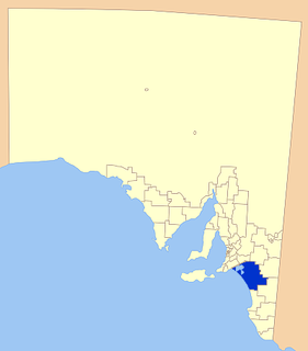
The Mid Murray Council is a local government area in South Australia in the Murray and Mallee region of South Australia. The council spans the area from the Riverland through the Murraylands to the eastern slopes of the Mount Lofty Ranges. It includes 220 km of the Murray River. The council seat is at Mannum; it also maintains secondary offices at Cambrai and Morgan.

Coorong District Council is a local government area in South Australia located between the River Murray and the Limestone Coast region. The district cover mostly rural areas with small townships, as well as part of the Coorong National Park.
The District Council of Waikerie was a local government area in South Australia from 1914 to 1997, centring on the town of Waikerie.
The District Council of Loxton was a local government area in South Australia from 1910 to 1997, centring on the town of Loxton.

The District Council of Crystal Brook-Redhill was a local government area in South Australia.

The Hundred of Bagot is a cadastral hundred in the County of Eyre in South Australia. It is located between the Mount Lofty Ranges on the west and the Murray River further to the east. The Hundred of Bagot is almost exactly spans the boundaries of the contemporary town of Sedan.

The District Council of Northern Yorke Peninsula was a local government area in South Australia from 1984 to 1997. The council seat was at Kadina.

The District Council of Central Yorke Peninsula was a local government area in South Australia from 1969 to 1997. The council seat was at Maitland.

The District Council of Mobilong was a local government area in South Australia from 1884 to 1977.

The District Council of English was a local government area in South Australia from 1878 to 1932.
The City of Hindmarsh Woodville was a local government area in South Australia from 1993 to 1997 seated at the inner north west Adelaide suburbs of Hindmarsh and Woodville.
The District Council of Mannum was a local government area in South Australia from 1877 to 1997, centring on the town of Mannum.

The District Council of Morgan was a local government area in South Australia from 1888 to 1997, centring on the town of Morgan.

The District Council of Mount Pleasant was a local government area in South Australia from 1935 to 1997. The council seat was located at Mount Pleasant.

The District Council of Ridley was a local government area in South Australia from 1976 to 1991.
The District Council of Truro was a local government area in South Australia from 1876 to 1991.
The District Council of Onkaparinga was a local government council of South Australia from 1853 to 1997.

The Hundred of Forster, formerly the hundreds of Giles and Morphett, is a cadastral hundred in the County of Albert, South Australia.

The County of Albert is one of the 49 cadastral counties of South Australia on the east banks of the River Murray. It was proclaimed by Governor Richard MacDonnell in 1860 and named for Albert, Prince Consort of Queen Victoria.

The District Council of Sedan was a local government area in South Australia seated at the town of Sedan from 1933 until 1976.


