Karoonda is a town in the middle of the Murray Mallee region of South Australia. The current boundaries include the former town of Lowaldie, which was the next stop on the railway line away from Adelaide.

Coonawarra is a small town north of Penola in South Australia. It is best known for the Coonawarra wine region named after it.

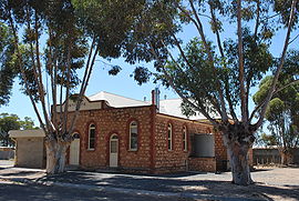
Tantanoola is a town in regional South Australia. The name is derived from the aboriginal word tentunola, which means boxwood / brushwood hill or camp. Tantanoola was originally named 'Lucieton' by Governor Jervois after his daughter Lucy Caroline, on 10 July 1879. It was changed by Governor Robinson to 'Tantanoola' on 4 October 1888. At the 2006 census, Tantanoola had a population of 255.

Buckleboo is a locality in the Australian state of South Australia on the Eyre Peninsula located about 313 kilometres (194 mi) northwest of the state capital of Adelaide and about 31 kilometres (19 mi) northwest of the municipal seat of Kimba.

Coonalpyn is a town and a locality in the Australian state of South Australia located about 143 kilometres (89 mi) south-east of the state capital of Adelaide and about 61 kilometres (38 mi) south-east of the municipal seat in Tailem Bend. It is situated in the local government area of the Coorong District Council and is in the State electoratal district of MacKillop and the Federal division of Barker.
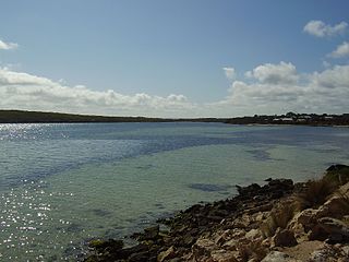
Coffin Bay, originally Coffin's Bay, is a town at the southern extremity of the Eyre Peninsula, a wheat growing area of South Australia. At the 2016 census, Coffin Bay had a population of 611.

Beachport is a small coastal town in the Australian state of South Australia about 311 kilometres (193 mi) south-east of the state capital of Adelaide and about 34 kilometres (21 mi) north-west of the municipal seat in Millicent, located at the northern end of Rivoli Bay. Beachport has a large crayfishing fleet, and is known for its 772-metre (2,533 ft)-long jetty, the second-longest in South Australia after the one at Port Germein. The towns Norfolk pines, white sand beach and clear waters are alluring to visitors
Poochera is a small grain belt town 60 km north-west of Streaky Bay on the Eyre Peninsula, South Australia.
Mount Compass is a town and locality in the Australian state of South Australia located in the Mount Lofty Ranges, on the A13 south of Adelaide, and north of Victor Harbor. It is a small community, traditionally supported by farming. Both market gardens and dairy have proved lucrative in the area. At the 2016 census, Mount Compass shared a population of 1,457 with adjoining localities.

Wilmington is a town and locality in the Yorke and Mid North region of South Australia.The town is located in the District Council of Mount Remarkable local government area, 305 kilometres (190 mi) north of the state capital, Adelaide.

Sedan is a rural town in South Australia. It is located about 100 kilometres east of Adelaide and about 20 kilometres west of the Murray River. It is located on the dry eastern side of the Mount Lofty Ranges.
Hynam is a town and locality in the Australian state of South Australia located in the state's south-east within the Limestone Coast region on the border with the state of Victoria about 302 kilometres south east of the state capital of Adelaide and about 11 kilometres east of the municipal seat of Naracoorte.
Peebinga is a town and locality in the Australian state of South Australia. Peebinga was the terminus of the Peebinga railway line which was built in 1914 as part of a major state government project to open up the Murray Mallee for grazing and cropping.

Pinkerton Plains is a locality in the Mid North of South Australia, Australia.
Glenburnie is an eastern suburb of Mount Gambier.
Mount Hope is a small town on the Flinders Highway on the west coast of Eyre Peninsula in South Australia. It was the terminus of a branch of the Eyre Peninsula Railway from Yeelanna from 1914 until but the line was closed and dismantled in 1966. The town was surveyed in 1916, and proposed to be named Mount Woakwine, but no action was taken to call it that.
Verran is a locality in the Australian state of South Australia located on the Eyre Peninsula about 241 kilometres west of the state capital of Adelaide. Its name is derived from the cadastral unit of the Hundred of Verran, which was named for former Premier John Verran.
Dismal Swamp is a locality in the Australian state of South Australia located about 361 kilometres (224 mi) south-east of the state capital of Adelaide and about 19 kilometres (12 mi) north-west of the municipal seat of Mount Gambier.
Kringin is a town and a locality in the Australian state of South Australia located in the state’s east about 199 kilometres (124 mi) east of the state capital of Adelaide and about 61 kilometres (38 mi) south of the municipal seat of Loxton.
Marne Valley Conservation Park is a protected area in the Australian state of South Australia located in the locality of Cambrai about 77 kilometres (48 mi) north-west of the state capital of Adelaide and about 30 kilometres (19 mi) west of the municipal seat of Mannum.