Hacks Lagoon Conservation Park is a protected area in the Australian state of South Australia located in the locality of Bool Lagoon about 24 kilometres south of the municipal seat of Naracoorte.

The County of Flinders is one of the 49 cadastral counties of South Australia. The county covers the southern part of the Eyre Peninsula “bounded on the north by a line connecting Point Drummond with Cape Burr, and on all other sides by the seacoast, including all islands adjacent to the main land.”
Hambidge Wilderness Protection Area is a protected area in the Australian state of South Australia located in the gazetted locality of Hambidge about 140 kilometres north of Port Lincoln and 15 kilometres north east of Lock.

The County of Hindmarsh is one of the 49 cadastral counties of South Australia. It was proclaimed by Governor George Grey in 1842 and named for Governor John Hindmarsh.

County of Carnarvon is a cadastral unit located in the Australian state of South Australia which covers the full extent of Kangaroo Island. It was proclaimed in 1874 by Governor Musgrave in response to the demand for agriculture land on Kangaroo Island.
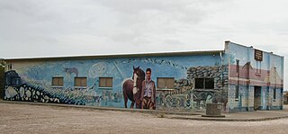
Brownlow is a locality in the Australian state of South Australia about 98 kilometres north-east of the Adelaide city centre

County of Burra is a cadastral unit located in the Australian state of South Australia which covers land located in the state’s east associated with the town of Burra. It was proclaimed in 1851 by Governor Young and named after the town of Burra.
The County of Musgrave is a cadastral unit in the Australian state of South Australia that covers land on the west coast of Eyre Peninsula. It was proclaimed on 22 June 1876 and named after Anthony Musgrave, the Governor of South Australia from 9 June 1876 to 29 January 1877.
Darke Range Conservation Park is a protected area in the Australian state of South Australia located on the Eyre Peninsula in the gazetted locality of Darke Peak about 2 kilometres (1.2 mi) west of the town centre in Darke Peak.

County of Le Hunte is a cadastral unit located in the Australian state of South Australia that covers land located in the centre of Eyre Peninsula. It was proclaimed in 1908 and named after George Le Hunte who was the Governor of South Australia from July 1903 to February 1909.

County of Buxton is a cadastral unit located in the Australian state of South Australia that covers land located in the centre of Eyre Peninsula. It was proclaimed in 1896 and named after Thomas Buxton who was the Governor of South Australia from 29 October 1895 to 29 March 1899. It has been divided into thirteen sub-divisions known as hundreds, with the most recent being created in 1928.

The County of Jervois is a cadastral unit in the Australian state of South Australia that covers land on the east coast of the Eyre Peninsula. It was proclaimed on 24 January 1878 and named after William Jervois, the Governor of South Australia from October 1877 to January 1883.
Monarto Woodlands Conservation Park is a protected area in the Australian state of South Australia in the gazetted localities of Monarto South and White Hill west of Murray Bridge.
Kinchina Conservation Park is a protected area in the Australian state of South Australia in the north of the Gifford Hill Range on the eastern flanks the localities of Rocky Gully and White Hill, west of Murray Bridge.
Wiljani Conservation Park is a protected area in the Australian state of South Australia in the gazetted locality of Mount Pleasant located about 3.5 kilometres (2.2 mi) north-west of the town centre in Mount Pleasant.
Annadale is a locality in South Australia. It is located on the plains east of the Mount Lofty Ranges astride the Sturt Highway 110 kilometres (68 mi) from Adelaide, between Truro and Blanchetown, South Australia. Halfway House Road is a heavy vehicle detour route that runs south from the Sturt Highway at Annadale. Annadale occupies the central part of the hundred of Anna.

County of Taunton is a cadastral unit located in the Australian state of South Australia on land on the east coast of Lake Torrens about 160 kilometres (99 mi) from the city of Port Augusta. It was proclaimed in 1877 and named after Lord Taunton who was the Secretary for the Colonies from 1855 to 1858. It has been partially divided in the following sub-units of hundreds – Bunyeroo, Carr, Edeowie, Nilpena, Oratunga and Parachilna.
Pike River Conservation Park is a protected area located in the Australian state of South Australia in the locality of Mundic Creek about 215 kilometres (134 mi) north-east of the state capital of Adelaide and about 2 kilometres (1.2 mi) south of the town of Paringa.
Padthaway Conservation Park is a protected area in the Australian state of South Australia located in the state's south-east in the gazetted locality of Padthaway about 253 kilometres (157 mi) south-east of the state capital of Adelaide and about 2.5 kilometres (1.6 mi) north-east of the locality's town centre.

County of Hanson is a cadastral unit located in the Australian state of South Australia that covers land in the Flinders Ranges immediately east of the town of Hawker. It was proclaimed on 20 July 1877 and is named after Sir Richard Davies Hanson who served as Premier, Administrator and Chief Justice of South Australia. It has been partially divided in the following sub-units of hundreds – Adams, Arkaba, French, Moralana and Warcowie.
