

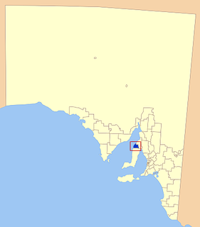
The Corporate Town of Wallaroo was a local government area in South Australia from 1874 to 1997, centred on the town of Wallaroo. [1] [2]
The Corporate Town of Wallaroo was a local government area in South Australia from 1874 to 1997, centred on the town of Wallaroo. [1] [2]
The municipality was proclaimed on 25 June 1874, following a petition from local residents that February, although there been had earlier opposition to incorporation. [1] [3] [4] It consisted of five members at its creation, with two seats from each of a North Ward and South Ward and a separate position for the mayor. [1]
The first town hall had originally been the Wallaroo Institute, but had subsequently been taken over by the council for use as a town hall. [5] This became too small for community purposes, and a new town hall was built in 1902 at a cost of £3,050. [6] The building was completely destroyed by fire on 26 December 1917, involving substantial loss of municipal records. [7] [4] It was immediately rebuilt, with the new hall reopening in February 1919. [8]
Prior to the collapse of the Wallaroo and Kadina Mining Company in 1923, the Wallaroo council bought power from the company rather than producing it themselves, leaving them temporarily stranded when the company went into liquidation that year. [9] In 1936, the municipality covered an area of approximately two and three quarter square miles, and had a population of 4,000. It was responsible for 29 miles of streets and roads and 800 acres of parklands, and had undergone an active tree planting program. [4] It ceased to exist in 1997, when it merged with the District Council of Northern Yorke Peninsula to form the District Council of the Copper Coast. [2]

Wallaroo is a port town on the western side of Yorke Peninsula in South Australia, 160 kilometres (100 mi) northwest of Adelaide. It is one of the three Copper Triangle towns famed for their historic shared copper mining industry, and known together as "Little Cornwall", the other two being Kadina, about 8 kilometres (5 mi) to the east, and Moonta, about 18 kilometres (11 mi) south. In 2015, Wallaroo had an estimated population of 4,010.

Kadina is a town on the Yorke Peninsula of the Australian state of South Australia, approximately 144 kilometres north-northwest of the state capital of Adelaide. The largest town of the Peninsula, Kadina is one of the three Copper Triangle towns famous for their shared copper mining history. The three towns are known as "Little Cornwall" for the significant number of immigrants from Cornwall who worked at the mines in the late 19th century.

Moonta is a town on the Yorke Peninsula of South Australia, 165 km (103 mi) north-northwest of the state capital of Adelaide. It is one of three towns known as the Copper Coast or "Little Cornwall" for their shared copper mining history.
The Copper Coast Council is a local government area in the Australian state of South Australia located at the northern end of the Yorke Peninsula. It was established in 1997 and its seat is in Kadina.

Jerusalem is a suburb of the town of Kadina on the Yorke Peninsula. It is located in the Copper Coast Council. The boundaries were formally gazetted in January, 1999, although the name had long been in use for the area.

Wallaroo Mines is a suburb of the inland town of Kadina on the Yorke Peninsula in the Copper Coast Council area.. It was named for the land division in which it was established in 1860, the Hundred of Wallaroo, as was the nearby coastal town of Wallaroo. The boundaries were formally gazetted in January 1999 for "the long established name".
Matta Flat is a suburb of the town of Kadina on the Yorke Peninsula. It is located in the Copper Coast Council. The boundaries were formally gazetted in January 1999, although the name had long been in use for the area.
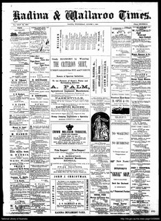
The Kadina and Wallaroo Times was a newspaper published in Kadina, and also serving the nearby Wallaroo, South Australia from August 1888 to August 1966. In 1968 the paper merged to form the Yorke Peninsula Country Times.

John Frederick Herbert was an Australian politician who represented the South Australian House of Assembly multi-member seat of Wallaroo from 1912 to 1918. He represented the United Labor Party until he joined the National Party in the 1917 Labor split.
John Albert Southwood was an Australian politician, newspaperman and trade unionist. He represented the South Australian House of Assembly multi-member seats of Wallaroo from 1912 to 1915 and East Torrens from 1915 to 1921. He was a member of the United Labor Party until 1917, when he joined the National Party after the 1917 Labor split, but sat as an independent from 1920 until his retirement in 1921.
Henry Lamshed was a farmer and politician in colonial South Australia.
Ninnes is a locality at the northeastern corner of Yorke Peninsula and western side of the Mid North of South Australia. It lies where the Upper Yorke Road from Kulpara to Bute is crossed by the road from Paskeville to Lochiel. The dominant industry is broadacre grain and sheep farming.
New Town is a suburb of the town of Kadina on the Yorke Peninsula. It is located in the Copper Coast Council. The boundaries were formally gazetted in January 1999, although the name had long been in use for the area.

The Balaklava-Moonta railway line was a railway line on the South Australian Railways network. It ran across the top of the Yorke Peninsula.
The District Council of Bute was a local government area in South Australia from 1885 to 1997.
The District Council of Northern Yorke Peninsula was a local government area in South Australia from 1984 to 1997. The council seat was at Kadina.
The Corporate Town of Moonta was a local government area in South Australia from 1872 to 1984, centred on the town of Moonta.
The District Council of Kadina was a local government area in South Australia from 1888 to 1984.
The Corporate Town of Kadina was a local government area in South Australia from 1872 to 1977, based in the town of Kadina.
The District Council of Green's Plains was a local government area in South Australia from 1871 to 1888. It was the first local government on the Yorke Peninsula.