District Council of English

Last updated

The District Council of English was a local government area in South Australia from 1878 to 1932. [1]

Local government in the Australian state of South Australia describes the organisations and processes by which towns and districts can manage their own affairs to the extent permitted by section 64A of Constitution Act 1934 (SA).

South Australia State of Australia

South Australia is a state in the southern central part of Australia. It covers some of the most arid parts of the country. With a total land area of 983,482 square kilometres (379,725 sq mi), it is the fourth-largest of Australia's states and territories by area, and fifth largest by population. It has a total of 1.7 million people, and its population is the second most highly centralised in Australia, after Western Australia, with more than 77 percent of South Australians living in the capital, Adelaide, or its environs. Other population centres in the state are relatively small; Mount Gambier, the second largest centre, has a population of 28,684.

The council was proclaimed on 31 October 1878, consisting of the whole of the cadastral Hundred of English, in which residents had been advocating for their own district council since at least 1873. The first five councillors were appointed in the founding proclamation: Albert Day, John Farley, George Jansen, Wilhelm Ferdinand Sieber, and Johann Miekel. [2] [3] It gained the neighbouring Hundred of Bower under the District Councils Act 1887 , with the new area represented by two additional councillors. [4] [5] The council seat was located at Point Pass, even though the largest town in the district was Robertstown. [1] The council had four wards: Bower Ward, Emmaus Ward, Robertstown Ward and Point Pass Ward. [6]

Hundred of English Cadastral in South Australia

The Hundred of English is a cadastral unit of hundred containing all or part of the localities of Brady Creek, Robertstown, Rocky Plain, Geranium Plains, Ngapala, Point Pass, Australia Plains and Eudunda. It is one of the 16 hundreds of the County of Eyre. It was named in 1866 by Governor of South Australia, Dominick Daly after T English MLC (1820–1884), a former mayor of Adelaide and current Member of the colony's Legislative Council at the time.

The District Councils Act 1887 was an act of the Parliament of South Australia. It received assent on 9 December 1887, and its provisions came into effect when proclaimed by Governor William C. F. Robinson on 5 January 1888.

Point Pass, South Australia Town in South Australia

Point Pass is a small town in the Mid North of South Australia, 120 kilometres North of Adelaide which is the capital city of South Australia. The town is located 11 kilometres (6.8 mi) north of Eudunda, in the Regional Council of Goyder. At the 2006 census, Robertstown and the surrounding area had a population of 322.

The council amalgamated with the adjacent District Council of Apoinga to form the District Council of Robertstown on 5 May 1932, becoming the English and Point Pass wards of the new council. [1] [7] The English council had strongly protested any alteration of its boundaries; although unsuccessful in stopping the merger, local opposition did overturn an earlier plan to split the Point Pass area from the new council and place it in the District Council of Eudunda. [8] [9] One former English chairman, A. W. Farley, had been a lone voice in support of the merger, claiming that the councils "had been bankrupt for ten years, inferior metal had been placed on the roads which did not last, and the money had been frittered away." [10] [8]

District Council of Apoinga

The District Council of Apoinga was a local government area in South Australia from 1873 to 1932.

The District Council of Robertstown was a local government area in South Australia from 1932 to 1997. The central town and council seat was Robertstown.

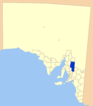
The District Council of Eudunda was a local government area in South Australia from 1932 to 1997. The central town and council seat was Eudunda. It was established on 12 May 1932 with the amalgamation of the District Council of Julia and the District Council of Neales. By 1936, it had been divided up into four wards: Brownlow, Eudunda and Neales and Julia. It met at the District Hall at Eudunda, which had formerly been owned by the Neales council, until 1963. The council existed until 1997, when it amalgamated with the District Council of Burra Burra, the District Council of Hallett and the District Council of Robertstown to form the Regional Council of Goyder.

Chairmen

Name dates notes
J. G. Ruediger 1887 [11]
Day 1890 [12]
Johann Wilhelm Nicolai 1892–1894 [13]
H Klabe 1912 [14]
E. G. Schmidt 1928–1929 [15] [16]

Related Research Articles

Morgan railway line

The Morgan railway line or North-West Bend railway was a railway line on the South Australian Railways network.

District Council of Burra Burra

The District Council of Burra Burra was a local government area in South Australia from 1935 to 1997.

Apoinga, South Australia Town in South Australia

Apoinga is a rural locality in the Mid North region of South Australia, situated in the Regional Council of Goyder.

The District Council of Hallett was a local government area in South Australia from 1877 to 1997.

The District Council of Neales was a local government area in South Australia from 1878 to 1932. The main town and council seat was Eudunda.

District Council of Julia local government area in South Australia

The District Council of Julia was a local government area in South Australia from 1874 to 1932. The council seat was located at Hampden.

The District Council of Mount Bryan was a local government area in South Australia from 1874 to 1935.

The District Council of Booborowie was a local government area in South Australia from 1875 to 1935.

District Council of Hanson

The District Council of Hanson was a local government area in South Australia from 1878 to 1935.

District Council of Burra

The District Council of Burra was a local government area in South Australia from 1872 to 1935.

Baldina, South Australia Town in South Australia

Baldina is a rural locality in the Mid North region of South Australia, situated in the Regional Council of Goyder. It was established in August 2000, when boundaries were formalised for the "long established local name".

Emu Downs, South Australia Town in South Australia

Emu Downs is a rural locality in the Mid North region of South Australia, situated in the Regional Council of Goyder.

Ngapala, South Australia Town in South Australia

Ngapala is a rural locality in the Mid North region of South Australia, situated in the Regional Council of Goyder. It was established in August 2000, when boundaries were formalised for the "long established local name". It is divided between the cadastral Hundreds of English and Julia Creek.

Porter Lagoon, South Australia Town in South Australia

Porter Lagoon is a rural locality in the Mid North region of South Australia, situated in the Regional Council of Goyder. It was established in August 2000, when boundaries were formalised for the "long established local name". Most of the locality lies in the cadastral Hundred of Hanson; a small strip along the eastern side lies in the Hundred of Apoinga.

Koonoona, South Australia Town in South Australia

Koonoona is a rural locality in the Mid North region of South Australia, situated in the Regional Council of Goyder. It was established in August 2000, when boundaries were formalised for the "long established local name". It occupies the north-western corner of the cadastral Hundred of Apoinga.

Gum Creek, South Australia Town in South Australia

Gum Creek is a rural locality in the Mid North region of South Australia, situated in the Regional Council of Goyder. It was established in August 2000, when boundaries were formalised for the "long established local name". It is named for the Gum Creek pastoral property, which originally extended from Farrell Flat to Mount Bryan, with the homestead being located in the Gum Creek locality. The property was owned by a number of notable figures, with Sir John Duncan succeeding Sir Walter Hughes as owner.

References

  1. 1 2 3 Marsden, Susan (2012). "A History of South Australian Councils to 1936" (PDF). Local Government Association of South Australia. p. 11. Retrieved 30 October 2015.
  2. "Thursday, October 31, 1878" (PDF). The Government Gazette of South Australia. Government of South Australia. Retrieved 3 November 2016.
  3. "GOVERNMENT GAZETTE". The South Australian Advertiser . 2 August 1873. p. 5 (Unknown). Retrieved 3 November 2016 via National Library of Australia.
  4. "The District Councils Act 1887 No. 419". Flinders University. Retrieved 3 November 2016.
  5. "DISTRICT COUNCILS". The South Australian Advertiser . XXX (9143). 7 February 1888. p. 7. Retrieved 3 November 2016 via National Library of Australia.
  6. "Advertising". Adelaide Observer . LV (2,960). 25 June 1898. p. 23. Retrieved 3 November 2016 via National Library of Australia.
  7. "LARGER LOCAL GOVERNMENT AREAS". The Chronicle . LXXIV (3906). Adelaide. 15 October 1931. p. 3. Retrieved 3 November 2016 via National Library of Australia.
  8. 1 2 "Altering of District Council Areas". Burra Record . 52 (46). South Australia. 18 November 1931. p. 4. Retrieved 3 November 2016 via National Library of Australia.
  9. "NEW LOCAL GOVERNMENT BOUNDARIES". The Chronicle . LXXIV (3,928). Adelaide. 17 March 1932. p. 41. Retrieved 3 November 2016 via National Library of Australia.
  10. "DISTRICT COUNCIL OF APOINGA". Burra Record . 52 (20). South Australia. 20 May 1931. p. 1. Retrieved 3 November 2016 via National Library of Australia.
  11. "The Kapunda Herald". Kapunda Herald . XXIII (2014). South Australia. 1 November 1887. p. 2. Retrieved 3 November 2016 via National Library of Australia.
  12. "DISTRICT COUNCIL". Kapunda Herald . XXVI (2,285). South Australia. 6 June 1890. p. 3. Retrieved 18 June 2017 via National Library of Australia.
  13. "OBITUARY NOTICES". The Observer . LXXXV (4,455). Adelaide. 10 November 1928. p. 48. Retrieved 3 November 2016 via National Library of Australia.
  14. "DISTRICT COUNCIL OF ENGLISH". The Chronicle . LIV (2,790). Adelaide. 10 February 1912. p. 30. Retrieved 18 June 2017 via National Library of Australia.
  15. "MR. McINTOSH AT POINT PASS". The Chronicle . LXX (3,736). Adelaide. 28 April 1928. p. 37. Retrieved 3 November 2016 via National Library of Australia.
  16. "SETTLERS ASK FOR WATER". The Register News-Pictorial . XCIV (27,284). South Australia. 25 January 1929. p. 13. Retrieved 3 November 2016 via National Library of Australia.

Coordinates: 34°04′33″S139°03′02″E / 34.075730°S 139.050560°E / -34.075730; 139.050560

Geographic coordinate system Coordinate system

A geographic coordinate system is a coordinate system that enables every location on Earth to be specified by a set of numbers, letters or symbols. The coordinates are often chosen such that one of the numbers represents a vertical position and two or three of the numbers represent a horizontal position; alternatively, a geographic position may be expressed in a combined three-dimensional Cartesian vector. A common choice of coordinates is latitude, longitude and elevation. To specify a location on a plane requires a map projection.