Robertstown, South Australia

Last updated

Robertstown
South Australia
Robertstown, South Australia.jpg
Australia South Australia location map.svg
Red pog.svg
Robertstown
Coordinates 34°00′0″S139°04′0″E / 34.00000°S 139.06667°E / -34.00000; 139.06667
Population223 (2021 census) [1]
Postcode(s) 5381
Elevation344 m (1,129 ft)
Location
LGA(s) Regional Council of Goyder
State electorate(s) Stuart
Federal division(s) Grey
Localities around Robertstown:
Emu Downs Hallelujah Hills Bright
Brady Creek Robertstown Rocky Plain
Ngapala Point Pass Australia Plains
Footnoteselevation [2]

Robertstown is a town in the Mid North region of South Australia, situated 125 km north of Adelaide, in the Regional Council of Goyder. At the 2021 census, Robertstown had a population of 223 people. [3]

Contents

Etymology

Mr John Roberts, the township's namesake, pictured c.1880. Mr John Roberts, the township was laid out by Mr Roberts in 1871 and was given his name.jpg
Mr John Roberts, the township‘s namesake, pictured c.1880.

Robertstown derives its name from John Roberts, the first postmaster in the region, who established the town layout in 1871. Previously, it was referred to as Emu Flats. [4]

History

The Robertstown area is the traditional lands of the Ngadjuri people. [5] The Ngadjuri have been largely overlooked in the histories of colonisation and the subsequent dispossession from their traditional lands.

In the early days of colonisation, the land in the district was primarily leased to stations like Anlaby and Koonoona. However, from 1850 onwards, the area was surveyed into smaller blocks, attracting European settlers to the region. The first settlers were likely stock overlanders from New South Wales. [4]

As the settlement grew, a wine shanty operated by Mr. O'Dea became the first shop in the area. John Roberts, a Koonunga storekeeper, later catered to the community with his traveling shop and eventually settled in the town, opening a general store and post office. Later, Roberts' son constructed a new store, which was renamed Lehmann's Store after being acquired by a long-serving employee. As of 2023, Lehmann's Store continues to operate, preserving a piece of the town's history. [6]

The S.A. Asbestos & Mining Co. Ltd operated a mine from 1894 that was 8 miles (13 km) northeast of the town. [7] The Blue Hole Mine was operated as an open-cut quarry from 1940 to 1951, 5 kilometres (3.1 mi) northwest of the town. [8]

Robertstown was previously the terminus of the Robertstown railway line from Eudunda and Adelaide, which operated between 1914 [9] and 1990. [10] Over time, the population of Robertstown gradually increased, reaching a peak of approximately 2,100 residents in 1936.

Demographics

According to the 2021 Census, Robertstown has a population of 223 people, with males accounting for 49.8% and females making up the remaining 50.2%. The median age of residents in Robertstown is 59. Approximately 1.3% of the population identifies as Aboriginal and/or Torres Strait Islander.

Robertstown has 58 families and 143 private dwellings, with an average of 1.9 people per household. The town has a substantial Lutheran community, with 27.4% of its residents practicing this religion, a figure considerably higher than the state average of 2.4%. This strong affiliation with Lutheranism can be attributed to the area's notable Lutheran heritage. The top three countries of birth for residents are Australia, England, and New Zealand.

The top three occupations in the town are managers, machinery operators and drivers, and labourers. The dominant industries in Robertstown include grain-sheep or grain-beef cattle farming, road freight transport, bakery product manufacturing, and supermarket and grocery stores. The median weekly household income in Robertstown is $748, lower than the state average.

Median monthly mortgage repayments in Robertstown are $433, lower than the state average. The median weekly rent in the town is $193, also lower than the state average. Robertstown has an average of 2.3 motor vehicles per dwelling, highlighting the importance of private transportation in the area. [3]

Sports and recreation

Robertstown's sporting facilities include an oval; basketball, netball, and tennis courts; and a bowling green. Robertstown has several sports clubs catering to various interests including:

Robertstown has a history of hosting motorcycle events, including the South Australian Reliability Trials Championship (SART). One of the rounds is held in Robertstown and is known as the Lew Job 2 Day event, organised by the Velocette Motorcycle Club. [11]

Robertstown also has two children's playgrounds. [12]

Nature and trails

Robertstown Oval hosts a free campground with a public dump point. [15]

Related Research Articles

<span class="mw-page-title-main">Burra, South Australia</span> Town in South Australia

Burra is a pastoral centre and historic tourist town in the mid-north of South Australia. It lies east of the Clare Valley in the Bald Hills range, part of the northern Mount Lofty Ranges, and on Burra Creek. The town began as a single company mining township that, by 1851, was a set of townships collectively known as "The Burra". The Burra mines supplied 89% of South Australia's and 5% of the world's copper for 15 years, and the settlement has been credited with saving the economy of the struggling new colony of South Australia. The Burra Burra Copper Mine was established in 1848 mining the copper deposit discovered in 1845. Miners and townspeople migrated to Burra primarily from Cornwall, Wales, Scotland and Germany. The mine first closed in 1877, briefly opened again early in the 20th century and for a last time from 1970 to 1981.

<span class="mw-page-title-main">Eudunda</span> Town in South Australia

Eudunda is a town in the Mid North region of South Australia, situated 110 kilometres northeast of Adelaide in the Regional Council of Goyder. As of 2021, Eudunda had a population of 815 people. Eudunda is known as the birthplace of author and educator Colin Thiele.

<span class="mw-page-title-main">Regional Council of Goyder</span> Local government area in South Australia

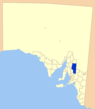
The Regional Council of Goyder is a local government area located in the Mid North region of South Australia. The council area is reliant on agriculture as a mainstay of its economy, with manufacturing and tourism also becoming prominent. The council seat is at Burra. A branch office is at Eudunda.

<span class="mw-page-title-main">Bower, South Australia</span> Town in South Australia

Bower is a town in South Australia, approximately halfway between Eudunda and Morgan on the Thiele Highway.

<span class="mw-page-title-main">Worlds End Highway</span>

Worlds End Highway is a road in the Yorke and Mid North region of South Australia running north from Eudunda through Robertstown to Goyder Highway 18 km southeast of Burra. The northern terminus of the highway is in a locality named Worlds End, leading to the name of the highway.

<span class="mw-page-title-main">Worlds End, South Australia</span> Town in South Australia

Worlds End is a locality 18 km southeast of Burra in South Australia. It also includes the area formerly known as Lapford.

<span class="mw-page-title-main">Point Pass, South Australia</span> Town in South Australia

Point Pass is a small town in the Mid North of South Australia, 115 kilometres north of Adelaide. It is located 11 kilometres (6.8 mi) north of Eudunda, in the Regional Council of Goyder. As of 2021, the population of Point Pass was 123.

<span class="mw-page-title-main">Bundey, South Australia</span> Town in South Australia

Bundey is a locality in the Mid North region of South Australia. It is located on Goyder's Line, on the plains between Burra and Morgan in the Regional Council of Goyder. The bounded locality of Bundey corresponds to the boundaries of the cadastral Hundred of Bundey, except for the southwestern corner of the Hundred which is the northeastern corner of the locality of Geranium Plains. Bundey was named in 1878 for politician William Henry Bundey.

<span class="mw-page-title-main">Australia Plains, South Australia</span> Town in South Australia

Australia Plains is a rural locality in the Mid North region of South Australia, situated 127 km northeast of Adelaide in the Regional Council of Goyder. As of 2021, the population of Australia Plains was 41.

<span class="mw-page-title-main">Geranium Plains, South Australia</span> Town in South Australia

Geranium Plains is a small town in the Regional Council of Goyder in South Australia. The post office opened in 1894, but has since closed. There was a proposal to rename it to Iperta in 1916, but this did not go ahead.

<span class="mw-page-title-main">District Council of Burra Burra</span> Local government area in South Australia

The District Council of Burra Burra was a local government area in South Australia from 1935 to 1997.

Apoinga is a rural locality in the Mid North region of South Australia, situated in the Regional Council of Goyder.

<span class="mw-page-title-main">Neales Flat, South Australia</span> Town in South Australia

NNeales Flat is a rural locality southeast of Eudunda in the Mid North region in South Australia. It is in the Regional Council of Goyder local government area, the South Australian House of Assembly electoral district of Stuart and the Australian House of Representatives Division of Grey.

The District Council of Robertstown was a local government area in South Australia from 1932 to 1997. The central town and council seat was Robertstown.

<span class="mw-page-title-main">District Council of Eudunda</span> Local government area in South Australia

The District Council of Eudunda was a local government area in South Australia from 1932 to 1997. The central town and council seat was Eudunda. It was established on 12 May 1932 with the amalgamation of the District Council of Julia and the District Council of Neales. By 1936, it was divided up into four wards: Brownlow, Eudunda and Neales and Julia. It met at the District Hall at Eudunda, which had formerly been owned by the Neales council, until 1963. The council existed until 1997, when it amalgamated with the District Council of Burra Burra, the District Council of Hallett and the District Council of Robertstown to form the Regional Council of Goyder.

Ngapala is a rural locality in the Mid North region of South Australia, situated in the Regional Council of Goyder. It was established in August 2000, when boundaries were formalised for the "long established local name". It is divided between the cadastral Hundreds of English and Julia Creek.

Bright is a rural locality in the Mid North region of South Australia, situated in the Regional Council of Goyder. It was established in August 2000, when boundaries were formalised for the "long established local name". It incorporates most of the cadastral Hundred of Bright, which was proclaimed on 17 June 1875 and named for politician Henry Edward Bright.

Porter Lagoon is a rural locality in the Mid North region of South Australia, situated in the Regional Council of Goyder. It was established in August 2000, when boundaries were formalised for the "long established local name". Most of the locality lies in the cadastral Hundred of Hanson; a small strip along the eastern side lies in the Hundred of Apoinga.

Koonoona is a rural locality in the Mid North region of South Australia, situated in the Regional Council of Goyder. It was established in August 2000, when boundaries were formalised for the "long established local name". It occupies the north-western corner of the cadastral Hundred of Apoinga.

Peep Hill is a rural locality in the Mid North region of South Australia, situated 120km north-east of Adelaide in the Regional Council of Goyder. It was established in August 2000, when boundaries were formalised for the "long established local name". As of 2021, Peep Hill has a population of 22 residents.

References

  1. Australian Bureau of Statistics (25 October 2007). "Robertstown (State Suburb)". 2006 Census QuickStats. Retrieved 16 July 2021.
  2. "Placename Details: Robertstown Railway Station". Property Location Browser. Land Services, Government of South Australia. SA0059039. Retrieved 15 February 2016.
  3. 1 2 "2021 Robertstown, Census All persons QuickStats | Australian Bureau of Statistics". www.abs.gov.au. Retrieved 5 July 2023.
  4. 1 2 Goyder, Regional Council of (16 October 2019). "Towns". Goyder Regional Council. Retrieved 5 July 2023.
  5. Studies, Australian Institute of Aboriginal and Torres Strait Islander (7 May 2023). "Map of Indigenous Australia". aiatsis.gov.au. Retrieved 5 July 2023.
  6. Green, Tanya (10 July 2020). "My Town: Merv Lehmann, Robertstown". SALIFE. Retrieved 5 July 2023.
  7. "Other Mines". Burra History Group. Retrieved 30 August 2016.
  8. "Blue Hole Mine (Apoinga Asbestos; Blue Success)". Mindat.org . Retrieved 30 August 2016.
  9. "ROBERTSTOWN RAILWAY". The Advertiser . Adelaide, SA: National Library of Australia. 10 December 1914. p. 9. Retrieved 21 February 2016.
  10. Mary Eberhard. "The last wheat train leaves Robertstown, 1986" (photograph). Johnny's Pages. Retrieved 21 February 2016.
  11. Battle, Geoff (19 December 2022). "RELIABILITY TRIALS – 'A HARD DAYS NIGHT' ONCE AGAIN IN 2023!". Motorcycling SA. Retrieved 5 July 2023.
  12. Goyder, Regional Council of (16 October 2019). "Robertstown Playground". Goyder Regional Council. Retrieved 5 July 2023.
  13. "325 km / 15 Day Hiking Trail | Lavender Federation Trail". Walking SA. Retrieved 6 July 2023.
  14. "Interactive Map of the Heysen Trail | Download GPX/GPS files". The Friends of the Heysen Trail. Retrieved 6 July 2023.
  15. O'Dea, Marie (3 December 2021). "Robertstown Oval". Visit Burra. Retrieved 5 July 2023.