The Regional Council of Goyder is a local government area located in the Mid North region of South Australia. The council area is reliant on agriculture as a mainstay of its economy, with manufacturing and tourism also becoming prominent. The council seat is at Burra. A branch office is at Eudunda.
Booborowie is a locality in South Australia. It is located 200 km (124 mi) north of Adelaide. At the 2016 census, the Booborowie district had a population of 218.

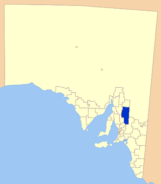
Worlds End is a locality 18 km southeast of Burra in South Australia. It also includes the area formerly known as Lapford.
Dawson is a rural locality in the Mid North region of South Australia, situated in the District Council of Peterborough. It covers the entirety of the cadastral Hundred of Coglin, with the exception of the small town of Oodla Wirra.

Mongolata is a rural locality in the Mid North region of South Australia, situated in the Regional Council of Goyder. The modern locality was established in August 2000, when boundaries were formalised for the "long established local name".

The District Council of Burra Burra was a local government area in South Australia from 1935 to 1997.
Apoinga is a rural locality in the Mid North region of South Australia, situated in the Regional Council of Goyder.
Collinsville is a rural locality in the Mid North region of South Australia, situated in the Regional Council of Goyder. It was established in August 2000, when boundaries were formalised for the "long established local name". It has almost exactly the same boundaries as the cadastral Hundred of Tomkinson, with small variations on its western border.
Brownlow is a locality in the Australian state of South Australia about 98 kilometres north-east of the Adelaide city centre
County of Burra is a cadastral unit located in the Australian state of South Australia which covers land located in the state’s east associated with the town of Burra. It was proclaimed in 1851 by Governor Young and named after the town of Burra.
The District Council of Burra was a local government area in South Australia from 1872 to 1935.
Baldina is a rural locality in the Mid North region of South Australia, situated in the Regional Council of Goyder. It was established in August 2000, when boundaries were formalised for the "long established local name".
Emu Downs is a rural locality in the Mid North region of South Australia, situated in the Regional Council of Goyder.
Porter Lagoon is a rural locality in the Mid North region of South Australia, situated in the Regional Council of Goyder. It was established in August 2000, when boundaries were formalised for the "long established local name". Most of the locality lies in the cadastral Hundred of Hanson; a small strip along the eastern side lies in the Hundred of Apoinga.
Koonoona is a rural locality in the Mid North region of South Australia, situated in the Regional Council of Goyder. It was established in August 2000, when boundaries were formalised for the "long established local name". It occupies the north-western corner of the cadastral Hundred of Apoinga.
Gum Creek is a rural locality in the Mid North region of South Australia, situated in the Regional Council of Goyder. It was established in August 2000, when boundaries were formalised for the "long established local name". It is named for the Gum Creek pastoral property, which originally extended from Farrell Flat to Mount Bryan, with the homestead being located in the Gum Creek locality. The property was owned by a number of notable figures, with Sir John Duncan succeeding Sir Walter Hughes as owner.
Willalo is a rural locality in the Mid North region of South Australia, situated in the Regional Council of Goyder. It was established in August 2000, when boundaries were formalised for the "long established local name". It was also known in its early days as North Booboorowie.
North Booborowie is a rural locality in the Mid North region of South Australia, situated in the Regional Council of Goyder. It was established in August 2008, when boundaries were formalised for the "long established local name". In early days, the North Booborowie name was sometimes used synonymously with Willalo, which is now gazetted as a separate locality to its north.
Leighton is a rural locality in the Mid North region of South Australia, situated in the Regional Council of Goyder. It was established in August 2000, when boundaries were formalised for the "long established local name".

County of Kimberley is a cadastral unit located in the Australian state of South Australia that covers land to the east of the Flinders Ranges about 45 kilometres (28 mi) east of the town of Peterborough. It was proclaimed in 1871 and named after John Wodehouse, 1st Earl of Kimberley, a British Secretary of State for the Colonies. It has been partially divided in the following sub-units of hundreds – Gumbowie, Hardy, Ketchowla, Parnaroo, Terowie and Wonna.
