
Kilcoy is a rural town and locality in the Somerset Region, Queensland, Australia. In the 2016 census, the locality of Kilcoy had a population of 1,898 people.

Maryvale is a rural town and locality in the Southern Downs Region, Queensland, Australia. In the 2016 census, the locality of Maryvale had a population of 303 people.
William Spence Peter was a pioneer pastoralist of South Australia and New Zealand, and a member of the New Zealand Legislative Council from 1868 to 1891.
Witchelina Nature Reserve, in South Australia, is situated on a former pastoral lease known as Witchelina that had operated as both a sheep station and cattle station, before being converted into a nature reserve by the Nature Foundation. The station gave its name to the locality of Witchelina.

Worlds End is a locality 18 km southeast of Burra in South Australia. It also includes the area formerly known as Lapford.
South Australian Mining Association was a no-liability company which established several mines in South Australia, notably the "Grey Wheal", or north mine at Burra, which made a fortune for its promoters, the "Snobs", while the adjacent southern claim, by the Princess Royal Company ("Nobs") proved worthless.
Yarrah is a rural locality in the Far North region of South Australia. The eastern section of Yarrah lies within the Flinders Ranges Council, while the western section lies in the Pastoral Unincorporated Area.

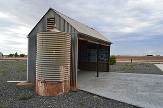
Mongolata is a rural locality in the Mid North region of South Australia, situated in the Regional Council of Goyder. The modern locality was established in August 2000, when boundaries were formalised for the "long established local name".
The District Council of Apoinga was a local government area in South Australia from 1873 to 1932.
Grace Plains is a rural locality in South Australia on the northern Adelaide Plains about 64 kilometres (40 mi) north of the state capital of Adelaide. It is divided between the Adelaide Plains Council and the Wakefield Regional Council. The formal boundaries were established in June 1997 for the long established local name with respect of the section in the District Council of Mallala ; the portion in the Wakefield council was added in January 2000. It is named after Grace Montgomery Farrell, widow of Rev C. B. Howard, the first South Australian Colonial Chaplain; she later married James Farrell, Dean of Adelaide.
The District Council of Hanson was a local government area in South Australia from 1878 to 1935.
Baldina is a rural locality in the Mid North region of South Australia, situated in the Regional Council of Goyder. It was established in August 2000, when boundaries were formalised for the "long established local name".
John Grainger was an English real estate investor and member of the South Australian Legislative Council from February 1851 to December 1854.
Emu Downs is a rural locality in the Mid North region of South Australia, situated in the Regional Council of Goyder.
Ngapala is a rural locality in the Mid North region of South Australia, situated in the Regional Council of Goyder. It was established in August 2000, when boundaries were formalised for the "long established local name". It is divided between the cadastral Hundreds of English and Julia Creek.
Koonoona is a rural locality in the Mid North region of South Australia, situated in the Regional Council of Goyder. It was established in August 2000, when boundaries were formalised for the "long established local name". It occupies the north-western corner of the cadastral Hundred of Apoinga.

Canowie Belt is a rural locality in the Mid North region of South Australia, situated in the Regional Council of Goyder. It was established in August 2000, when boundaries were formalised for the "long established local name". The name is adapted from "Kanya-owie", an Aboriginal word for "rock waterhole", and was associated with the Canowie Station pastoral lease.
Willalo is a rural locality in the Mid North region of South Australia, situated in the Regional Council of Goyder. It was established in August 2000, when boundaries were formalised for the "long established local name". It was also known in its early days as North Booboorowie.
North Booborowie is a rural locality in the Mid North region of South Australia, situated in the Regional Council of Goyder. It was established in August 2008, when boundaries were formalised for the "long established local name". In early days, the North Booborowie name was sometimes used synonymously with Willalo, which is now gazetted as a separate locality to its north.
Leighton is a rural locality in the Mid North region of South Australia, situated in the Regional Council of Goyder. It was established in August 2000, when boundaries were formalised for the "long established local name".
