Cambrai is a small town located on the eastern side of the Mount Lofty Ranges, along the River Marne. Originally named Rhine Villa, it was one of many Australian towns renamed during World War I to remove any connection with German place names and named after the Battle of Cambrai.

Buccleuch is a place in South Australia situated along the Pinnaroo railway line and Mallee Highway (B12), approximately 140 km east of Adelaide. It is part of the Coorong District Council. There is an active Lutheran Church in Buccleuch.

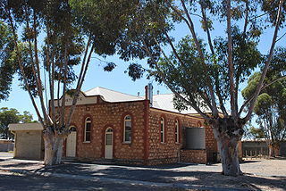
Bower is a town in South Australia, approximately halfway between Eudunda and Morgan on the Thiele Highway.

Worlds End is a locality 18 km southeast of Burra in South Australia. It also includes the area formerly known as Lapford.

Steinfeld is a locality in South Australia on the plains east of the Mount Lofty Ranges, and north of the Sturt Highway. The village of Steinfeld was established in the 19th century. It was renamed to Stonefield in 1918 as many places with German or German-sounding names were changed around World War I. The name reverted to Steinfeld in 1986.
Point Pass is a small town in the Mid North of South Australia, 120 kilometres North of Adelaide which is the capital city of South Australia. The town is located 11 kilometres (6.8 mi) north of Eudunda, in the Regional Council of Goyder. At the 2006 census, Robertstown and the surrounding area had a population of 322.

Bundey is a locality in the Mid North region of South Australia. It is located on Goyder's Line, on the plains between Burra and Morgan in the Regional Council of Goyder. The bounded locality of Bundey corresponds to the boundaries of the cadastral Hundred of Bundey, except for the southwestern corner of the Hundred which is the northeastern corner of the locality of Geranium Plains. Bundey was named in 1878 for politician William Henry Bundey.

Geranium Plains is a small town in the Regional Council of Goyder in South Australia. The post office opened in 1894, but has since closed. There was a proposal to rename it to Iperta in 1916, but this did not go ahead.
Hallelujah Hills is a rural locality in the Mid North region of South Australia, situated in the Regional Council of Goyder.
Apoinga is a rural locality in the Mid North region of South Australia, situated in the Regional Council of Goyder.
The District Council of Apoinga was a local government area in South Australia from 1873 to 1932.

County of Burra is a cadastral unit located in the Australian state of South Australia which covers land located in the state’s east associated with the town of Burra. It was proclaimed in 1851 by Governor Young and named after the town of Burra.
Baldina is a rural locality in the Mid North region of South Australia, situated in the Regional Council of Goyder. It was established in August 2000, when boundaries were formalised for the "long established local name".
Emu Downs is a rural locality in the Mid North region of South Australia, situated in the Regional Council of Goyder.
Ngapala is a rural locality in the Mid North region of South Australia, situated in the Regional Council of Goyder. It was established in August 2000, when boundaries were formalised for the "long established local name". It is divided between the cadastral Hundreds of English and Julia Creek.
Rocky Plain is a rural locality in the Mid North region of South Australia, situated in the Regional Council of Goyder. It was established in August 2000, when boundaries were formalised for the "long established local name".
Porter Lagoon is a rural locality in the Mid North region of South Australia, situated in the Regional Council of Goyder. It was established in August 2000, when boundaries were formalised for the "long established local name". Most of the locality lies in the cadastral Hundred of Hanson; a small strip along the eastern side lies in the Hundred of Apoinga.
Koonoona is a rural locality in the Mid North region of South Australia, situated in the Regional Council of Goyder. It was established in August 2000, when boundaries were formalised for the "long established local name". It occupies the north-western corner of the cadastral Hundred of Apoinga.
Brady Creek is a rural locality in the Mid North region of South Australia, situated in the Regional Council of Goyder. It was established in August 2000, when boundaries were formalised for the "long established local name" for the creek which it is centred on and named after. It is divided between the cadastral Hundreds of Apoinga and English.
Peep Hill is a rural locality in the Mid North region of South Australia, situated in the Regional Council of Goyder. It was established in August 2000, when boundaries were formalised for the "long established local name". It is reported to be named for "a round hill in the last range towards the east".
