
Paratoo is a locality in the Australian state of South Australia located about 254 kilometres (158 mi) north-east of the state capital of Adelaide and about 52 kilometres (32 mi) north-east of the municipal seat in Peterborough.

Mundulla is a town and a locality in south eastern South Australia. The town is located in the local government area of Tatiara District Council about 278 kilometres (173 mi) south east of the state capital of Adelaide.

Boston is a locality on the Eyre Peninsula of South Australia, situated in the District Council of Lower Eyre Peninsula. It consists of a coastal section immediately north of Port Lincoln and a broader area inland; while it is residential along the coast, much of the locality remains semi-rural. The name and boundaries were formalised in October 2003 for the long established local name. On 15 October 2009, sections of Boston were severed and added to North Shields and the new locality of Tiatukia, while a portion of adjacent Hawson was added to Boston.
Overland Corner is a locality in the Australian state of South Australia located in the state’s east about 181 kilometres (112 mi) north-east of the state capital of Adelaide and about 30 kilometres (19 mi) west of the municipal seat in Berri.
Mantung is a town and a locality in the Australian state of South Australia located in the state's south-east about 140 kilometres (87 mi) east of the state capital of Adelaide, and about 58 kilometres (36 mi) north-east and about 48 kilometres (30 mi) south-west respectively of the municipal seats of Karoonda and Loxton.

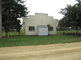
Parnaroo is a rural locality in South Australia, situated east of Peterborough. It shares the same boundaries as the cadastral Hundred of Parnaroo, which was established on 31 October 1878. It was reportedly named for an Aboriginal word meaning "rain of little stones", which had been taken from a sheep run opened in the area in 1854. The modern locality was formalised in August 2000, and named for the long established local name.

Ulooloo is a locality in the Mid North of South Australia. It is midway between Burra and Peterborough on the Barrier Highway from Adelaide to Broken Hill, New South Wales.

Kanyaka is a rural locality in the Far North region of South Australia, situated in the Flinders Ranges Council.

Wilcowie is a rural locality in the Far North region of South Australia. It lies in the Pastoral Unincorporated Area of the state. The name and boundaries were selected on 26 April 2013, with the locality being named after the former Wilcowie pastoral property. The ruins of the former Wilcowie Homestead survive today.

Kiana is a coastal locality on the Eyre Peninsula of South Australia, situated within the District Council of Lower Eyre Peninsula. The modern boundaries were formally established in October 2003, with it being named after the cadastral Hundred of Kiana. The modern locality only covers the northern half of the hundred; the southern half is the locality of Mount Hope. The hundred itself was given an Aboriginal name by Governor William Jervois in 1879.
Mayfield is a rural locality in the Mid North region of South Australia. It is situated in the Northern Areas Council.
Pine Creek is a rural locality in the Mid North region of South Australia, situated in the Regional Council of Goyder. It was established in August 2000 when boundaries were formalised for the long established local name.
Collinsville is a rural locality in the Mid North region of South Australia, situated in the Regional Council of Goyder. It was established in August 2000, when boundaries were formalised for the "long established local name". It has almost exactly the same boundaries as the cadastral Hundred of Tomkinson, with small variations on its western border.
Mount Bryan East is a rural locality in the Mid North region of South Australia, situated in the Regional Council of Goyder. It was established in August 2000, when boundaries were formalised for the "long established local name".

Flinders Ranges is a locality in the Australian state of South Australia located in the mountain range of the same name, about 380 kilometres north of the state capital of Adelaide, about 86 kilometres north-east of the municipal seat of Quorn and about 131 kilometres north-east of the centre of Port Augusta in the state’s Far North region.
Franklyn is a rural locality in the Mid North region of South Australia, situated in the Regional Council of Goyder. It was established in August 2000, when boundaries were formalised for the "long established local name". It comprises the northern section of the cadastral Hundred of Wonna. The name stems from a Franklyn House in Devonshire.
Suttontown is a hamlet located immediately north of Mount Gambier in the south-east of South Australia.
Joanna is a locality in the Australian state of South Australia located in the state's south-east within the state’s Limestone Coast region about 325 kilometres south east of the state capital of Adelaide, about 19.5 kilometres south-east of the municipal seat of Naracoorte.
Mingbool is a locality in the Australian state of South Australia located about 372 kilometres (231 mi) south-east of the state capital of Adelaide adjoining the border with the state of Victoria and about 16 kilometres (9.9 mi) north-west of the municipal seat of Mount Gambier.

County of Kimberley is a cadastral unit located in the Australian state of South Australia that covers land to the east of the Flinders Ranges about 45 kilometres (28 mi) east of the town of Peterborough. It was proclaimed in 1871 and named after John Wodehouse, 1st Earl of Kimberley, a British Secretary of State for the Colonies. It has been partially divided in the following sub-units of hundreds – Gumbowie, Hardy, Ketchowla, Parnaroo, Terowie and Wonna.
