The Regional Council of Goyder is a local government area located in the Mid North region of South Australia. The council area is reliant on agriculture as a mainstay of its economy, with manufacturing and tourism also becoming prominent. The council seat is at Burra. A branch office is at Eudunda.

Bower is a town in South Australia, approximately halfway between Eudunda and Morgan on the Thiele Highway.

Hansborough is a locality along the former Morgan railway line adjacent to the Thiele Highway, in South Australia's Mid North region. It is situated 9 kilometres south-west of Eudunda and 18 kilometres north-east of Kapunda. The Light River runs through the locality.

Worlds End is a locality 18 km southeast of Burra in South Australia. It also includes the area formerly known as Lapford.
Belton is a rural locality in South Australia, located in the District Council of Orroroo Carrieton. It is traversed by the Carrieton-Barata Road, the Carrieton-Belton Road and the Weira Creek. The locality was established on 26 April 2013 in respect to “the long established local name.”

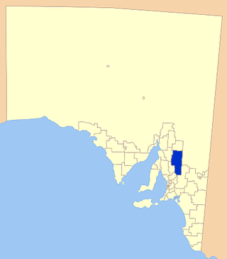
Bundey is a locality in the Mid North region of South Australia. It is located on Goyder's Line, on the plains between Burra and Morgan in the Regional Council of Goyder. The bounded locality of Bundey corresponds to the boundaries of the cadastral Hundred of Bundey, except for the southwestern corner of the Hundred which is the northeastern corner of the locality of Geranium Plains. Bundey was named in 1878 for politician William Henry Bundey.

Geranium Plains is a small town in the Regional Council of Goyder in South Australia. The post office opened in 1894, but has since closed. There was a proposal to rename it to Iperta in 1916, but this did not go ahead.
Hallelujah Hills is a rural locality in the Mid North region of South Australia, situated in the Regional Council of Goyder.
Apoinga is a rural locality in the Mid North region of South Australia, situated in the Regional Council of Goyder.
The District Council of Apoinga was a local government area in South Australia from 1873 to 1932.
Baldina is a rural locality in the Mid North region of South Australia, situated in the Regional Council of Goyder. It was established in August 2000, when boundaries were formalised for the "long established local name".
Emu Downs is a rural locality in the Mid North region of South Australia, situated in the Regional Council of Goyder.
Ngapala is a rural locality in the Mid North region of South Australia, situated in the Regional Council of Goyder. It was established in August 2000, when boundaries were formalised for the "long established local name". It is divided between the cadastral Hundreds of English and Julia Creek.
Rocky Plain is a rural locality in the Mid North region of South Australia, situated in the Regional Council of Goyder. It was established in August 2000, when boundaries were formalised for the "long established local name".
Bright is a rural locality in the Mid North region of South Australia, situated in the Regional Council of Goyder. It was established in August 2000, when boundaries were formalised for the "long established local name". It incorporates most of the cadastral Hundred of Bright, which was proclaimed on 17 June 1875 and named for politician Henry Edward Bright.
Porter Lagoon is a rural locality in the Mid North region of South Australia, situated in the Regional Council of Goyder. It was established in August 2000, when boundaries were formalised for the "long established local name". Most of the locality lies in the cadastral Hundred of Hanson; a small strip along the eastern side lies in the Hundred of Apoinga.
Koonoona is a rural locality in the Mid North region of South Australia, situated in the Regional Council of Goyder. It was established in August 2000, when boundaries were formalised for the "long established local name". It occupies the north-western corner of the cadastral Hundred of Apoinga.
Buchanan is a rural locality in the Mid North region of South Australia, situated in the Regional Council of Goyder. It was established in August 2000, when boundaries were formalised for the "long established local name".
Peep Hill is a rural locality in the Mid North region of South Australia, situated in the Regional Council of Goyder. It was established in August 2000, when boundaries were formalised for the "long established local name". It is reported to be named for "a round hill in the last range towards the east".
Hampden is a rural locality in the Mid North region of South Australia, situated in the Regional Council of Goyder. It was established in August 2000, when boundaries were formalised for the "long established local name". It was named for William Hampden Dutton, brother of Frederick Dutton, who established Anlaby Station.
