
Wallaroo is a port town on the western side of Yorke Peninsula in South Australia, 160 kilometres (100 mi) northwest of Adelaide. It is one of the three Copper Triangle towns famed for their historic shared copper mining industry, and known together as "Little Cornwall", the other two being Kadina, about 8 kilometres (5 mi) to the east, and Moonta, about 18 kilometres (11 mi) south. In 2016, Wallaroo had a population of 3,988 according to the census held.

Blinman is a locality incorporating two towns located in the Australian state of South Australia within the Flinders Ranges about 425 kilometres (264 mi) north of the state capital of Adelaide. It is very small but has the claim of being the highest surveyed town in South Australia. It serves as a base for large acre pastoralists and tourism. The town is just north of the Flinders Ranges National Park, is 60 kilometres north of Wilpena Pound.

The Regional Council of Goyder is a local government area located in the Mid North region of South Australia. The council area is reliant on agriculture as a mainstay of its economy, with manufacturing and tourism also becoming prominent. The council seat lies at Burra, with a branch office situated at Eudunda.
Robertstown is a town in South Australia. The town is located 23 kilometres (14 mi) north of Eudunda, in the Regional Council of Goyder. At the 2021 census, Robertstown and the surrounding area had a population of 223. Robertstown is named for the John Roberts, the first postmaster in the area, who laid out the town in 1871. It was previously known as Emu Flats and Roberts Town.

Worlds End is a locality 18 km southeast of Burra in South Australia. It also includes the area formerly known as Lapford.

Bundey is a locality in the Mid North region of South Australia. It is located on Goyder's Line, on the plains between Burra and Morgan in the Regional Council of Goyder. The bounded locality of Bundey corresponds to the boundaries of the cadastral Hundred of Bundey, except for the southwestern corner of the Hundred which is the northeastern corner of the locality of Geranium Plains. Bundey was named in 1878 for politician William Henry Bundey.

The District Council of Burra Burra was a local government area in South Australia from 1935 to 1997.
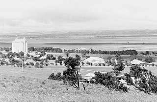
The District Council of Robertstown was a local government area in South Australia from 1932 to 1997. The central town and council seat was Robertstown.

The District Council of Eudunda was a local government area in South Australia from 1932 to 1997. The central town and council seat was Eudunda. It was established on 12 May 1932 with the amalgamation of the District Council of Julia and the District Council of Neales. By 1936, it was divided up into four wards: Brownlow, Eudunda and Neales and Julia. It met at the District Hall at Eudunda, which had formerly been owned by the Neales council, until 1963. The council existed until 1997, when it amalgamated with the District Council of Burra Burra, the District Council of Hallett and the District Council of Robertstown to form the Regional Council of Goyder.
The District Council of Hallett was a local government area in South Australia from 1877 to 1997.
The District Council of Apoinga was a local government area in South Australia from 1873 to 1932.
County of Burra is a cadastral unit located in the Australian state of South Australia which covers land located in the state’s east associated with the town of Burra. It was proclaimed in 1851 by Governor Young and named after the town of Burra.
The District Council of English was a local government area in South Australia from 1878 to 1932.
Baldina is a rural locality in the Mid North region of South Australia, situated in the Regional Council of Goyder. It was established in August 2000, when boundaries were formalised for the "long established local name".
Emu Downs is a rural locality in the Mid North region of South Australia, situated in the Regional Council of Goyder.
Ngapala is a rural locality in the Mid North region of South Australia, situated in the Regional Council of Goyder. It was established in August 2000, when boundaries were formalised for the "long established local name". It is divided between the cadastral Hundreds of English and Julia Creek.
Bright is a rural locality in the Mid North region of South Australia, situated in the Regional Council of Goyder. It was established in August 2000, when boundaries were formalised for the "long established local name". It incorporates most of the cadastral Hundred of Bright, which was proclaimed on 17 June 1875 and named for politician Henry Edward Bright.
Porter Lagoon is a rural locality in the Mid North region of South Australia, situated in the Regional Council of Goyder. It was established in August 2000, when boundaries were formalised for the "long established local name". Most of the locality lies in the cadastral Hundred of Hanson; a small strip along the eastern side lies in the Hundred of Apoinga.
Koonoona is a rural locality in the Mid North region of South Australia, situated in the Regional Council of Goyder. It was established in August 2000, when boundaries were formalised for the "long established local name". It occupies the north-western corner of the cadastral Hundred of Apoinga.
Brady Creek is a rural locality in the Mid North region of South Australia, situated in the Regional Council of Goyder. It was established in August 2000, when boundaries were formalised for the "long established local name" for the creek which it is centred on and named after. It is divided between the cadastral Hundreds of Apoinga and English.
