Porter Lagoon, South Australia

Last updated

Porter Lagoon
South Australia
Australia South Australia location map.svg
Red pog.svg
Porter Lagoon
Coordinates 33°49′25″S138°52′38″E / 33.823550°S 138.877270°E / -33.823550; 138.877270 Coordinates: 33°49′25″S138°52′38″E / 33.823550°S 138.877270°E / -33.823550; 138.877270
Population10 (2016 census) [1]
Postcode(s) 5416 [2]
LGA(s) Regional Council of Goyder
State electorate(s) Stuart [2]
Federal division(s) Grey [2]
Localities around Porter Lagoon:
Hanson
Farrell Flat
Hanson Burra
Farrell Flat Porter Lagoon Koonoona
Farrell Flat Black Springs Koonoona
Black Springs
FootnotesCoordinates [3]
Adjoining localities [3]

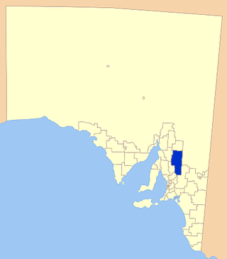
Porter Lagoon is a rural locality in the Mid North region of South Australia, situated in the Regional Council of Goyder. [2] It was established in August 2000, when boundaries were formalised for the "long established local name". Most of the locality lies in the cadastral Hundred of Hanson; a small strip along the eastern side lies in the Hundred of Apoinga. [3]

The area was originally the territory of the Ngadjuri people. [4] The dominant feature of the locality is the eponymous lagoon. [3] The lagoon can cover several miles in wet seasons, and is "intensely salty". It is used by "many thousands of water birds, pelicans, great cormorants, whiskered terns and silver gulls" at certain times of year. [5]

In the late nineteenth and early twentieth century, it was a popular alternate "seaside" attraction, with visitors coming from across the district. [6] [7] It was a popular venue for aquatic sports when the water level was high enough, had both a boat club and a tennis club, and was also a popular hunting ground when wild fowl were in season. [8] [9] [10] The boat club had tenure of the lagoon in the late 1920s, and banned the drinking of alcohol in the vicinity. [11] In 1935 a newspaper correspondent wrote that the lagoon had been drying up, and was only six inches deep, with the water "always very salt, now positively brine". [12]

In 1939, a correspondent described swimming in Porter Lagoon as "the remedy being worse than the complaint" due to the water being at an exceptionally low level, such that bathers bore a "close resemblance to the Biblical character, Lot's wife, when they emerge from the brine", although they noted that the previous year it had been a "veritable 'sea-side' resort for residents living anywhere near it - hundreds of bathers taking full advantage of its cooling and invigorating prospects. [13] The Porters Lagoon Boat Club ceased to exist on 30 June 1947, having been weakened by a series of dry seasons and the impact of World War II. [14] [15]

By the early 1950s, there was an issue with the provision of facilities at the lagoon, as the District Council of Burra Burra noted that they "had no one who could be made responsible for the maintenance of lavatories, etc., at this locality." [16] In 1954, the Burra Demobilised Soldiers' Association undertook a project to build conveniences such as toilets, dressing sheds and rainwater tanks, and received a license over the north end of the lagoon for that purpose. [15] [17] [18]

Related Research Articles

<span class="mw-page-title-main">Regional Council of Goyder</span> Local government area in South Australia

The Regional Council of Goyder is a local government area located in the Mid North region of South Australia. The council area is reliant on agriculture as a mainstay of its economy, with manufacturing and tourism also becoming prominent. The council seat is at Burra. A branch office is at Eudunda.

<span class="mw-page-title-main">Worlds End, South Australia</span> Town in South Australia

Worlds End is a locality 18 km southeast of Burra in South Australia. It also includes the area formerly known as Lapford.

<span class="mw-page-title-main">Bundey, South Australia</span> Town in South Australia

Bundey is a locality in the Mid North region of South Australia. It is located on Goyder's Line, on the plains between Burra and Morgan in the Regional Council of Goyder. The bounded locality of Bundey corresponds to the boundaries of the cadastral Hundred of Bundey, except for the southwestern corner of the Hundred which is the northeastern corner of the locality of Geranium Plains. Bundey was named in 1878 for politician William Henry Bundey.

<span class="mw-page-title-main">District Council of Burra Burra</span> Local government area in South Australia

The District Council of Burra Burra was a local government area in South Australia from 1935 to 1997.

The District Council of Robertstown was a local government area in South Australia from 1932 to 1997. The central town and council seat was Robertstown.

<span class="mw-page-title-main">District Council of Eudunda</span> Local government area in South Australia

The District Council of Eudunda was a local government area in South Australia from 1932 to 1997. The central town and council seat was Eudunda. It was established on 12 May 1932 with the amalgamation of the District Council of Julia and the District Council of Neales. By 1936, it was divided up into four wards: Brownlow, Eudunda and Neales and Julia. It met at the District Hall at Eudunda, which had formerly been owned by the Neales council, until 1963. The council existed until 1997, when it amalgamated with the District Council of Burra Burra, the District Council of Hallett and the District Council of Robertstown to form the Regional Council of Goyder.

The District Council of Hallett was a local government area in South Australia from 1877 to 1997.

The District Council of Apoinga was a local government area in South Australia from 1873 to 1932.

The District Council of Booborowie was a local government area in South Australia from 1875 to 1935.

The District Council of English was a local government area in South Australia from 1878 to 1932.

The Corporate Town of Burra was a local government area in South Australia from 1876 to 1969.

The District Council of Hanson was a local government area in South Australia from 1878 to 1935.

The District Council of Burra was a local government area in South Australia from 1872 to 1935.

Baldina is a rural locality in the Mid North region of South Australia, situated in the Regional Council of Goyder. It was established in August 2000, when boundaries were formalised for the "long established local name".

Emu Downs is a rural locality in the Mid North region of South Australia, situated in the Regional Council of Goyder.

Ngapala is a rural locality in the Mid North region of South Australia, situated in the Regional Council of Goyder. It was established in August 2000, when boundaries were formalised for the "long established local name". It is divided between the cadastral Hundreds of English and Julia Creek.

Koonoona is a rural locality in the Mid North region of South Australia, situated in the Regional Council of Goyder. It was established in August 2000, when boundaries were formalised for the "long established local name". It occupies the north-western corner of the cadastral Hundred of Apoinga.

Gum Creek is a rural locality in the Mid North region of South Australia, situated in the Regional Council of Goyder. It was established in August 2000, when boundaries were formalised for the "long established local name". It is named for the Gum Creek pastoral property, which originally extended from Farrell Flat to Mount Bryan, with the homestead being located in the Gum Creek locality. The property was owned by a number of notable figures, with Sir John Duncan succeeding Sir Walter Hughes as owner.

Willalo is a rural locality in the Mid North region of South Australia, situated in the Regional Council of Goyder. It was established in August 2000, when boundaries were formalised for the "long established local name". It was also known in its early days as North Booboorowie.

Leighton is a rural locality in the Mid North region of South Australia, situated in the Regional Council of Goyder. It was established in August 2000, when boundaries were formalised for the "long established local name".

References

  1. Australian Bureau of Statistics (27 June 2017). "Porter Lagoon (State Suburb)". 2016 Census QuickStats. Retrieved 14 June 2021. OOjs UI icon edit-ltr-progressive.svg
  2. 1 2 3 4 "Search result(s) for Porter Lagoon, 5416". Location SA Map Viewer. Government of South Australia. Retrieved 27 November 2016.
  3. 1 2 3 4 "Search result(s) for Porter Lagoon, 5416". Property Location Browser. Government of South Australia. Archived from the original on 12 October 2016. Retrieved 27 November 2016.
  4. Emmaus to Worlds End: a history of the Robertstown Council Area. The Area - Its Settlement and Development: District Council of Robertstown. 1986.
  5. Hoskins, Paul M. (2011). Caleb. Xlibris Corporation. pp. 18–19. ISBN   9781465300331.
  6. "PORTER'S LAGOON". Burra Record . Vol. XV, no. 328. South Australia. 27 February 1895. p. 3. Retrieved 27 November 2016 via National Library of Australia.
  7. "Porter's Lagoon". Burra Record . Vol. XV, no. 313. South Australia. 17 April 1895. p. 3. Retrieved 27 November 2016 via National Library of Australia.
  8. "PORTER'S LAGOON". Burra Record . Vol. XXXXIX, no. 1. South Australia. 5 January 1927. p. 3. Retrieved 27 November 2016 via National Library of Australia.
  9. "Historical Timelines". Burra History Group. Retrieved 27 November 2016.
  10. "PORTER'S LAGOON". Burra Record . Vol. 58, no. 15. South Australia. 13 April 1937. p. 2. Retrieved 27 November 2016 via National Library of Australia.
  11. "PORTER'S LAGOON". Burra Record . Vol. XXXXIXIII, no. 4. South Australia. 30 January 1929. p. 3. Retrieved 27 November 2016 via National Library of Australia.
  12. "PORTER'S LAGOON". Burra Record . Vol. 56, no. 9. South Australia. 27 February 1935. p. 3. Retrieved 27 November 2016 via National Library of Australia.
  13. "Porter's Lagoon Not So Good For Bathing". Burra Record . Vol. 60, no. 2. South Australia. 10 January 1939. p. 2. Retrieved 27 November 2016 via National Library of Australia.
  14. "District Council of Burra Burra". Burra Record . Vol. 70, no. 34. South Australia. 26 August 1947. p. 8. Retrieved 27 November 2016 via National Library of Australia.
  15. 1 2 ""Seaside Resort" For District". Burra Record . Vol. 84, no. 8. South Australia. 2 March 1954. p. 1. Retrieved 27 November 2016 via National Library of Australia.
  16. "District Council of Burra". Burra Record . Vol. 80, no. 12. South Australia. 21 October 1952. p. 7. Retrieved 27 November 2016 via National Library of Australia.
  17. "DEMOBILISED SOLDIERS GET PERMIT". Burra Record . Vol. 85, no. 14. South Australia. 13 April 1954. p. 1. Retrieved 27 November 2016 via National Library of Australia.
  18. "Porters Lagoon Project". Burra Record . Vol. 86, no. 44. South Australia. 9 November 1954. p. 1. Retrieved 27 November 2016 via National Library of Australia.