Hilltown, South Australia

Last updated
Hilltown
South Australia

Soldiers' Memorial Hall, Hilltown, South Australia..JPG

Soldiers' Memorial Hall, Hilltown
Australia South Australia location map.svg
Red pog.svg
Hilltown
Coordinates 33°41′11″S138°38′11″E / 33.6865°S 138.6364°E / -33.6865; 138.6364 Coordinates: 33°41′11″S138°38′11″E / 33.6865°S 138.6364°E / -33.6865; 138.6364
Established 1866
Postcode(s) 5455
Elevation 348 m (1,142 ft)
LGA(s) Clare and Gilbert Valley Council
State electorate(s) Frome
Federal Division(s) Wakefield
Localities around Hilltown:
Euromina Andrews Leighton
Anama Hilltown Gum Creek
Bungaree Barinia Hill River

Hilltown is a locality in the District Council of Clare and Gilbert Valleys of South Australia. The former town centre is located on Hilltown Road, which runs north-south between Andrews and Hill River, while the unsealed Harvey Highway connects the former town centre to RM Williams Way. [1] It is about 4 km east of RM Williams Way, on the former Spalding railway line.

South Australia State of Australia

South Australia is a state in the southern central part of Australia. It covers some of the most arid parts of the country. With a total land area of 983,482 square kilometres (379,725 sq mi), it is the fourth-largest of Australia's states and territories by area, and fifth largest by population. It has a total of 1.7 million people, and its population is the second most highly centralised in Australia, after Western Australia, with more than 77 percent of South Australians living in the capital, Adelaide, or its environs. Other population centres in the state are relatively small; Mount Gambier, the second largest centre, has a population of 28,684.

Andrews, South Australia Town in South Australia

Andrews is a rural locality in the Northern Areas Council of South Australia, located on the Hill River. Its boundaries were formalised in April 2001 for the long established name for the area. The district, which is primarily dedicated to primary production, mainly grain farming, is in the Spalding Ward of the council. The township has bulk grain handling and storage facilities as well as limited sporting and community facilities. The Hill River Road and the Hill River run north-south through the locality, while Andrews Road runs east-west, connecting the Goyder Highway with RM Williams Way. In the 2011 census, the population of Andrews was too low to separately report; it was included in that of adjacent Spalding.

Contents

History

It was created in the 1860s when closer settlement came to the Mid-North, allowing grain farming by self-employed farmers. The government town of Hilltown was surveyed in September 1865. [2] The first lots at Hilltown were sold by public auction in March 1866. Street names of the surveyed township honored pioneering pastoralists of the region such as John Harris Browne and Charles Brown Fisher.

John Harris Browne Australian explorer and pastoralist

John Harris Browne, generally referred to as J. Harris Browne, was an explorer in Australia and a pioneer pastoralist.

Charles Brown Fisher Australian pastoralist and livestock breeder

Charles Brown Fisher, generally referred to as C. B. Fisher, was an Australian pioneer pastoralist and livestock breeder.

It was proposed to rename it Yakkalo in 1916 and Milne in 1926, but neither took effect. [2] Subsequent public infrastructure, since closed, included a railway siding and primary school. The Spalding railway line passed the town in 1922, the station was named for the Hundred of Milne which is the cadastral division in which the town was established. It was named in 1860 after Sir William Milne, MP. [3] The town was recorded as diminished in 1929. [2] The local railway station had been opened under the name of Milne, but was altered to Hilltown in 1939. [4] The railway closed in 1984. Hilltown Post Office opened on 2 January 1914 and closed on 4 April 1985. [5]

The Spalding railway line was a railway line on the South Australian Railways network which branched from the Peterborough line at Riverton and passed through the Clare Valley to Spalding. The line opened from Riverton to Clare on 5 July 1918, being extended to Spalding on 9 January 1922. The cessation of railway services was a consequence of the Ash Wednesday bushfires in February 1983, which caused major damage to infrastructure between Sevenhill and Penwortham. The line was formally closed on 17 April 1984.

William Milne (politician) Australian politician

Sir William Milne was an Australian entrepreneur and politician, serving as the member for Onkaparinga in the South Australian House of Assembly from 1857 to 1868. He was elected to the South Australian Legislative Council in 1869, and was President of the South Australian Legislative Council from 25 July 1873 to 1881.

A private subdivision named Dudley formerly existed on the border of Hilltown and Barinia; it has now been subsumed into the two localities. [6]

Features

The Clare Valley Aerodrome is located in the south-west corner of the locality, on the corner of RM Williams Way and Cornwell Road. [7] The Hilltown Soldiers' Memorial Hall is still available for community use. [8] [9]

Clare Valley Aerodrome airport in Australia

Clare Valley Aerodrome is an airport located 14 km (8.7 mi) north of the town of Clare, South Australia. The Clare Valley Flying Group began construction of the airfield in 2010 and it was officially opened in November 2014.

Related Research Articles

Clare and Gilbert Valleys Council Local government area in South Australia

The Clare and Gilbert Valleys Council is a local government area located in the Yorke and Mid North region of South Australia. The council was founded on 1 July 1997 with the amalgamation of the District Council of Clare, the District Council of Riverton and the District Council of Saddleworth and Auburn. The council seat is located at Clare; it also maintains branch offices at Riverton and Saddleworth.

Spalding, South Australia Town in South Australia

Spalding is a town located north of the Clare Valley in South Australia, Australia. At the 2006 census, Spalding had a population of 212.

Carrieton Town in South Australia

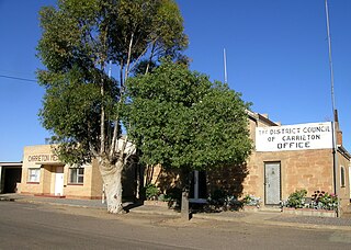
Carrieton is a small town situated in the Flinders Ranges of South Australia. It is located between the towns of Orroroo to the south and Cradock to the north.

Buccleuch, South Australia Town in South Australia

Buccleuch is a place in South Australia situated along the Pinnaroo railway line and Mallee Highway (B12), approximately 140 km east of Adelaide. It is part of the Coorong District Council. There is an active Lutheran Church in Buccleuch.

Parrakie, South Australia Town in South Australia

Parrakie, South Australia is a small town on the Mallee Highway and Pinnaroo railway line approximately 26 kilometres west of Lameroo. The name is derived from the Aboriginal word perki which means cave or limestone sink hole. The town was surveyed in 1907.

Bruce, South Australia Town in South Australia

Bruce is a town and a locality in the Australian state of South Australia.

Galga, South Australia Town in South Australia

Galga is a settlement in the northern Murray Mallee region of South Australia. The town of Galga was surveyed in 1915 after the Waikerie railway line from Karoonda to Waikerie was opened in 1914. The line was shortened to Galga in 1990, and closed completely in 1994. There is a small bulk grain silo at Galga, but it is no longer regularly used. Galga has an active Country Fire Service brigade with one fire truck.

Hynam, South Australia Town in South Australia

Hynam is a town and locality in the Australian state of South Australia located in the state's south-east within the Limestone Coast region on the border with the state of Victoria about 302 kilometres south east of the state capital of Adelaide and about 11 kilometres east of the municipal seat of Naracoorte.

Black Rock, South Australia Town in South Australia

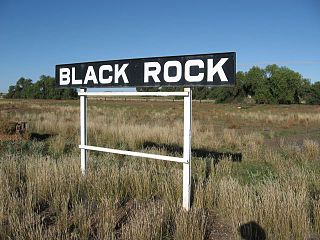
Black Rock is a hamlet in South Australia on the Black Rock Plains at the intersection of the south-north RM Williams Way (B80) between Jamestown and Orroroo and the west-east Wilmington–Ucolta Road (B56) to Peterborough, in the Mid North section of the state.

Yatina Town in South Australia

Yatina is a town and locality in the Australian state of South Australia located on the RM Williams Way about 222 kilometres (138 mi) north of the state capital of Adelaide and about 31 kilometres (19 mi) and 21 kilometres (13 mi) respectively from the municipal seats of Jamestown and Orroroo.

Hansborough, South Australia Town in South Australia

Hansborough is a locality along the former Morgan railway line adjacent to the Thiele Highway, in South Australia's Mid North region. It is situated 9 kilometres south-west of Eudunda and 18 kilometres north-east of Kapunda. The Light River runs through the locality.

Peebinga, South Australia Town in South Australia

Peebinga is a town and locality in the Australian state of South Australia. Peebinga was the terminus of the Peebinga railway line which was built in 1914 as part of a major state government project to open up the Murray Mallee for grazing and cropping.

Mantung, South Australia Town in South Australia

Mantung is a town and a locality in the Australian state of South Australia located in the state's south-east about 140 kilometres (87 mi) east of the state capital of Adelaide, and about 58 kilometres (36 mi) north-east and about 48 kilometres (30 mi) south-west respectively of the municipal seats of Karoonda and Loxton.

Hill River, South Australia Town in South Australia

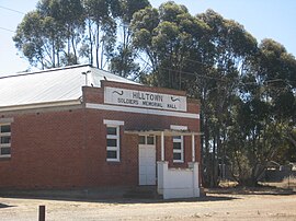
Hill River is a locality in the Yorke and Mid North region of South Australia, about 127 kilometres north of the Adelaide city centre. It is bisected by the Hill River, an ephemeral stream from which it derives its name. Its boundaries were created in January 2001 for the “long established name.”

Hammond, South Australia Town in South Australia

Hammond is a town and locality in the Australian state of South Australia located in the southern Flinders Ranges.

Kanyaka, South Australia Town in South Australia

Kanyaka is a rural locality in the Far North region of South Australia, situated in the Flinders Ranges Council.

Yarrah, South Australia Town in South Australia

Yarrah is a rural locality in the Far North region of South Australia. The eastern section of Yarrah lies within the Flinders Ranges Council, while the western section lies in the Pastoral Unincorporated Area.

Mount Mary, South Australia Town in South Australia

Mount Mary is a small town on the Thiele Highway between Eudunda and Morgan in South Australia. It was also served by the Morgan railway line from 1878 until 1969 and is named for the Mount Mary railway station on that line.

Kringin, South Australia Suburb of District Council of Loxton Waikerie , South Australia

Kringin is a town and a locality in the Australian state of South Australia located in the state’s east about 199 kilometres (124 mi) east of the state capital of Adelaide and about 61 kilometres (38 mi) south of the municipal seat of Loxton.

References

  1. "Hilltown, 5455". Location SA Map Viewer. Government of South Australia. Retrieved 16 February 2016.
  2. 1 2 3 "Hilltown". Property Location Viewer. Government of South Australia. SA0042842. Retrieved 16 February 2016.
  3. "Placename Details: Hundred of Milne". Property Location Browser. Government of South Australia. 29 January 2009. SA0007587. Retrieved 18 February 2016.
  4. "New Road from Clare to Blyth". Northern Argus . Clare, SA: National Library of Australia. 14 April 1939. p. 7. Retrieved 19 February 2016.
  5. "Hilltown". Post Office Reference. Premier Postal. Retrieved 16 February 2016.
  6. "Dudley". Property Location Viewer. Government of South Australia. Retrieved 16 February 2016.
  7. "Hilltown SA 5455". Google Maps. Retrieved 16 February 2016.
  8. "Halls". Clare and Gilbert Valleys Council. Retrieved 16 February 2016.
  9. "Hilltown Soldiers' Memorial Hall". Monument Australia. Retrieved 16 February 2016.