
Port Pirie is a city and seaport on the east coast of the Spencer Gulf in South Australia, 223 km (139 mi) north of the state capital, Adelaide. The settlement was founded in 1845 and at June 2018 had an estimated urban population of 14,188. Port Pirie is the eighth most populous city in South Australia after Adelaide, Mount Gambier, Gawler, Mount Barker, Whyalla, Murray Bridge, Port Lincoln.

Peterborough is a town in the mid north of South Australia, in wheat country, just off the Barrier Highway. At the 2016 census, Peterborough had a population of 1,419. It was originally named Petersburg after the landowner, Peter Doecke, who sold land to create the town. It was one of 69 places in South Australia renamed in 1917 due to anti-German sentiments during World War I.

Hahndorf is a small town in the Adelaide Hills region of South Australia. Currently an important tourism spot, it has previously been a centre for farming and services.

Truro is a town in South Australia, 80 km northeast of Adelaide. It is situated in an agricultural and pastoral district on the Sturt Highway, east of the Barossa Valley, where the highway crosses somewhat lofty and rugged parts of the Mount Lofty Ranges. At the 2011 census, Truro had a population of 395.

Laura is a rural town in the Mid North region of South Australia, 12 km north of Gladstone on the Horrocks Highway and 40 km east of Port Pirie. The first European to explore the district was Thomas Burr in September 1842. His promising reports soon led to occupation of the district by pastoralists, one of whom was Herbert Bristow Hughes. When the present town was surveyed he named it for his wife, Laura née White.

Baldivis is a semi-rural residential suburb 46 kilometres (29 mi) south of the central business district of Perth, the capital of Western Australia, and 11 kilometres (6.8 mi) southeast of the regional centre of Rockingham. It is located within the City of Rockingham local government area.
Mount Osmond is a small suburb of 2,497 people in the South Australian capital city of Adelaide. It is part of the City of Burnside local government area and located in the foothills of the Adelaide Hills, five kilometres south east of the city centre. The suburb is high on the hill of the same name, which is the last hill on the right when approaching Adelaide down the South Eastern Freeway before the road levels out onto the Adelaide Plains. It is bounded to the north by the suburb of Beaumont, to the north-east by Burnside, to the east by Waterfall Gully, to the south by Leawood Gardens/Eagle On The Hill, to the south-west by Urrbrae, to the west by Glen Osmond and to the north-west by St Georges.
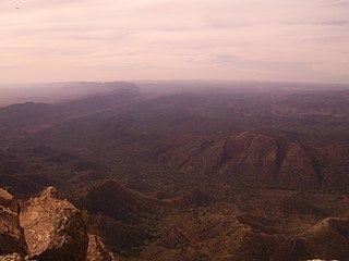
Wilpena Pound, also known by its Adnyamathanha name of Ikara, meaning "meeting place", is a natural amphitheatre of mountains located 429 kilometres (267 mi) north of Adelaide, South Australia, Australia in the heart of the Flinders Ranges National Park. The Pound is accessed via a sealed road which continues on to the northern Flinders Ranges town of Blinman and to the south, Hawker.
Highgate is a suburb of Adelaide in the City of Unley. It is surrounded by Fullarton and Malvern.
British colonisation of South Australia describes the planning and establishment of the colony of South Australia by the British government, covering the period from 1829, when the idea was raised by the then imprisoned Edward Gibbon Wakefield, to 1842, when the South Australia Act 1842 changed the form of government to a Crown colony.
John Ainsworth Horrocks was an English pastoralist and explorer who was one of the first European settlers in the Clare Valley of South Australia where, in 1840, he established the village of Penwortham.
Kersbrook is a town near Adelaide, South Australia. It is located in the Adelaide Hills Council local government area. At the 2006 census, Kersbrook had a population of 367.
Inverbrackie is a place within the locality of Woodside in the Australian state of South Australia located about 3 kilometres (1.9 mi) from the 'town centre' in Woodside.

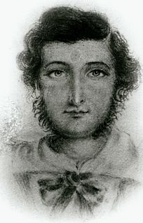
Sir John Morphett was a South Australian pioneer, landowner and politician. His younger brother George Morphett was also an early setter in South Australia.

Marrabel is a township and locality beside the Light River in South Australia's Mid North. It is in the Clare and Gilbert Valleys Council local government area, 100 kilometres (62 mi) north west of the state capital, Adelaide. At the 2006 census, Marrabel had a population of 209.

Prospect Hill is a heritage-listed hill in Pemulwuy and Prospect in the greater western region of Sydney, New South Wales, Australia. Situated about 30 kilometres west of central Sydney, the hill is Sydney's largest body of igneous rock and is higher than the ridges of the Cumberland Plain around it, with its present-day highest point being 117 metres high, although before its summit was quarried away it rose to a height of 131 metres above sea level.

The Light River, commonly called the River Light, is a seasonal and significant river in the Mid North region of the Australian state of South Australia named for early surveyor William Light.
William Spence Peter was a pioneer pastoralist of South Australia and New Zealand, and a member of the New Zealand Legislative Council from 1868 to 1891.
Anlaby or Anlaby Station is a pastoral lease located about 12 kilometres (7 mi) south east of Marrabel and 14 kilometres (9 mi) north of Kapunda in the state of South Australia.
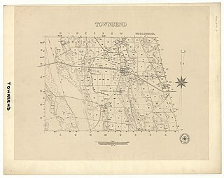
The Hundred of Townsend is a cadastral unit of hundred located in the Limestone Coast region in the south-east of South Australia.
