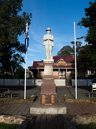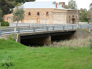
Burra is a pastoral centre and historic tourist town in the mid-north of South Australia. It lies east of the Clare Valley in the Bald Hills range, part of the northern Mount Lofty Ranges, and on Burra Creek. The town began as a single company mining township that, by 1851, was a set of townships collectively known as "The Burra". The Burra mines supplied 89% of South Australia's and 5% of the world's copper for 15 years, and the settlement has been credited with saving the economy of the struggling new colony of South Australia. The Burra Burra Copper Mine was established in 1848 mining the copper deposit discovered in 1845. Miners and townspeople migrated to Burra primarily from Cornwall, Wales, Scotland and Germany. The mine first closed in 1877, briefly opened again early in the 20th century and for a last time from 1970 to 1981.

The first railway in colonial South Australia was a line from the port of Goolwa on the River Murray to an ocean harbour at Port Elliot, which first operated in December 1853, before its completion in May 1854.

Tarlee is a town in South Australia. The origin of the name is uncertain, but it is thought to be a corruption of the name Tralee in Ireland. The township of Tarlee was advertised as readied for sale by auction in 1867. Tarlee is in the lower Mid North region where Horrocks Highway crosses the Gilbert River. It is approximately 8 km south of Giles Corner, where the Barrier Highway to Broken Hill diverges from the Horrocks Highway through the Clare Valley. At the 2016 census, Tarlee had a population of 302.

The Clare and Gilbert Valleys Council is a local government area located in the Yorke and Mid North region of South Australia. The council was founded on 1 July 1997 with the amalgamation of the District Council of Clare, the District Council of Riverton and the District Council of Saddleworth and Auburn. The council seat is located at Clare; it also maintains branch offices at Riverton and Saddleworth.

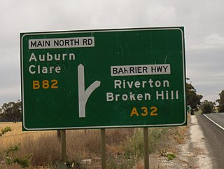
Giles Corner is the name of the intersection of Main North Road and the Barrier Highway, halfway between the towns of Tarlee and Rhynie. The Barrier Highway branches off from Horrocks Highway at this location, heading north towards Riverton, Burra and eventually Broken Hill. Horrocks Highway continues in a northerly direction, on to the towns of Rhynie, Auburn and Clare. There is also an unsealed back road starting just north of the junction which heads west and ends at the road between Balaklava and Owen, approximately 20 kilometres away. Although not a town, Giles Corner is sign posted to mark its location.

Saddleworth is a small town in the Mid North region of South Australia. The town is situated on the Gilbert River and along with neighbouring towns of Riverton, Rhynie and Tarlee the local area is known as the Gilbert Valley. The town is bisected by the Barrier Highway. At the 2016 census, Saddleworth had a population of 470.

Hamley Bridge is a community in South Australia located at the junction of the Gilbert and Light rivers, as well as the site of a former railway junction.

Rhynie is a small town in South Australia, halfway between Tarlee and Auburn, along the Horrocks Highway. It was surveyed and founded in 1859.

The Gilbert River is a river in the Mid North region of South Australia.

The Rattler Rail Trail is a 19 km (12 mi) rail trail which joins onto the southern end of the Riesling Trail at Auburn, South Australia. Following the route of the former Spalding railway line, the trail takes its name from the rattling old train that used to ply the route. The Rattler Rail Trail passes through farming land as it wends its way to Riverton via Rhynie. Bike hire is available in the town of Auburn.

Manoora is a settlement in the Mid North region of South Australia on the Barrier Highway and upper reaches of the Gilbert River. It was also on the Peterborough railway line serving Burra until the line was closed. At the 2006 census, Manoora had a population of 277.
Susannah Hannaford, née Elliott was an early immigrant to South Australia.
The Spalding railway line was a railway line on the South Australian Railways network which branched from the Peterborough line at Riverton and passed through the Clare Valley to Spalding. The line opened from Riverton to Clare on 5 July 1918, being extended to Spalding on 9 January 1922. The cessation of railway services was a consequence of the Ash Wednesday bushfires in February 1983, which caused major damage to infrastructure between Sevenhill and Penwortham. The line was formally closed on 17 April 1984.

The Peterborough railway line was a railway line on the South Australian Railways network. It extended from a junction at Roseworthy on the Morgan railway line through Hamley Bridge, Riverton, initially to Tarlee, then extended in stages to Peterborough.

The County of Light is one of the 49 cadastral counties of South Australia. It was proclaimed by Governor George Grey in 1842 and named for the River Light, the river being named after Colonel William Light, the first Surveyor-General of South Australia. It covers the modern region of the Barossa Valley and a portion of the northern Mt Lofty Ranges. It is bounded by the upper Wakefield River in the north, the approximate path of Horrocks Highway in the west, and the North Para River in the south, and is bisected east to west by the River Light.
The Kapunda Herald was a newspaper published in Kapunda, South Australia from 29 October 1864 to 25 January 1951. From 1864 to 1878 the masthead was subtitled "and Northern Intelligencer". It was published weekly, except for the period February 1872 to September 1894 when it appeared bi-weekly. When closed, the newspaper was merged with the Barossa News to become the Barossa and Light Herald.

The Hundred of Gilbert is a cadastral unit of hundred in the northern Mount Lofty Ranges including the town of Riverton. It is one of the nine hundreds of the County of Light. It was proclaimed in 1851 by Governor Henry Young and named after the Gilbert River, which flows from north to south through the hundred. The river, in turn, was named in honour of South Australian pioneer Thomas Gilbert.
The Plains Producer is a weekly newspaper published Wednesdays by Papers and Publications Pty. Ltd. in Balaklava, South Australia. It was founded in 1903 and was printed until 1941, when it was stopped by the second world war. The publication was revived in 1946 and it has been published continuously since then.


