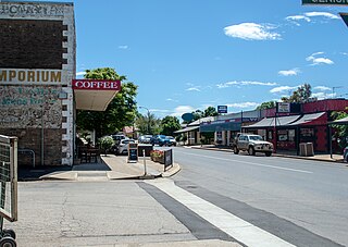
The Clare Valley wine region is one of Australia's oldest wine regions, best known for Riesling wines. It lies in the Mid North of South Australia, approximately 142 km north of Adelaide. The valley runs north-south, with Horrocks Highway as the main thoroughfare.

The first railway in colonial South Australia was a line from the port of Goolwa on the River Murray to an ocean harbour at Port Elliot, which first operated in December 1853, before its completion in May 1854.
The Mawson Trail is a long-distance cycling and walking trail in South Australia starting just east of Adelaide in the Adelaide Hills and extending almost 900 kilometres (560 mi) to Blinman in the Flinders Ranges. It is suitable for mountain bikes.

Riverton is a small town in the Mid North of South Australia, in the Gilbert Valley. It is situated on the Gilbert River, from which the town derives its name. Both the Gilbert Valley and Gilbert River were named after the South Australian pioneer Thomas Gilbert. Riverton was first settled in 1856, as a settlement along the bullock track from the mining town of Burra to the capital city Adelaide. It grew from a plan designed by a James Masters who had established the nearby town of Saddleworth. The streets of Riverton received their names chiefly from James Masters and his friends. They commemorate persons notable in the history of the district or the state. At the 2011 census, Riverton had a population of 810. Including the rural areas surrounding the town, the population was 1213.

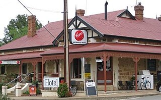
Watervale is a town on the Horrocks Highway in the Clare Valley, South Australia, approximately 9 kilometres north of Auburn and 15 kilometres south of Clare. It is surrounded by a number of small wineries and several B&Bs. The Riesling Trail runs past the town to the west, between the Highway and the Skilly Hills. The town has a number of 19th-century heritage buildings, including the former Stanley Grammar School, which now provides private bed and breakfast accommodation.

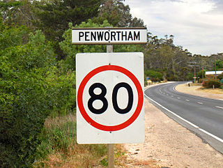
Penwortham is a small town in the Clare Valley, South Australia, along the Horrocks Highway, approximately 10 kilometres south of Clare and 14 kilometres north of Auburn.

Auburn is a small town in the southern edge of the Clare Valley, in the Mid North of South Australia.

The Clare and Gilbert Valleys Council is a local government area located in the Yorke and Mid North region of South Australia. The council was founded on 1 July 1997 with the amalgamation of the District Council of Clare, the District Council of Riverton and the District Council of Saddleworth and Auburn. The council seat is located at Clare; it also maintains branch offices at Riverton and Saddleworth.

The town of Clare is located in South Australia in the Mid North region, 136 km north of Adelaide. It gives its name to the Clare Valley wine and tourist region.

The Skilly Hills are a range of hills which make up part of the Mount Lofty Ranges in South Australia's Mid North region.

The Australian monastic town of Sevenhill is in the Clare Valley of South Australia, approximately 130 km north of Adelaide. The town was founded by members of the Jesuit order in 1850. The name, bestowed by Austrian Jesuit priest Aloysius Kranewitter, is in homage to the seven hills of Rome.

Spalding is a town located north of the Clare Valley in South Australia, Australia. At the 2016 census, Spalding had a population of 215.

Halbury is a former railway town in South Australia, west of the Clare Valley, halfway between Balaklava and Auburn. At the 2006 census, Halbury had a population of 363.

Rhynie is a small town in South Australia, halfway between Tarlee and Auburn, along the Horrocks Highway. It was surveyed and founded in 1859.

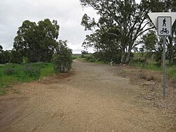
The Rattler Rail Trail is a 19 km (12 mi) rail trail which joins onto the southern end of the Riesling Trail at Auburn, South Australia. Following the route of the former Spalding railway line, the trail takes its name from the rattling old train that used to ply the route. The Rattler Rail Trail passes through farming land as it wends its way to Riverton via Rhynie. Bike hire is available in the town of Auburn.
Grosset Wines is an Australian winery based in the Clare Valley wine region of South Australia.
The locality of Barinia is situated in South Australia in the Mid North region, approximately 10 km north of Clare. It was a railway siding on the Spalding railway line, which closed in 1984. In November 2009 it became the northern terminus of the Riesling Trail, which utilises the route of the former railway.

The Clare Valley is a valley located in South Australia about 100 kilometres north of Adelaide in the Clare and Gilbert Valleys council area. It is the river valley formed by the Hutt River but is also strongly associated with the roughly parallel Hill River. The valley is traversed by the Horrocks Highway and the towns in the valley along that route from south to north are Auburn, Leasingham, Watervale, Penwortham, Sevenhill and Clare. The geographical feature has given rise to the Clare Valley wine region designation, a notable winegrowing region of Australia.
The Spalding railway line was a railway line on the South Australian Railways network which branched from the Peterborough line at Riverton and passed through the Clare Valley to Spalding. The line opened from Riverton to Clare on 5 July 1918, being extended to Spalding on 9 January 1922. The cessation of railway services was a consequence of the Ash Wednesday bushfires in February 1983, which caused major damage to infrastructure between Sevenhill and Penwortham. The line was formally closed on 17 April 1984.


