Clare and Gilbert Valleys Council

Last updated

Clare and Gilbert Valleys Council
South Australia
Clare and Gilbert Valleys LGA.png
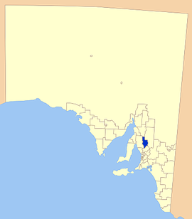
Location of Clare and Gilbert Valleys Council
Population9,187 (LGA 2021) [1]
 • Density5/km2 (13/sq mi)
Established1997
Area1,840 km2 (710.4 sq mi)
MayorWayne Thomas [2]
Council seat Clare
Region Yorke and Mid North [3]
State electorate(s) Frome, Goyder
Federal division(s) Grey
Website Clare and Gilbert Valleys Council
LGAs around Clare and Gilbert Valleys Council:
Northern Areas
Wakefield Clare and Gilbert Valleys Council Goyder
Light

The Clare and Gilbert Valleys Council is a local government area located in the Yorke and Mid North region of South Australia. [3] The council was founded on 1 July 1997 with the amalgamation of the District Council of Clare, the District Council of Riverton and the District Council of Saddleworth and Auburn. [4] The council seat is located at Clare; it also maintains branch offices at Riverton and Saddleworth. [5]

Contents

Geography

It includes the towns and localities of Anama, Armagh, Auburn, Barinia, Benbournie, Black Springs, Bungaree, Boconnoc Park, Clare, Emu Flat, Giles Corner, Gillentown, Hill River, Hilltown, Leasingham, Manoora, Marrabel, Mintaro, Penwortham, Polish Hill River, Rhynie, Riverton, Saddleworth, Sevenhill, Spring Farm, Spring Gully, Stanley, Stanley Flat, Steelton, Stockport, Tarlee, Tarnma, Tothill Belt, Tothill Creek, Undalya, Waterloo, Watervale and Woolshed Flat, and parts of Alma, Farrell Flat, Halbury, Hoyleton and Salter Springs. [6]

Councillors

The Clare and Gilbert Valleys Council has a directly elected mayor. [7]

WardCouncillorNotes
Mayor [2]  Wayne Thomas
Deputy Mayor Elizabeth Calvert
Unsubdivided [2]  Ann Alder
 Malcolm Bartholomaeus
 Leon Bruhn
 Ian Burfitt
 Lucy Drummond
 Nedd Golding
 Cate Hunter
 Brian Koch

See also

Related Research Articles

<span class="mw-page-title-main">Clare Valley wine region</span>

The Clare Valley wine region is one of Australia's oldest wine regions, best known for Riesling wines. It lies in the Mid North of South Australia, approximately 142 km north of Adelaide. The valley runs north-south, with Horrocks Highway as the main thoroughfare.

<span class="mw-page-title-main">Light Regional Council</span> Local government area in South Australia

Light Regional Council is a local government area north of Adelaide in South Australia. It is based in the town of Kapunda, and includes the towns of Freeling, Greenock, Hansborough, Hewett, Roseworthy and Wasleys.

<span class="mw-page-title-main">Riverton, South Australia</span> Town in South Australia

Riverton is a small town in the Mid North of South Australia, in the Gilbert Valley. It is situated on the Gilbert River, from which the town derives its name. Both the Gilbert Valley and Gilbert River were named after the South Australian pioneer Thomas Gilbert. Riverton was first settled in 1856, as a settlement along the bullock track from the mining town of Burra to the capital city Adelaide. It grew from a plan designed by a James Masters who had established the nearby town of Saddleworth. The streets of Riverton received their names chiefly from James Masters and his friends. They commemorate persons notable in the history of the district or the state. At the 2011 census, Riverton had a population of 810. Including the rural areas surrounding the town, the population was 1213.

<span class="mw-page-title-main">Penwortham, South Australia</span> Town in South Australia

Penwortham is a small town in the Clare Valley, South Australia, along the Horrocks Highway, approximately 10 kilometres south of Clare and 14 kilometres north of Auburn.

<span class="mw-page-title-main">Auburn, South Australia</span> Town in South Australia

Auburn is a small town in the southern edge of the Clare Valley, in the Mid North of South Australia.

<span class="mw-page-title-main">Clare, South Australia</span> Town in South Australia

The town of Clare is located in South Australia in the Mid North region, 136 km north of Adelaide. It gives its name to the Clare Valley wine and tourist region.

<span class="mw-page-title-main">Mintaro, South Australia</span> Town in South Australia

Mintaro is a historic town in the eastern Clare Valley, east of the Horrocks Highway, about 126 kilometres north of Adelaide, South Australia. The town lies at the south-eastern corner of the Hundred of Clare, within the Clare Valley wine region. Established in 1849, Mintaro is situated on land which was bought originally by Joseph and Henry Gilbert, which they sub-divided into 80 allotments.

<span class="mw-page-title-main">Saddleworth, South Australia</span> Town in South Australia

Saddleworth is a small town in the Mid North region of South Australia. The town is situated on the Gilbert River and along with neighbouring towns of Riverton, Rhynie and Tarlee the local area is known as the Gilbert Valley. The town is bisected by the Barrier Highway. At the 2016 census, Saddleworth had a population of 470.

<span class="mw-page-title-main">Hamley Bridge, South Australia</span> Town in South Australia

Hamley Bridge is a community in South Australia located at the junction of the Gilbert and Light rivers, as well as the site of a former railway junction.

<span class="mw-page-title-main">Woolshed Flat, South Australia</span> Suburb of District Council of Clare and Gilbert Valleys, South Australia

Woolshed Flat is a locality near the southern end of the Clare Valley in South Australia. It is located in the District Council of Clare and Gilbert Valleys.

Stanley was an electoral district of the House of Assembly in the Australian state of South Australia.

Wooroora was an electoral district of the House of Assembly in the Australian colony of South Australia.

<span class="mw-page-title-main">Hill River, South Australia</span> Town in South Australia

Hill River is a locality in the Yorke and Mid North region of South Australia, about 127 kilometres north of the Adelaide city centre. It is bisected by the Hill River, an ephemeral stream from which it derives its name. Its boundaries were created in January 2001 for the “long established name.”

<span class="mw-page-title-main">Hundred of Clare</span> Cadastral in South Australia

The Hundred of Clare is a cadastral unit of hundred in the northern Mount Lofty Ranges centred on the town of Clare. It is one of the 16 hundreds of the County of Stanley.

<span class="mw-page-title-main">Hundred of Gilbert</span> Cadastral in South Australia

The Hundred of Gilbert is a cadastral unit of hundred in the northern Mount Lofty Ranges including the town of Riverton. It is one of the nine hundreds of the County of Light. It was proclaimed in 1851 by Governor Henry Young and named after the Gilbert River, which flows from north to south through the hundred. The river, in turn, was named in honour of South Australian pioneer Thomas Gilbert.

Tothill Creek is a locality in the Mid North of South Australia. it is in the District Council of Clare and Gilbert Valleys, 16 kilometres east of Saddleworth. It was named for Charles Tothill, who held land under an occupation licence from 1843. The area was part of Anlaby Station.

<span class="mw-page-title-main">Hundred of Alma</span> Cadastral in South Australia

The Hundred of Alma is a cadastral unit of hundred located on the northern Adelaide Plains of South Australia spanning the township of Alma and the Alma Plains. The hundred was proclaimed in 1856 in the County of Gawler and named by Governor Richard Graves MacDonnell for the River Alma on the Crimean Peninsula, the location of the Battle of the Alma, the first Allied victory in the Crimean War. The hundred is bounded on the north by the Wakefield River and on the south by the Light River

<span class="mw-page-title-main">Corporation and District Council of Clare</span> Local government area in South Australia

The Corporation and District Council of Clare were twin local government areas in South Australia centred on the town of Clare. The district council existed from 1853 until 1997, while the town corporation existed from 1868 until 1969.

The Hundred of Stanley is a cadastral unit of hundred in the northern Mount Lofty Ranges. It is one of the 16 hundreds of the County of Stanley.

References

  1. Australian Bureau of Statistics (28 June 2022). "Clare and Gilbert Valleys (Local Government Area)". Australian Census 2021 QuickStats. Retrieved 28 June 2022.  OOjs UI icon edit-ltr-progressive.svg
  2. 1 2 3 "Elected Members". Clare & Gilbert Valleys Council. Retrieved 6 June 2019.
  3. 1 2 "Yorke and Mid North SA Government region" (PDF). The Government of South Australia. Retrieved 10 October 2014.
  4. "Clare & Gilbert Valleys Council Profile". District Council of Clare & Gilbert Valleys. Retrieved 31 March 2016.
  5. "Contact Us". Clare & Gilbert Valleys Council. Retrieved 1 April 2016.
  6. "Location SA Map Viewer". Government of South Australia. Retrieved 1 April 2016.
  7. "Election Results 2014" (PDF). Local Government Association of South Australia. Archived from the original (PDF) on 30 June 2007. Retrieved 1 April 2016.

33°49′59″S138°37′01″E / 33.833°S 138.617°E / -33.833; 138.617