City of Holdfast Bay

Last updated

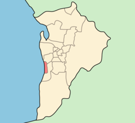
City of Holdfast Bay
South Australia
Adelaide-LGA-Holdfast Bay-MJC.png
Population37,543 (LGA 2021) [1]
 • Density2,736,37/km2 (708,720/sq mi)
Area13.72 km2 (5.3 sq mi)
MayorAmanda Wilson
Council seat Brighton
Region Southern Adelaide [2]
State electorate(s) Bright, Morphett
Federal division(s) Boothby, Hindmarsh
Holdfastbay.png
Website City of Holdfast Bay
LGAs around City of Holdfast Bay:
City of West Torrens City of West Torrens
City of Holdfast Bay City of Marion
City of Marion City of Marion
City of Holdfast Bay municipal offices in Brighton (formerly the Brighton Town Hall), opened in 1937. Brighton municipal offices.JPG
City of Holdfast Bay municipal offices in Brighton (formerly the Brighton Town Hall), opened in 1937.

The City of Holdfast Bay is a local government area in the south-western coastal suburbs of Adelaide, South Australia.

Contents

History

The council was formed 1 January 1997, when the City of Glenelg and City of Brighton councils were amalgamated by the state government. As a result, there are two council offices, one in the historic Glenelg Library on Colley Terrace and the other on Jetty Road, Brighton.

Council

The current council as of November 2021 is: [3]

WardParty [4] CouncillorNotes
Mayor IndependentAmanda Wilson
Brighton  Labor Rosemary Clancy
 IndependentRobert Snewin
 IndependentJane Fleming
Glenelg IndependentBob Patton
 IndependentRebecca Abley
 IndependentPhilip Chabrel
Seacliff IndependentAnnette Bradshaw
 IndependentSusan Lonie
 IndependentClare Lindop
Somerton IndependentJanet Fletcher
 IndependentJohn Smedley
 IndependentWill Miller

Mayors

The Council has had 4 mayors: Brian Nadilo (1997-2006), Ken Rollond (2006-2014), Stephen Patterson (2014-2017) and Amanda Wilson (2018-). [5]

Suburbs

Wards

The council consists of four Wards: Glenelg, Somerton, Brighton and Seacliff. Each Ward is represented by three Ward Councillors.

Sister city

There is one Sister city to Holdfast Bay. [6]

Flag of Japan.svg Hayama, Kanagawa , Japan

See also

Related Research Articles

<span class="mw-page-title-main">The Old Gum Tree</span>

The Old Gum Tree is a historic site in Glenelg North, South Australia. Near this tree on 28 December 1836, the British governor John Hindmarsh delivered the proclamation announcing the establishment of Government of the colony of South Australia. A ceremony is held each year at the site on Proclamation Day, with the current Governor reading out Hindmarsh's original speech.

<span class="mw-page-title-main">Division of Boothby</span> Australian federal electoral division

The Division of Boothby is an Australian federal electoral division in South Australia. The division was one of the seven established when the former Division of South Australia was redistributed on 2 October 1903 and is named after William Boothby (1829–1903), the Returning Officer for the first federal election.

<span class="mw-page-title-main">Glenelg, South Australia</span> Suburb of Adelaide, South Australia

Glenelg is a beach-side suburb of the South Australian capital of Adelaide. Located on the shore of Holdfast Bay in Gulf St Vincent, it has become a tourist destination due to its beach and many attractions, home to several hotels and dozens of restaurants.

<span class="mw-page-title-main">City of Mitcham</span> Local government area in South Australia

The City of Mitcham is a local government area in the foothills of southern Adelaide, South Australia. Within its bounds is Flinders University, South Australia's third largest, and the notable, affluent suburb of Springfield which contains some of the city's most expensive properties.

<span class="mw-page-title-main">Brighton, South Australia</span> Suburb of Adelaide, South Australia

Brighton is a coastal suburb of Adelaide, South Australia, situated between Seacliff and Glenelg and aside Holdfast Bay. Some notable features of the area are the Brighton-Seacliff Yacht Club, the Brighton Surf Lifesaving Club, the Brighton Jetty, and a beach. The Windsor Theatre, constructed in 1925, is a long-standing institution.

<span class="mw-page-title-main">Marino, South Australia</span> Suburb of Adelaide, South Australia

Marino is a coastal suburb in the south of Adelaide, South Australia that's surrounded by a conservation park and rugged coastline. This suburb is a brilliant place for families to develop an adventurous life in a unique setting with most houses having sea views and access to meandering public open spaces. The suburb even has its own working lighthouse. Marino's elevated position provides panoramic views of the ocean – Gulf St Vincent, the metropolitan beaches and Adelaide CBD. Marino has access to the North or South via Brighton Road, has two railway stations on the main Seaford Line and a host of walking and cycle trails to the neighbouring beaches and wine region. A community cooperative has purchased a restaurant building on the beachfront on Marine Parade. It's called Marino Rocks Social. The cooperative's first project is to run a cafe. The cooperative has 250 members, all with equal status, who have invested money or effort and is completely independent of other local community associations.

Seacliff Park is a suburb of Adelaide partly in the City of Marion and the City of Holdfast Bay. The suburb is adjacent to South Brighton in the north, Seaview Downs to the east, Hallett Cove to the south, and Marino and Seacliff on its western side. The suburb is divided diagonally by Ocean Road, with the northern part of the suburb mainly residential, and the southern park partly occupied by a golf course and a quarry.

<span class="mw-page-title-main">City of West Torrens</span> Local government area in South Australia

The City of West Torrens is a local government area in the western suburbs of Adelaide, South Australia. Since the 1970s, the area was mainly home to many open spaces and parks, however after the mid-1990s (1993–1995) the LGA became more residential.

<span class="mw-page-title-main">Electoral district of Morphett</span> State electoral district of South Australia

Morphett is a single-member electoral district for the South Australian House of Assembly. The electorate is located approximately 10 kilometres (6.2 mi) slightly south of west of the Adelaide city centre, bounded by the Holdfast Bay coastline to the west and Marion Road to the east. It is approximately 14 km2 (5.4 sq mi) in area, and includes the suburbs of Camden Park, Glenelg, Glenelg East, Glenelg North, Glenelg South, Glengowrie, Morphettville, Novar Gardens, and Park Holme, as well as a portion of Somerton Park.

<span class="mw-page-title-main">Anzac Highway</span> Highway in Adelaide

Anzac Highway is an 8.7-kilometre-long (5.4 mi) main arterial road heading southwest from the city of Adelaide, the capital of South Australia, to the beachside suburb of Glenelg.

<span class="mw-page-title-main">Seacliff, South Australia</span> Suburb of Adelaide, South Australia

Seacliff is a coastal suburb located in the capital city of South Australia; Adelaide. Overseen by the council, City of Holdfast Bay, this suburb is adjacent to South Brighton, Seacliff Park, Marino and Kingston Park.

<span class="mw-page-title-main">Glenelg North, South Australia</span> Suburb of Adelaide, South Australia

Glenelg North is a seaside suburb of Adelaide, South Australia. It is located in both the City of Holdfast Bay and the City of West Torrens.

<span class="mw-page-title-main">Holdfast Bay</span> Bay in Gulf St Vincent, South Australia

The Holdfast Bay is a small bay in Gulf St Vincent, next to Adelaide, South Australia. Along its shores lie the local government area of the City of Holdfast Bay and the suburbs of Glenelg and Glenelg North

<span class="mw-page-title-main">Tapleys Hill Road</span>

Tapleys Hill Road is a north–south arterial road which runs parallel to the coast through western Adelaide, Australia. This name covers many consecutive streets and is not widely known to most drivers except for the northernmost section, as the entire allocation is still best known as by the names of its constituent parts: Tapleys Hill Road proper, Brighton Road, Ocean Boulevard, Lonsdale Road, Dyson Road, Murray Road, and Gawler Street. This article will deal with the entire length of the corridor for sake of completion, as well to avoid confusion between declarations.

<span class="mw-page-title-main">Glenelg East, South Australia</span> Suburb of Adelaide, South Australia

Glenelg East is a residential suburb 9 kilometres (5.6 mi) south-west of the centre of Adelaide, South Australia. It is characterised by quarter-acre blocks with heritage homes and parks intermingled with contemporary modern homes and low-rise multi-dwelling units.

Kingston Park is a small beachside suburb, 17 kilometres (11 mi) south of the Adelaide city centre. Kingston Park is within the City of Holdfast Bay and flanked by the neighbouring suburbs of Marino to the south and Seacliff to the north and east.

Hove is a coastal suburb of Adelaide, South Australia. It is situated north of Brighton, west of Warradale, and south of North Brighton. Running along the west of the suburb is the Esplanade, a street with numerous townhouses with views of the Gulf St Vincent. The suburb is bisected by its major thoroughfare, Brighton Road. Property prices are generally higher on the coastal side of Brighton Road.

The Holdfast Bay railway line was a railway in western Adelaide. The line started in the city from the Adelaide railway station, and then headed west. From approximately where Henley Beach Road currently is, the railway then followed an almost direct route to the seaside suburb of Glenelg.

<span class="mw-page-title-main">City of Brighton (South Australia)</span> Local government area in South Australia

The City of Brighton was a local government area in South Australia seated at the Adelaide sea-side township of Brighton from 1858 until 1997.

<span class="mw-page-title-main">City of Glenelg</span> Local government area in South Australia

The City of Glenelg was a local government area in South Australia seated at the Adelaide sea-side township of Glenelg from 1855 until 1997.

References

  1. Australian Bureau of Statistics (28 June 2022). "Holdfast Bay (Local Government Area)". Australian Census 2021 QuickStats. Retrieved 28 June 2022.  OOjs UI icon edit-ltr-progressive.svg
  2. "Southern Adelaide SA Government region" (PDF). The Government of South Australia. Archived from the original (PDF) on 27 March 2019. Retrieved 17 April 2017.
  3. "Elected Members". www.holdfast.sa.gov.au. Retrieved 18 May 2018.
  4. "Elected Members Register of Interests" (PDF). City of Holdfast Bay. Archived from the original (PDF) on 16 January 2017. Retrieved 6 June 2016.
  5. "First Female Mayor" . Retrieved 18 December 2022.
  6. "Hayama Sister City". City of Holdfast Bay. Archived from the original on 31 May 2010. Retrieved 4 June 2010.

35°1′S138°31′E / 35.017°S 138.517°E / -35.017; 138.517