Wattle Range Council

Last updated

Wattle Range Council
South Australia
Wattle Range LGA.png
Position of the Wattle Range Council
Coordinates 37°27′55″S140°30′00″E / 37.4653°S 140.4999°E / -37.4653; 140.4999
Population11,888 (LGA 2021) [1]
 • Density3,03/km2 (780/sq mi)
Established1997
Area3,923.5 km2 (1,514.9 sq mi)
MayorDes Noll
Council seat Millicent
Region Limestone Coast [2]
State electorate(s) MacKillop, Mount Gambier
Federal division(s) Barker
Wattle Range Council logo.png
Website Wattle Range Council
LGAs around Wattle Range Council:
District Council of Robe Naracoorte Lucindale Council
Southern Ocean Wattle Range Council Glenelg (Vic)
Southern Ocean District Council of Grant

Wattle Range Council is a local government area in the Limestone Coast region of South Australia. It stretches from the coast at Beachport east to the Victorian border. It had a population of over 11,000 as at the 2016 Census.

Contents

The council is divided into four wards; Kintore, Riddoch, Sorby Adams and Corcoran wards, with two or more councillors representing each ward. The council seat is located at Millicent. [3]

History

The aboriginal people of the region were composed of five powerful tribes, each occupying its own territory which was strictly defined, and territorial rights guarded jealously. Each had different dialects and the names of the tribes were Bungandidj, Pinegunga, Mootatunga, Wichitunga and Polingunga, of which the first was the most powerful. [4] The tract of country occupied by the Booandik extended from the mouth of the Glenelg River to Rivoli Bay North (Beachport) for about 30 miles inland.

European settlers first moved into the area in the late 1840s, and by the 1860s opened up tracts of land for farming cereal crops. Beachport became an important port during the 1880s, further increasing the population of the area. [4] The first local government areas were set up around the three towns of Millicent, Penola and Beachport in the late 19th century, with each operating independently of each other until 1997.

The Wattle Range Council was formed in 1997 from the amalgamation of the District Council of Beachport, the District Council of Millicent and the District Council of Penola. [5] [6]

Geography

The council includes the towns and localities of Beachport, Burrungule, Comaum, Coonawarra, Furner, German Flat, Glencoe, Glenroy, Hatherleigh, Kalangadoo, Kangaroo Inn, Koorine, Krongart, Maaoupe, Magarey, Millicent, Moerlong, Monbulla, Mount Burr, Mount McIntyre, Nangwarry, Penola, Rendelsham, Rocky Camp, Sebastopol, Short, Southend, Thornlea, Wattle Range and Wattle Range East, and parts of Bool Lagoon, Bray, Canunda, Clay Wells, Nora Creina, Tantanoola and Wepar. [7]

Economy

The local economy is dependent on wide range of activities, with agriculture, fishing, forestry and tourism making up the major components.

Sheep and cattle farming are the prominent agricultural venture, with dairy farming common also. Cereal cropping is also prevalent in the nutrient-rich soils of the South East. [8]

Viticulture is well established in the council area, with one of South Australia's premier wine growing regions, the Coonawarra wine region, located in its bounds, with rich terra rossa soil aiding the wine quality. [9]

Forestry and milling have also been important to the district, with processing plants at Nangwarry and Millicent.

Tourism is a diverse, growing aspect of the economy, with seaside towns such as Beachport attracting tourists for the seaside atmosphere, and others such as Coonawarra, for the wine growing industry. [10] A niche tourism activity is cave diving in the water-filled caves and sinkholes present in the southern part of the council's area as well as in the adjoining local government area of the District Council of Grant. This activity attracts cave divers from around the globe. Popular sites include Fossil Cave , Pines and Tank Cave. [11] [12]

Elected Members

WardElected MembersPosition
N/A [13]  Des NollMayor
Corcoran [13]  Glenn BrownDeputy Mayor
 Sharon CoxCouncillor
 John DrewCouncillor
 Moira NeagleCouncillor
 Graham SlarksCouncillor
Kintore [13]  Peter DunnicliffCouncillor
 Kevin McGrathCouncillor
Riddoch [13]  Dean BurrowCouncillor
 Rick PaltridgeCouncillor
Sorby Adams [13]  Deb AgnewCouncillor
 Dale PriceCouncillor

Wattle Range Council has a directly elected mayor. [13] A councillor is appointed by council as deputy mayor at the start of each term in office.

See also

Related Research Articles

<span class="mw-page-title-main">Limestone Coast</span> Region in South Australia

The Limestone Coast is a name used since the early twenty-first century for a South Australian government region located in the south east of South Australia which immediately adjoins the continental coastline and the Victorian border. The name is also used for a tourist region and a wine zone both located in the same part of South Australia.

<span class="mw-page-title-main">Adelaide Plains</span> Coastal plain in South Australia

The Adelaide Plains is a plain in South Australia lying between the coast on the west and the Mount Lofty Ranges on the east. The southernmost tip of the plain is in the southern seaside suburbs of Adelaide around Brighton at the foot of the O'Halloran Hill escarpment with the south Hummocks Range and Wakefield River roughly approximating the northern boundary.

<span class="mw-page-title-main">Penola, South Australia</span> Town in southern South Australia, Australia

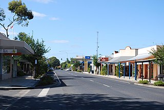
Penola is a town in the Australian state of South Australia located about 388 kilometres (241 mi) southeast of the state capital of Adelaide in the wine growing area known as the Coonawarra. At the 2021 Australian Census, the town of Penola had a population of 1,376.

<span class="mw-page-title-main">Coonawarra, South Australia</span> Town in South Australia

Coonawarra is a small town north of Penola in South Australia. It is best known for the Coonawarra wine region named after it.

<span class="mw-page-title-main">Millicent, South Australia</span> Town in South Australia

Millicent is a town in the Australian state of South Australia located about 399 kilometres (248 mi) south-east of the state capital of Adelaide and about 50 kilometres (31 mi) north of the regional centre of Mount Gambier. In the 2011 census, the population was 5,024.

<span class="mw-page-title-main">Beachport</span> Town in South Australia

Beachport is a small coastal town in the Australian state of South Australia about 311 kilometres (193 mi) south-east of the state capital of Adelaide and about 34 kilometres (21 mi) north-west of the municipal seat in Millicent, located at the northern end of Rivoli Bay. Beachport has a large crayfishing fleet, and is known for its 772-metre (2,533 ft)-long jetty, the second-longest in South Australia after the one at Port Germein. The towns Norfolk pines, white sand beach and clear waters are alluring to visitors

<span class="mw-page-title-main">District Council of Grant</span> Local government area in South Australia

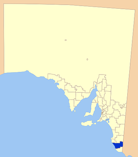
The District Council of Grant is a local government area located in the Limestone Coast region of South Australia, and is the southernmost council in the state.

Glencoe is a town in South Australia, Australia, located 27 kilometres (17 mi) north-west of Mount Gambier.

Furner is a town and locality in the Australian state of South Australia. Furner is a farming community.

<span class="mw-page-title-main">Rendelsham, South Australia</span> Town in South Australia

Rendelsham is a town in the south-east of South Australia, 392 kilometres (244 mi) south east of the state capital, Adelaide. It is on the Southern Ports Highway between Beachport and Millicent.

Victoria was an electorate in the South Australian House of Assembly from 1857 until 1902 and from 1915 to 1993.

<span class="mw-page-title-main">Limestone Coast zone (wine)</span>

Limestone Coast zone is a wine zone located in the south east of South Australia. It extends south of a line of latitude approximately in line with Cape Willoughby at the east end of Kangaroo Island and it is bounded by the continental coastline and the border with Victoria. It consists of the following wine regions all of which have received appellation as an Australian Geographical Indication (AGI): Coonawarra, Mount Benson, Mount Gambier, Robe, Padthaway, Wrattonbully and a small number of vineyards located outside the above regions. The zone received AGI in 1996.

<span class="mw-page-title-main">Bool Lagoon, South Australia</span> Suburb of Naracoorte Lucindale Council, Wattle Range Council, South Australia

Bool Lagoon is a locality in the Australian state of South Australia located in the south-east of the state in the Limestone Coast region about 311 kilometres south east of the state capital of Adelaide.

<span class="mw-page-title-main">County of Grey</span> Cadastral in South Australia

The County of Grey is one of the 49 cadastral counties of South Australia. It was proclaimed in 1846 by Governor Frederick Robe and named for former Governor George Grey. It covers the extreme south-east of the state from Penola and Lake George southwards. This includes the following contemporary local government areas of the state:

The Hundred of Mount Muirhead is a cadastral division of the County of Grey in southeastern South Australia. It was named on 15 July 1869 for the geographical feature of the same name which, in turn, was named by Charles Bonney for one of his stockmen.

Kangaroo Inn is a locality in the Australian state of South Australia located in the state's south-east within the Limestone Coast region about 306 kilometres (190 mi) south-east of the state capital of Adelaide, and about 30 kilometres (19 mi) south-east and about 46 kilometres (29 mi) north-west respectively of the municipal seats of Robe and Millicent.

The Pennant is a weekly newspaper published in Penola, South Australia, from July 1946. Along with The Border Watch, it was most recently owned by the Scott Group of Companies. After 74 years of publishing, however, the newspaper was discontinued on 21 August 2020. However, in March 2022 the newspaper was relaunched with funding after an 18-month hiatus.

Wattle Range is a locality in the Australian state of South Australia located in the state’s south-east about 328 kilometres (204 mi) south-east of the state capital of Adelaide and about 25 kilometres (16 mi) north-east of the municipal seat in Millicent.

The District Council of Millicent was a local government area in South Australia seated at Millicent.

References

  1. Australian Bureau of Statistics (28 June 2022). "Wattle Range (Local Government Area)". Australian Census 2021 QuickStats. Retrieved 28 June 2022.  OOjs UI icon edit-ltr-progressive.svg
  2. "Limestone Coast SA Government region" (PDF). The Government of South Australia. Retrieved 10 October 2014.
  3. "Wattle Range Council" . Retrieved 12 April 2016.
  4. 1 2 Manning Index, South East , retrieved 18 June 2007
  5. Wattle Range Council, Home, archived from the original on 28 August 2007, retrieved 18 June 2007
  6. "Thursday, 13 February 1997" (PDF). The Government Gazette of South Australia. Government of South Australia. Retrieved 22 November 2016.
  7. "Location SA Map Viewer". Government of South Australia. Retrieved 12 April 2016.
  8. Wattle Range Council, Primary Industries, archived from the original on 11 August 2007, retrieved 18 June 2007
  9. WineDiva, Coonawarra region , retrieved 18 June 2007
  10. Wattle Range Tourism, Home , retrieved 18 June 2007
  11. "The Pines – 5L061". Richard "Harry" Harris. Archived from the original on 28 February 2005. Retrieved 9 October 2013.
  12. "Tank Cave 5L230". Richard "Harry" Harris. Archived from the original on 23 September 2015. Retrieved 9 October 2013.
  13. 1 2 3 4 5 6 "Election Results 2014" (PDF). Local Government Association of South Australia. Retrieved 15 February 2016.