Tantanoola, South Australia

Last updated

Tantanoola
South Australia
TantanoolaPostOffice.JPG
Post office
Australia South Australia location map.svg
Red pog.svg
Tantanoola
Coordinates 37°41′51″S140°27′20″E / 37.697439°S 140.455519°E / -37.697439; 140.455519 Coordinates: 37°41′51″S140°27′20″E / 37.697439°S 140.455519°E / -37.697439; 140.455519 [1]
Population
Established10 July 1879 (town)
23 February 1995 (locality) [4] [5]
Postcode(s) 5280 [6]
Elevation25 m (82 ft) (Railway Station) [7]
Time zone ACST (UTC+9:30)
 • Summer (DST) ACDT (UTC+10:30)
Location
LGA(s)
Region Limestone Coast [8]
County Grey [1]
State electorate(s) MacKillop [9]
Federal Division(s) Barker [10]
Mean max temp [11] Mean min temp [11] Annual rainfall [11]
19.0 °C
66 °F
8.2 °C
47 °F
712.4 mm
28 in
Localities around Tantanoola:
Millicent Rocky Camp
Mount Burr
Mount McIntyre
Canunda Tantanoola Glencoe
German Flat German Creek Burrungule
FootnotesAdjoining localities [1]

Tantanoola is a town in regional South Australia. The name is derived from the aboriginal word tentunola, which means boxwood / brushwood hill or camp. Tantanoola was originally named 'Lucieton' by Governor Jervois after his daughter Lucy Caroline, on 10 July 1879. It was changed by Governor Robinson to 'Tantanoola' on 4 October 1888. At the 2006 census, Tantanoola had a population of 255. [12]

Contents

Tantanoola is in the Wattle Range Council local government area, the South Australian House of Assembly electoral districts of MacKillop and Mount Gambier, and the Australian House of Representatives Division of Barker.

The primary school closed in July 2020 after the farcical situation of having more staff than students. The remaining students transferred to nearby schools in Millicent and Mount Gambier.

History

The township of Tantanoola is situated in the Hundred of Hindmarsh, 425 km south east of Adelaide, and was once a portion of Mayurra Station. It was the second town of importance on the Mount Gambier to Rivoli Bay railway line which was built in 1878, converted from narrow to broad gauge in 1957 and ceased operating to freight in April 1995 then Limestone Coast Railway tourist passengers on 1 July 2006 which spanned across 128 years between Tantanoola and Mount Gambier.[ citation needed ]

The historic Tantanoola railway station is listed on the South Australian Heritage Register. [13]

Tantanoola Tiger

Caves near Tantanoola Tantanoola-cave.jpg
Caves near Tantanoola

Tantanoola is known for the Tantanoola Tiger, a phantom cat which supposedly stalked the area during the late nineteenth century. In August 1895 an animal was shot by one Thomas John Donovan, which was believed to have been the mysterious predator. The animal turned out to be more like a wolf than a cat. Later, it was determined to be an Arabian wolf, although how it arrived in South Australia has been the subject of a number of theories. It is currently preserved and on display at the Tantanoola Hotel (which is also known colloquially as the Tantanoola Tiger Hotel). [14] Tantanoola Caves Conservation Park, featuring a spectacular dolomite cave is located nearby.

Australian poet Max Harris wrote a poem titled "The Tantanoola Tiger", which is included in the collection The Angry Penguin: the Poetry of Max Harris , published by the National Library of Australia. [15] [16]

Snuggery

The next station northwest along the railway line was Snuggery. Snuggery is not recognised as a separate town, but is part of Tantanoola towards Millicent. The area includes the Snuggery Power Station with three diesel-powered gas turbines, and the Kimberly-Clark woodchip and paper pulp mill. The pulp mill was commissioned in 1992 but ceased operations in 2011. [17] It was demolished in November 2012. [18]

See also

Related Research Articles

Coonawarra, South Australia Town in South Australia

Coonawarra is a small town north of Penola in South Australia.

Trihi, South Australia Suburb of Wattle Range Council, South Australia

Trihi is a former locality in the Australian state of South Australia located in the state's south east about 343 kilometres (213 mi) south-east of the state capital of Adelaide and about 25 kilometres (16 mi) north-east of the municipal seat in Millicent.

Millicent, South Australia Town in South Australia

Millicent is a town in the Australian state of South Australia located about 399 kilometres (248 mi) south-east of the state capital of Adelaide and about 50 kilometres (31 mi) north of the regional centre of Mount Gambier. In the 2011 census, the population was 5,024.

Kalangadoo, South Australia Town in South Australia

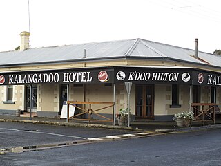
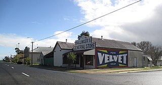
Kalangadoo is a locality in the Australian state of South Australia located about 348 kilometres (216 mi) south-east of the state capital of Adelaide and about 31 kilometres (19 mi) north of the regional centre of Mount Gambier.

Wolseley, South Australia Town in South Australia

Wolseley is a small South Australian town near the Victorian border. It is five kilometres south of the Dukes Highway and 13 kilometres east of Bordertown. It was first proclaimed a town in 1884.

Beachport Town in South Australia

Beachport is a small coastal town in the Australian state of South Australia about 311 kilometres (193 mi) south-east of the state capital of Adelaide and about 34 kilometres (21 mi) north-west of the municipal seat in Millicent, located at the northern end of Rivoli Bay. Beachport has a large crayfishing fleet, and is known for its 772-metre (2,533 ft)-long jetty, the second-longest in South Australia after the one at Port Germein.

Glencoe, South Australia Town in South Australia

Glencoe is a town in South Australia, Australia, located 27 kilometres (17 mi) north-west of Mount Gambier. At June 2016, Glencoe had an estimated population of 661.

Allendale East Suburb of District Council of Grant, South Australia

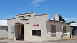
Allendale East is a town and locality in the Australian state of South Australia located in the state's south-east about 391 kilometres (243 mi) south-east of the state capital of Adelaide and about 20 kilometres (12 mi) south of the municipal seat of Mount Gambier.

Burrungule, South Australia Town in South Australia

Burrungule is a locality in South Australia.

Frances, South Australia Town in South Australia

Frances is a town in the Australian state of South Australia located about 291 kilometres (181 mi) south-east of the state capital, Adelaide and about 40 kilometres (25 mi) north-east of the municipal seat of Naracoorte in the state's Limestone Coast region and adjoining the border with the State of Victoria.

Hynam, South Australia Town in South Australia

Hynam is a town and locality in the Australian state of South Australia located in the state's south-east within the Limestone Coast region on the border with the state of Victoria about 302 kilometres south east of the state capital of Adelaide and about 11 kilometres east of the municipal seat of Naracoorte.

Nangwarry, South Australia Town in South Australia

Nangwarry is a town and a locality in the Australian state of South Australia located about 352 kilometres (219 mi) south-east of the state capital of Adelaide and about 32 kilometres (20 mi) north-west of the regional centre of Mount Gambier.

Rendelsham, South Australia Town in South Australia

Rendelsham is a town in the south-east of South Australia, 392 kilometres (244 mi) south east of the state capital, Adelaide. It is on the Southern Ports Highway between Beachport and Millicent.

Southend, South Australia Town in South Australia

Southend is a town and locality in the Australian state of South Australia located in the south-east of the state on the southern shore of Rivoli Bay about 324 kilometres (201 mi) south-east of the state capital of Adelaide.

Glenburnie, South Australia Suburb of District Council of Grant, South Australia

Glenburnie is a locality in the Australian state of South Australia located in the state's southeast adjoining the border with Victoria about 385 kilometres (239 mi) south-east of the state capital of Adelaide and about 9.3 kilometres (5.8 mi) east of the municipal seat of Mount Gambier.

Canunda, South Australia Suburb of District Council of Grant, Wattle Range Council., South Australia

Canunda is a locality in the Australian state of South Australia located on the state’s south-east coast overlooking the body of water known in Australia as the Southern Ocean and by international authorities as the Great Australian Bight. It is about 339 kilometres south-east of the state capital of Adelaide and 49 kilometres south of the centre of Mount Gambier.

Clay Wells, South Australia Suburb of District Council of Robe, South Australia

Clay Wells is a locality in the Australian state of South Australia located in the state's south-east within the Limestone Coast region about 300 kilometres (190 mi) south east of the state capital of Adelaide, and about 39 kilometres (24 mi) south-east and about 35 kilometres (22 mi) north-west respectively of the municipal seats of Robe and Millicent.

Mount McIntyre, South Australia Suburb of Wattle Range Council, South Australia

Mount McIntyre is a locality in the Australian state of South Australia located in the state’s south-east about 388 kilometres (241 mi) south-east of the state capital of Adelaide and about 16 kilometres (9.9 mi) east of the municipal seat in Millicent.

Magarey, South Australia Suburb of Wattle Range Council, South Australia

Magarey is a locality in the Australian state of South Australia located in the state’s south-east about 307 kilometres (191 mi) south-east of the state capital of Adelaide and about 35 kilometres (22 mi) west of the municipal seat in Millicent.

Wattle Range, South Australia Suburb of Wattle Range Council, South Australia

Wattle Range is a locality in the Australian state of South Australia located in the state’s south-east about 328 kilometres (204 mi) south-east of the state capital of Adelaide and about 25 kilometres (16 mi) north-east of the municipal seat in Millicent.

References

  1. 1 2 3 4 5 "Search results for 'Tantanoola, LOCB' with the following datasets being selected - 'Suburbs and Localities', 'Government Towns', 'Counties', 'Local Government Areas', 'SA Government Regions', 'Land Development Plan Zone Categories' and 'Gazetteer'". Location SA Map Viewer. Government of South Australia. Retrieved 25 November 2018.
  2. Australian Bureau of Statistics (27 June 2017). "Tantanoola (UCL)". 2016 Census QuickStats. Retrieved 21 February 2018. OOjs UI icon edit-ltr-progressive.svg
  3. Australian Bureau of Statistics (27 June 2017). "Tantanoola (SSC)". 2016 Census QuickStats. Retrieved 21 February 2018. OOjs UI icon edit-ltr-progressive.svg
  4. Morgan, William (10 July 1878). "Untitled proclamation re the Town of Lucieton" (PDF). The South Australian Government Gazette. Government of South Australia. p. 70. Retrieved 25 November 2018.
  5. Kentish, P.M. (23 February 1995). "GEOGRAPHICAL NAMES ACT, 1991 Notice to Assign Boundaries to a Place" (PDF). The South Australian Government Gazette. South Australian Government. p. 678. Retrieved 15 May 2018.
  6. 1 2 3 "Postcode for Tantanoola, South Australia". Postcodes Australia. Retrieved 21 February 2018.
  7. "Search results for 'Tantanoola, LOCB' with the following datasets being selected - 'Suburbs and Localities', 'Gazetteer' and 'Railway'". Location SA Map Viewer. Government of South Australia. Retrieved 25 November 2018.
  8. "Limestone Coast SA Government region" (PDF). The Government of South Australia. Retrieved 10 October 2014.
  9. "District of MacKillop Background Profile". Electoral Commission SA. Retrieved 29 March 2016.
  10. "Federal electoral division of Barker" (PDF). Australian Electoral Commission. Retrieved 28 March 2016.
  11. 1 2 3 "Monthly climate statistics: Summary statistics Mount Gambier Aero (nearest weather station)". Commonwealth of Australia , Bureau of Meteorology. Retrieved 27 November 2018.
  12. Australian Bureau of Statistics (25 October 2007). "Tantanoola (L) (Urban Centre/Locality)". 2006 Census QuickStats. Retrieved 29 October 2011.
  13. "Tantanoola Railway Station & Goods Shed". South Australian Heritage Register. Department of Environment, Water and Natural Resources. Retrieved 26 August 2016.
  14. "Tantanoola". Wattle Range Council. Archived from the original on 28 September 2007. Retrieved 31 May 2007.
  15. "Harris Poetry". ernmalley.com. 28 December 2007. Retrieved 13 September 2008.
  16. "Angry Penguin: Selected Poems of Max Harris". nla.gov.au. 11 September 2000. Retrieved 13 September 2008.
  17. "Kimberly-Clark Corporation: A Proud History". Kimberly-Clark . Retrieved 16 May 2016.
  18. Tasha Impey (5 November 2012). "Explosive end for Tantanoola pulp mill". ABC South East SA. Retrieved 16 May 2016.