
Billiatt Conservation Park, formerly the Billiatt National Park, is a protected area in the Australian state of South Australia located in the locality of Sandalwood about 200 kilometres (120 mi) east of the state capital of Adelaide.
Fairview Conservation Park is a protected area in the Australian state of South Australia located in the gazetted locality of Woolumbool about 17 kilometres (11 mi) north of Lucindale in the state's Limestone Coast region.
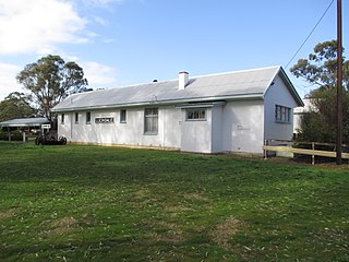
Lucindale is a small town in the south-east region of South Australia. The town is located 345 kilometres (214 mi) south east of the state capital, Adelaide. At the 2006 census, Lucindale had a population of 301. The town is best known for hosting the annual South East Field Days, attracting over 26,000 visitors every March.
Cox Scrub Conservation Park is a protected area in the Australian state of South Australia located in the gazetted localities of Ashbourne and Nangkita about 55 kilometres (34 mi) south of the state capital of Adelaide.

Torrens Island Conservation Park is a protected area in the Australian state of South Australia located on Torrens Island in the Adelaide metropolitan area about 17 kilometres north-northwest of the state capital of Adelaide and about 3.9 kilometres north-northeast of Port Adelaide.
Ramsay Conservation Park is a protected area in the Australian state of South Australia located in the Yorke Peninsula in the locality of Ramsay about 6.5 kilometres west-northwest of the town of Port Vincent.
Tucknott Scrub Conservation Park is a protected area located in the Australian state of South Australia on the Eyre Peninsula in the gazetted locality of Whites Flat about 12 kilometres north-east of the town centre in Wanilla and about 30 kilometres north of the municipal seat of Port Lincoln.
Thidna Conservation Park is a protected area located in the Australian state of South Australia on the Yorke Peninsula in the locality of Corny Point about 45 kilometres (28 mi) west of the state capital of Adelaide and about 60 kilometres (37 mi) south-west of the municipal seat of Maitland.
Penola Conservation Park is a protected area located in the Australian state of South Australia in the locality of Monbulla about 329 kilometres (204 mi) south-east of the state capital of Adelaide and about 12 kilometres (7.5 mi) west of the town of Penola.
Kyeema Conservation Park is a protected area located in the Australian state of South Australia in the locality of Kyeema about 38 kilometres (24 mi) south of the state capital of Adelaide and about 12 kilometres (7.5 mi) east of the town of Willunga.
Lowan Conservation Park is a protected area located in the Australian state of South Australia in the locality of Bowhill about 99 kilometres (62 mi) east of the state capital of Adelaide and about 9 kilometres (5.6 mi) west of the town of Perponda.
Karte Conservation Park is a protected area located in the Australian state of South Australia in the localities of Karte and Parilla about 193 kilometres (120 mi) east of the state capital of Adelaide and about 26 kilometres (16 mi) north-west of the town of Pinnaroo.
Carcuma Conservation Park is a protected area located in the Australian state of South Australia in the locality of Carcuma about 155 kilometres (96 mi) south-east of the state capital of Adelaide and about 22 kilometres (14 mi) north-east of the town of Coonalpyn.
Ettrick Conservation Park is a protected area located in the Australian state of South Australia in the locality of Ettrick about 80 kilometres (50 mi) east of the state capital of Adelaide and about 24 kilometres (15 mi) north-east of the city of Murray Bridge.
Caroona Creek Conservation Park is a protected area located in the Australian state of South Australia in the localities of Collinsville and Mount Bryan East about 173 kilometres (107 mi) north-east of the state capital of Adelaide and about 19 kilometres (12 mi) east of the town of Hallett.
Wolseley Common Conservation Park is a protected area located in the Australian state of South Australia in the locality of Wolseley about 260 kilometres (160 mi) south-east of the state capital of Adelaide, about 13 kilometres (8.1 mi) south-east of the town of Bordertown and immediately adjoining the south-west side of the town of Wolseley.
Aberdour Conservation Park is a protected area in the Australian state of South Australia located in the state's south-east in the locality of Willalooka about 226 kilometres (140 mi) south-east of the state capital of Adelaide and about 35 kilometres (22 mi) south of the town of Keith.
Geegeela Conservation Park is a protected area in the Australian state of South Australia located in the state's south-east in the gazetted locality of Bangham about 277 kilometres (172 mi) north-west of the state capital of Adelaide and about 12 kilometres (7.5 mi) north-west of the town centre in Frances.
Padthaway Conservation Park is a protected area in the Australian state of South Australia located in the state's south-east in the gazetted locality of Padthaway about 253 kilometres (157 mi) south-east of the state capital of Adelaide and about 2.5 kilometres (1.6 mi) north-east of the locality's town centre.
Mount Monster Conservation Park is a protected area in the Australian state of South Australia located in the state’s south-east in the gazetted locality of Keith about 210 kilometres (130 mi) south-east of the state capital of Adelaide and about 12 kilometres (7.5 mi) south of the town centre in Keith.
