Lincoln National Park is a protected area in the Australian state of South Australia located about 249 kilometres (155 mi) west of the state capital of Adelaide and about 9.5 kilometres (5.9 mi) south of the municipal seat of Port Lincoln. It consists of a mainland area on the Jussieu Peninsula on the south eastern tip of Eyre Peninsula and a number of nearby islands. The national park contains significant sites of natural, indigenous and early European heritage.
Fairview Conservation Park is a protected area in the Australian state of South Australia located in the gazetted locality of Woolumbool about 17 kilometres (11 mi) north of Lucindale in the state's Limestone Coast region.
Ravine Des Casoars Wilderness Protection Area is a protected area located on the west end of Kangaroo Island in South Australia about 80 km (50 mi) west of Kingscote. It was established in 1993 on land previously part of the Flinders Chase National Park.

Seal Bay Conservation Park is a protected area located on the south coast of Kangaroo Island in the Australian state of South Australia. It is the home of the third largest Australian sea lion colony in Australia.
Lake Bonney SE is a coastal freshwater lake located in the Limestone Coast region of South Australia in the gazetted locality of Canunda. It has a surface area of 79 square kilometres (31 sq mi).

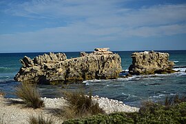
Carpenter Rocks is a town and locality located 35 kilometres (22 mi) south-west of Mount Gambier in the south-east of South Australia. The area faces the Southern Ocean and is renowned for its rugged coastline which provides exceptional fishing and diving locations.

Southend is a town and locality in the Australian state of South Australia located in the south-east of the state on the southern shore of Rivoli Bay about 324 kilometres (201 mi) south-east of the state capital of Adelaide.
Lake Newland Conservation Park is a protected area in the Australian state of South Australia located on the west coast of the Eyre Peninsula about 10 kilometres (6.2 mi) north of the town of Elliston. It was proclaimed in 1991 in order to protect Lake Newland, a hypersaline lake, and an associated wetland complex. It lies in the traditional lands of the Wirangu people.
Vivonne Bay Conservation Park, formerly the Vivonne Bay National Park, is a protected area in the Australian state of South Australia located on the south coast of Kangaroo Island in the gazetted locality of Vivonne Bay. It was dedicated in 1971 to conserve coastal country containing vegetation not already protected in Kelly Hill Conservation Park.
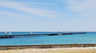
Rivoli Bay, is a bay located on the south-east coast of the Australian state of South Australia about 311 kilometres south-southeast of the state capital of Adelaide and about 65 kilometres northwest by west of the regional centre of Mount Gambier. It was named in 1802 by the Baudin expedition of 1800-03 after André Masséna, the Duke of Rivoli and Marshal of France. It is one of four 'historic bays' located on the South Australian coast.

Franklin Harbor Conservation Park is a protected area in the Australian state of South Australia located on the east coast of Eyre Peninsula in the gazetted locality of Cowell about 5 kilometres south of the town centre in Cowell.

Cape Willoughby Conservation Park, formerly part of the Cape Hart Conservation Park, is a protected area in the Australian state of South Australia located on the north coast of the Dudley Peninsula on Kangaroo Island in the gazetted locality of Willoughby about 27 kilometres south east of Penneshaw.

Kellidie Bay Conservation Park is a protected area in the Australian state of South Australia, located on the west coast of Eyre Peninsula immediately east of the town centre in Coffin Bay and immediately adjoining the south coast of Kellidie Bay in the localities of Coffin Bay, Kellidie Bay and Wangary.
Guichen Bay Conservation Park is a protected area in the Australian state of South Australia overlooking Guichen Bay located in the gazetted locality of Mount Benson about 8 kilometres north of the town centre of Robe.

Canunda is a locality in the Australian state of South Australia located on the state’s south-east coast overlooking the body of water known in Australia as the Southern Ocean and by international authorities as the Great Australian Bight. It is about 339 kilometres south-east of the state capital of Adelaide and 49 kilometres south of the centre of Mount Gambier.
Custon Conservation Park is a protected area in the Australian state of South Australia located in the state's Limestone Coast in the gazetted locality of Custon about 8 kilometres (5.0 mi) south of the town centre in Wolseley and about 20 kilometres (12 mi) south of the municipal seat of Bordertown.
Lower South East Marine Park is a marine protected area in the Australian state of South Australia located in the state's coastal waters in the state’s south-east adjoining the border with the state of Victoria.
Christmas Rocks Conservation Park is a protected area located in the Australian state of South Australia in the locality of Willalooka about 224 kilometres (139 mi) south-east of the state capital of Adelaide and about 29 kilometres (18 mi) south of the town of Keith.
Ramco Point Conservation Park is a protected area located in the Australian state of South Australia in the locality of Sunlands about 150 kilometres (93 mi) north-east of the state capital of Adelaide and about 7 kilometres (4.3 mi) north-west of the municipal seat of Waikerie.

Southern Kangaroo Island Marine Park is a marine protected area in the Australian state of South Australia located in state coastal waters adjoining both the south coast of Kangaroo Island and a group of islets located to the south of Kangaroo Island.