Tarpeena is a town and a locality on the Riddoch Highway between Penola and Mount Gambier in the Limestone Coast region of South Australia.
Pelican Point is a coastal town in South Australia that surrounds a headland on the continental coastline. It consists mostly of holiday shacks. The north side of the point faces Bungaloo Bay. The point was previously known as Pointe des Cordonniers. The current boundaries were created on 31 October 1996 including both the Bungaloo Bay and Pelican Point shack areas.
Allendale East is a town and locality in the Australian state of South Australia located in the state's south-east about 391 kilometres (243 mi) south-east of the state capital of Adelaide and about 20 kilometres (12 mi) south of the municipal seat of Mount Gambier.

Binnum is a locality in the Australian state of South Australia.
Burrungule is a locality in South Australia.

Kongorong is a locality in the Australian state of South Australia located southwest of Mount Gambier. It has an Australian rules football team and netball team. Kongorong Primary School had 61 students in 2010.
Mil-Lel is a northern suburb of Mount Gambier.

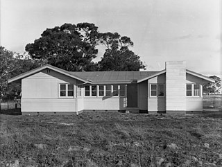
Moorak is a southern suburb of Mount Gambier - a city in South Australia.

Rendelsham is a town in the south-east of South Australia, 392 kilometres (244 mi) south east of the state capital, Adelaide. It is on the Southern Ports Highway between Beachport and Millicent.
Yahl is a Hamlet that is approx 7kms south east from Mount Gambier
Wandilo is a north-western suburb of Mount Gambier in the Australian state of South Australia. It was named after the railway station on the Mount Gambier railway line, and is recorded to mean "a swamp where native companions resort".
Mount Benson is a locality in the Australian state of South Australia located on the state's south-east coast overlooking Guichen Bay which is part of the body of water known in Australia as the Southern Ocean and by international authorities as the Great Australian Bight. It is about 269 kilometres south-east of the Adelaide city centre and 112 kilometres north-west of the centre of Mount Gambier.
Glenburnie is an eastern suburb of Mount Gambier.
Eight Mile Creek is a locality in the Australian state of South Australia located on the state's south-east coast overlooking the body of water known in Australia as the Southern Ocean and by international authorities as the Great Australian Bight. It is about 399 kilometres south-east of the state capital of Adelaide and about 24 kilometres south of the municipal seat of Mount Gambier in the south-east of the state.
Racecourse Bay is a locality in the Australian state of South Australia located on the state’s south-east coast overlooking the body of water known in Australia as the Southern Ocean and by international authorities as the Great Australian Bight. It is about 398 kilometres south-east of the state capital of Adelaide and 25 kilometres south of the municipal seat of Mount Gambier in the south-east of the state.
Nora Creina is a locality in the Australian state of South Australia located on the state’s south-east coast overlooking the Southern Ocean. It is about 99 kilometres to the north-west of the city of Mount Gambier and about 290 kilometres south-east of the state capital of Adelaide.
Caroline is a locality in the Australian state of South Australia located about 389 kilometres (242 mi) south-east of the state capital of Adelaide and about 12 kilometres (7.5 mi) southeast of the municipal seat of Mount Gambier adjoining the border with the state of Victoria.
Suttontown is a north-western suburb of Mount Gambier, a city in the south-east of South Australia.
Mingbool is a locality in the Australian state of South Australia located about 372 kilometres (231 mi) south-east of the state capital of Adelaide adjoining the border with the state of Victoria and about 16 kilometres (9.9 mi) north-west of the municipal seat of Mount Gambier.
Nene Valley is a locality in the Australian state of South Australia located on the state’s south-east coast overlooking the body of water known in Australia as the Southern Ocean and by international authorities as the Great Australian Bight about 377 kilometres (234 mi) south east of the state capital of Adelaide and about 23 kilometres (14 mi) south-west of the municipal seat of Mount Gambier.

