Protected areas of South Australia

Last updated
Cape Spencer Lighthouse, Innes National Park Cape Spencer lighthouse.JPG
Cape Spencer Lighthouse, Innes National Park

Protected areas of South Australia, consisting of protected areas located within South Australia and its immediate onshore waters and which are managed by South Australian Government agencies. As of 2018, South Australia contained 359 separate protected areas declared under the National Parks and Wildlife Act 1972, the Crown Land Management Act 2009 and the Wilderness Protection Act 1992. Together, they cover a total land area of 211,387.48 km2 (81,617.16 sq mi) or 21.5% of the state's area. [1]

Contents

Jurisdiction

The jurisdiction for legislation of protected areas within South Australia and the immediate onshore waters known officially as "the coastal waters and waters within the limits of South Australia" belong to the South Australian government. [2] The National Parks and Wildlife Act 1972 authorises the creation and management of protected areas, which form the majority of South Australia’s contribution to the National Reserve System. [1] [3]

Other South Australian legislation that may create protected areas includes the following: Forestry Act 1950, Wilderness Protection Act 1992, Historic Shipwrecks Act 1981, River Murray Act 2003, Adelaide Dolphin Sanctuary Act 2005, Fisheries Management Act 2007, Marine Parks Act 2007, Crown Land Management Act 2009, Arkaroola Protection Act 2012 and Native Vegetation Act 1991.

The Australian Government does not have power under the Australian constitution to legislate for protected areas within South Australia. However, its treaty obligations and its constitutional responsibilities permit the state to develop policies for protected areas and to enter into agreements concerning protected areas. Examples include nomination of sites under the Convention on Wetlands of International Importance (also known as the Ramsar Convention) and establishment of agreements for Indigenous Protected Areas.[ citation needed ]

National Parks and Wildlife Act 1972

The National Parks and Wildlife Act 1972 (also known as the National Parks Act) is the main South Australian legislation authorising the establishment and management of protected areas. [4] [5] [note 1] It is concerned with the establishment and management of reserves, establishment of sanctuaries, conservation of native plants and animals, declaration of protected animals, management of protected animals in respect to taking, keeping, farming and harvesting, and control of hunting. [4]

The act is administered by the Department for Environment and Water (DEW). [6]

Reserves declared under this act as of 2014 totalled 320, covering an area of 19,226,432 ha (47,509,550 acres) or 19.6% of South Australia's area. [1] As of 2021, there were 359 parks in South Australia subject to the act and national parks Regulations. [7]

The following types of reserves are listed within the Act: national parks, conservation parks, game reserves, recreation parks and regional reserves. [5]

National parks

National parks are "areas considered to be of national significance due to wildlife, natural features of the land, or Aboriginal or European heritage". [5] As of May 2020, the following national parks had been declared: [8] [note 2]

Conservation parks

Conservation parks are "areas protected for the purpose of conserving wildlife or the natural or historic features of the land". [5] As of 2021, the following conservation parks had been declared: [8] [note 3]

Former conservation parks include Cape Hart, Cape Torrens, Cleland, Ediacara, Eurilla, Investigator Group, Isles of St Francis, Mount Rescue, Mount Shaugh, Munga-Thirri–Simpson Desert Conservation Park, Naracoorte Caves, Port Gawler and Scorpion Springs, Spaniards Gully, Telowie Gorge, Western River, and Wirrabara Range.

Game reserves

Game reserves are "areas set aside for conservation of wildlife and the management of game for seasonal hunting". [5] As of 2018, the following game reserves had been declared: [8]

Former game reserves include Coorong and Katarapko. [4]

Recreation parks

Recreation parks are 'areas managed for public recreation and enjoyment in a natural setting.' [5] As of March 2018, the following recreation parks have been declared: [8]

Regional reserves

Regional reserves are "areas proclaimed for the purpose of conserving wildlife or natural or historical features while allowing responsible use of the area's natural resources". [5] As of 2021, the following regional reserves had been declared: [8]

Other South Australian legislation

Conservation reserves

Conservation reserves are a parcels of "land set aside for conservation of natural and cultural features under the Crown Land Management Act 2009". [5] As of 2018, the following conservation reserves had been declared: [8]

As of 2018, reserves declared under the Crown Land Management Act 2009 totalled 15, covering a total area of 19,471 ha (48,110 acres) or less than 0.1% of South Australia’s area. [1]

Native forest reserves

The Forestry Act 1950 allows for the declaration of forest reserves for "purposes relating to the conservation, development and management of land supporting native flora and fauna ...." Native forest reserves are administered by the South Australian Forestry Corporation (trading as ForestrySA) which is a wholly owned state government business. [12] [13] [14] As of 2014, the following native forest reserves, located in the Southern Flinders Ranges, the Mount Lofty Ranges and the Limestone Coast, had been declared: [14] [15]

  • Bagdad
  • Boolara
  • Burr Slopes South
  • Cave Range
  • Christmas Hill
  • Comaum
  • Congeratinga
  • Coralinga
  • Cudlee Creek
  • Deadmans Swamp
  • Dry Creek
  • Gillap North
  • Gillap South
  • Glencoe Hill
  • Grundy Lane
  • Hacket Hill
  • Hells Hole
  • Honan
  • Honeysuckle
  • Island Swamp
  • Kalumunda
  • Kangaroo Flat
  • Kay
  • Kennion
  • Kersbrook
  • King Tree
  • Knott Hill
  • Konetta
  • Laslett
  • Little Mt. Crawford
  • Long
  • Malone Heath
  • McRosties
  • Mount Benson
  • Mount Gawler
  • Mount McIntyre
  • Mount Panorama
  • Mount Watch
  • Muddy Flat
  • Nangwarry
  • Native Wells
  • Overland Track
  • Pond Flat
  • Rock Shelter
  • Rocky Reserve
  • Round Waterhole
  • Snow Gum
  • Springs Road
  • The Bluff
  • The Heath
  • The Marshes
  • The Woolwash
  • Topperwein
  • Tower Hill
  • Wandilo
  • Warreanga
  • Watts Gully
  • Whennen
  • White Waterhole
  • Windy Hill
  • Wombat Flat

Wilderness protection areas

The Wilderness Protection Act 1992 was established in 1992 to provide for "the protection of wilderness and the restoration of land to its condition before European colonisation". [16] The day-to-day administration of the act is carried out by DEW. [17] As of 2018, the following areas had been declared: [8] [18] [19]

As of 2018, reserves declared under the Wilderness Protection Act 1992 totalled 14, covering an area of 1,843,454 ha (4,555,270 acres) or 1.9% of South Australia’s area. [1]

Protected zones for historic shipwreck sites

The Historic Shipwrecks Act 1981, which is administered by DEW, allows for the creation of protected zones over land and water around historic shipwrecks. The following protected zones have been declared: [6] [21] [22]

River Murray protection area

The River Murray Act 2003, which is administered by DEW, has provision for "the protection and enhancement of the River Murray and related areas and ecosystems". [6] [23] As of 2010, the following protection areas had been designated:

Aquatic reserves

Aquatic reserves have been declared under the Fisheries Management Act 2007 (SA) and are managed by Primary Industries and Regions SA (PIRSA)]]. They were established "to protect the habitat, ecosystems and communities of the rich variety of underwater organisms found in the marine and estuarine waters of South Australia". The reserves, which are considered to be IUCN Category II protected areas, are as follows: [25] [26]

Adelaide Dolphin Sanctuary

Adelaide Dolphin Sanctuary (ADS) is a sanctuary area intended to protect the Indo-Pacific bottlenose dolphin (Tursiops aduncus) population residing in the Port Adelaide River estuary and Barker Inlet as well as protecting and enhancing the Port Adelaide River estuary and Barker Inlet. The sanctuary was declared under the Adelaide Dolphin Sanctuary Act 2005 and is managed by DEW. [6] [28] [29]

Marine parks

Marine parks are marine protected areas located within the immediate onshore waters of SA set aside under the Marine Parks Act 2007 (SA) "to preserve the biological diversity of the state's coastal, estuarine and marine environments while allowing ecologically sustainable use of the area's natural resources". [5] As of 2013, the following marine parks had been declared: [30]

Arkaroola protection area

The Arkaroola Protection Act 2012, which commenced operation on 26 April 2012, was created to "establish the Arkaroola Protection Area; to provide for the proper management and care of the area; and to prohibit mining activities in the area". The protection area, located 600 km (370 mi) north of Adelaide, includes the Arkaroola Pastoral Lease and the Mawson Plateau part of the Mount Freeling Pastoral Lease. The former lease, which has not been stocked for more than 30 years, is operated for the purpose of conservation and tourism under the name, Arkaroola Wilderness Sanctuary. The protection area is reported as satisfying the definition of a "category II National Park". [31] [32]

Native vegetation heritage agreements

A native vegetation heritage agreements, usually known as a heritage agreement, is a legally binding agreement between a landowner and the Minister for Environment, Sustainability and Conservation in which the landowner agrees to protect native vegetation in perpetuity. In return, the Minister may agree to reduce statutory fees such as local government rates or offer assistance in terms of funding of works such as fencing or provision of expert advice to "protecting and improving the conservation value of the heritage agreement area". [33] The enabling legislation is the Native Vegetation Act 1991. Land covered by heritage agreements is considered to meet IUCN Category III. As of 2014, 1537 agreements in respect to 634,242 hectares (1,567,250 acres) of land within SA, equivalent to 0.64% of the area of SA, had been entered into between landowners and the minister. [15] A notable example is the Gluepot Reserve. [34]

Australian government

World heritage site

As of 2015, Naracoorte Caves National Park was the sole World Heritage Site located in South Australia. It was co-listed under the name "Australian Fossil Mammal Sites (Riversleigh/Naracoorte)" together with Riversleigh, Queensland, in 1994. The listing acknowledged the fossil assemblages present at both sites to be a "superb illustration of the key stages of evolution of Australia’s unique fauna". [35]

Ramsar sites

As a contracting party to the Convention on Wetlands of International Importance (known as the Ramsar Convention), Australia is encouraged "to nominate sites containing representative, rare or unique wetlands, or that are important for conserving biological diversity, to the List of Wetlands of International Importance". [36] As of 2014, the Australian Government had nominated the following Ramsar sites within South Australia: [37]

Indigenous protected areas

An Indigenous protected area encompasses a voluntary agreement between owners of indigenous-owned land (known as traditional owners) and the Australian government. It is intended to "promote biodiversity and cultural resource conservation on indigenous owned land". [38] As of 2014, there were six within South Australia:

Biosphere reserves

Two biosphere reserves belonging to the UNESCO World Biosphere Reserve program are located within South Australia: the Mamungari Conservation Park and the Riverland Biosphere Reserve.

The Mamungari Conservation Park in western South Australia, formerly known as the Unnamed Conservation Park, is co-managed by its traditional owners and DEW. [45]

The Riverland Biosphere Reserve is located in the Riverland near Renmark. Two of its components are Calperum and Taylorville stations, which were respectively purchased by the Chicago Zoological Society in 1993 and the Australian Landscape Trust in 2000, with ownership being deeded to the Director of National Parks. Both properties are managed by the Australian Landscape Trust. [46] [47]

See also

Privately held reserves in South Australia

Notes

  1. The act uses the term "reserve" in lieu of the term "protected area"; the agency which administers the act generally uses the term "park".
  2. Updated in December 2021. [9]
  3. The list was updated in 2021 after five national parks had been created, incorporating several former conservation parks.
  4. Lake Frome Conservation Park is not to be confused with Lake Frome National Park, which is in the south-east of the state near Southend.

Related Research Articles

<span class="mw-page-title-main">Protected areas of Australia</span> Protected areas in Australia

Protected areas of Australia include Commonwealth and off-shore protected areas managed by the Australian government, as well as protected areas within each of the six states of Australia and two self-governing territories, the Australian Capital Territory and the Northern Territory, which are managed by the eight state and territory governments.

<span class="mw-page-title-main">Flinders Chase National Park</span> Protected area in South Australia

Flinders Chase National Park is a protected area in the Australian state of South Australia located at the west end of Kangaroo Island about 177 kilometres west-south west of the state capital of Adelaide and 110 kilometres west of the municipal seat of Kingscote. It is a sanctuary for endangered species and home to a few geological phenomena. It was the second national park to be declared in South Australia.

<span class="mw-page-title-main">Cleland National Park</span> Protected area in South Australia

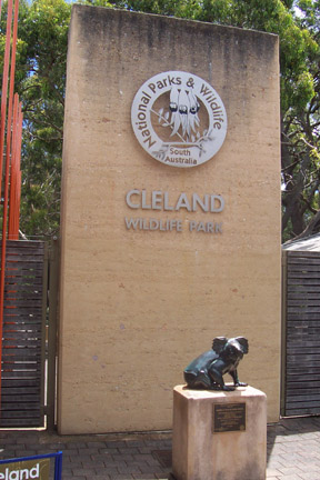
Cleland National Park, formerly Cleland Conservation Park, is a protected area located in the Adelaide Hills, South Australia about 22 kilometres (14 mi) south-east of the Adelaide city centre. It conserves a significant area of natural bushland on the Adelaide Hills face, including Mount Lofty Summit and Waterfall Gully.

<span class="mw-page-title-main">Cape Gantheaume Conservation Park</span> Protected area in South Australia

Cape Gantheaume Conservation Park, formerly the Cape Gantheaume National Park, is a protected area in the Australian state of South Australia located on the south coast of Kangaroo Island. Attractions include Murray Lagoon and D'Estrees Bay. It also includes Pelorus Islet located about 7 kilometres southeast of Cape Gantheaume.

<span class="mw-page-title-main">Seal Bay Conservation Park</span> Protected area in South Australia

Seal Bay Conservation Park is a protected area located on the south coast of Kangaroo Island in the Australian state of South Australia. It is the home of the third largest Australian sea lion colony in Australia.

<span class="mw-page-title-main">Investigator Strait</span> Body of water in South Australia

Investigator Strait is a body of water in South Australia lying between the Yorke Peninsula, on the Australian mainland, and Kangaroo Island. It was named by Matthew Flinders after his ship, HMS Investigator, on his voyage of 1801–1802. It is bordered by the Gulf St Vincent in the northeast.

Danggali Conservation Park is a protected area located about 65 kilometres north of Renmark in South Australia. The conservation park was proclaimed under the National Parks and Wildlife Act 1972 in 1976. In 2009, a portion of the conservation park was excised to create the Danggali Wilderness Protection Area. The conservation park is classified as an IUCN Category Ia protected area.

Nuyts Archipelago Conservation Park is a protected area in the Australian state of South Australia located on Eyre Island and St Peter Island in the Nuyts Archipelago located off the west coast of Eyre Peninsula about 10 kilometres south and 25 kilometres south-east respectively of Ceduna.

<span class="mw-page-title-main">Pullen Island (South Australia)</span> Island in South Australia

Pullen Island is a 1 ha granite island lying 0.5 km offshore from the town of Port Elliot on the southern coast of the Fleurieu Peninsula of South Australia. It was originally named Lipson Island but was renamed in 1839 by W.J.S. Pullen, the Colonial Marine Surveyor, after himself. The island is protected by designation as the Pullen Island Conservation Park.

Western River Wilderness Protection Area, formerly the Western River Conservation Park and the Western River National Park, is a protected area in the Australian state of South Australia located on the north coast of Kangaroo Island about 30 kilometres (19 mi) west of Parndana in the gazetted locality of Western River. Waterfall Creek, with its scenic Billy Goat Waterfall, are within the area.

Arkaroola Protection Area is a protected area located about 600 km (370 mi) north of the Adelaide city centre in the Australian state of South Australia. It was established in 2012 by the Arkaroola Protection Act 2012 "to provide for the proper management and care of the area; and to prohibit mining activities in the area". The protection area is reported as satisfying the definition of a "category II National Park".

<span class="mw-page-title-main">Penguin Island Conservation Park</span> Protected area in South Australia

Penguin Island Conservation Park is a protected area occupying Penguin Island and part of Cape Martin on the mainland in Rivoli Bay on the south east coast of South Australia about 1 kilometre south of Beachport.

Baudin Rocks Conservation Park is a protected area occupying Baudin Rocks on the south east coast of South Australia about 8.3 kilometres North-northwest of Robe. In 1965, the island was declared as a Fauna Reserve under the Fauna Conservation Act 1964 following a request from the Kingston Branch of the National Trust of South Australia to declare ‘a reserve to afford protection to the wildlife population’. The protected area status was retained following the enactment of the National Parks and Wildlife Act 1972 in 1972 when it was renamed as the Baudin Rocks Conservation Park.

Nuyts Archipelago Wilderness Protection Area is a protected area in the Australian state of South Australia located in the Nuyts Archipelago off the west coast of Eyre Peninsula within 10 kilometres to 75 kilometres south-west of Ceduna.

<span class="mw-page-title-main">Investigator Group Wilderness Protection Area</span> Protected area in South Australia

Investigator Group Wilderness Protection Area is a protected area in South Australia, located in the Investigator Group of islands off the west coast of Eyre Peninsula, between 25 kilometres and 70 kilometres south-west of Elliston.

Nuyts Reef Conservation Park is a protected area in the Australian state of South Australia associated with Nuyts Reef, which is located off the state's west coast in the Great Australian Bight about 29 kilometres west south-west of Fowlers Bay.

Gambier Islands Conservation Park is a protected area associated with the Gambier Islands Group which is located in the middle of the mouth of Spencer Gulf in South Australia about 71 kilometres south east of Port Lincoln. The conservation park consists of the following islands from within the group - North Island, South West Rock and Peaked Rocks. Wedge Island is not included in the conservation park. The land which now comprises the conservation park was previously declared as Fauna Reserves in March 1967 under the Fauna Conservation Act 1964 and was re-proclaimed in 1972 under the National Parks and Wildlife Act 1972. The area under protection is considered significant for the following reasons: 'a group of small islands utilised by seabirds and the Australian sea lion' and the 'North Island supports a population of the southern bush rat .' The conservation park is classified as an IUCN Category Ia protected area.

Lipson Island Conservation Park is a protected area in the Australian state of South Australia associated with Lipson Island in Spencer Gulf about 12 kilometres north northeast of Lipson.

Tumby Island Conservation Park is a protected area in the Australian state of South Australia associated with Tumby Island in Spencer Gulf and located about 5 kilometres southeast of the town of Tumby Bay.

Smooth Island is an island in the Australian state of South Australia located off the west coast of Eyre Peninsula about 52 kilometres south west of the town of Ceduna. It is both part of a local group of islands known as the Isles of St Francis group and a larger group known as the Nuyts Archipelago. It has enjoyed protected area status since the 1960s and since 2011, it has been part of the Nuyts Archipelago Wilderness Protection Area.

References

  1. 1 2 3 4 5 "Area Statement: Summary of Protected Areas In South Australia (as of 9 March 2018)" (PDF). Department of Environment, Water and Natural Resources. Archived (PDF) from the original on 18 August 2016. Retrieved 30 April 2018.
  2. "Australia's offshore jurisdiction: explanation of terminology in relation to petroleum exploration and development" (PDF). The Department of Resources, Energy and Tourism. p. 11. Archived (PDF) from the original on 12 March 2011. Retrieved 17 March 2013.
  3. "New parks and park additions (including National Reserve System (NRS) Program)". Department of Environment, Water and Natural Resources. Retrieved 29 March 2014.
  4. 1 2 3 "No. 56 of 1972 (National Parks and Wildlife Act, 1972)". The South Australian Government Gazette. Government of South Australia: 704. 27 April 1972. Retrieved 20 January 2017.
  5. 1 2 3 4 5 6 7 8 9 "Types of parks". Department of Environment, Water and Natural Resources. Archived from the original on 25 January 2014. Retrieved 29 March 2014.
  6. 1 2 3 4 "Department of Environment, Water and Natural Resources, Annual Report 1 July 2012 to 30 June 2013" (PDF). Annual Report: 12–13. 30 September 2013. ISSN   2202-6673. Archived (PDF) from the original on 24 September 2015. Retrieved 29 March 2014.
  7. "Find a Park". National Parks and Wildlife Service South Australia. Retrieved 8 August 2021.
  8. 1 2 3 4 5 6 7 "Protected Areas Information System Reserve List" (PDF). Government of South Australia. 9 March 2018. Archived (PDF) from the original on 26 April 2018. Retrieved 26 April 2018.
  9. Speirs, David (26 November 2021). "SA now home to Australia's biggest national park". Premier of South Australia. Retrieved 19 December 2021.
  10. "National Parks and Wildlife (Adelaide International Bird Sanctuary National Park—Winaityinaityi Pangkara—Mining Rights) Proclamation 2016" (PDF). South Australian Government Gazette. Government of South Australia. pp. 4240–4243. Archived (PDF) from the original on 28 October 2016. Retrieved 28 October 2016.
  11. "Glenthorne  National Park-Ityamaiitpinna Yarta". National Parks and Wildlife Service South Australia. Retrieved 19 December 2021.
  12. "Forestry Act 1950" (PDF). Government of South Australia. p. 2. Archived (PDF) from the original on 3 September 2007. Retrieved 29 March 2014.
  13. "Plantation Management – Regulation and Planning; South Australia; Legislation". Australian Local Government Association. Retrieved 17 March 2013.
  14. 1 2 "Native forest reserves" (PDF). ForestrySA. Archived (PDF) from the original on 24 March 2012. Retrieved 17 March 2013.
  15. 1 2 "CAPAD 2012 South Australia Summary (see 'DETAIL' tab)". CAPAD 2012. Australian Government - Department of the Environment. 6 February 2014. Retrieved 6 February 2014.
  16. "Wilderness protection in South Australia". Department of Environment, Water and Natural Resources. Retrieved 29 March 2014.
  17. "Wilderness Advisory Committee Annual Report 2012-13" (PDF). Annual Report: 9, 23–24. September 2013. ISSN   1832-9357 . Retrieved 17 March 2014.
  18. "Wilderness in South Australia Protecting Habitat, Preserving Landscapes" (PDF). Department of Environment Water and Natural Resources. 2008. p. 10. Archived (PDF) from the original on 14 March 2011.
  19. "Wilderness Advisory Committee Annual Report 2012-13" (PDF). Annual Report: 23. September 2013. ISSN   1832-9357 . Retrieved 17 March 2014.
  20. "Memory Cove Wilderness Protection Area Management Plan". Department of Environment Water and Natural Resources. 2005. p. 1. Archived from the original on 24 September 2015. Retrieved 26 January 2014.
  21. "Historic Shipwrecks Act 1981" (PDF). Government of South Australia. p. 4. Archived (PDF) from the original on 2 September 2007. Retrieved 29 March 2014.
  22. "Protected zone permits". Department of Environment, Water and Natural Resources. Retrieved 29 March 2014.
  23. "River Murray Act 2003" (PDF). Government of South Australia. Archived (PDF) from the original on 9 September 2007. Retrieved 29 March 2014.
  24. "River Murray protection area" (PDF). Department of Environment, Water and Natural Resources. Archived (PDF) from the original on 24 September 2015. Retrieved 29 March 2014.
  25. "Aquatic reserves". Primary Industries and Regions SA (PIRSA). Retrieved 7 January 2014.
  26. "Summary of SA Marine Protected Areas by Type (see 'SA Reserve List' tab)". Australian Government - Department of the Environment. 10 February 2003. Retrieved 5 October 2014.
  27. National Parks and Wildlife (Protected Animals—Marine Mammals) Regulations 2010 under the National Parks and Wildlife Act 1972 (PDF). Government of South Australia (GSA), Attorney-General's Department. 2014. p. 2. Archived from the original (PDF) on 17 January 2018. Retrieved 25 March 2015.
  28. "The Adelaide Dolphin Sanctuary". Natural Resources Management Adelaide and Mount Lofty Ranges. Retrieved 5 October 2014.
  29. "The Adelaide Dolphin Sanctuary Act". Department of Environment, Water and Natural Resources. Retrieved 22 March 2013.
  30. "MARINE PARKS ACT 2007: SECTION 14" (PDF). The South Australian Government Gazette. Archived from the original (PDF) on 24 September 2015. Retrieved 8 December 2013.
  31. "Arkaroola". Department of Environment, Water and Natural Resources. Retrieved 28 March 2014.
  32. "Arkaroola". Arkaroola Pty Ltd. Retrieved 28 March 2014.
  33. "Heritage agreements FAQs" (PDF). Department of Environment, Water and Natural Resources. Archived (PDF) from the original on 24 September 2015. Retrieved 6 May 2014.
  34. "Important Bird Areas factsheet: Riverland Mallee". BirdLife International. 2014. Retrieved 2 November 2014.
  35. World Heritage Committee. "Australian Fossil Mammal Sites (Riversleigh / Naracoorte)". United Nations Educational, Scientific and Cultural Organization. Retrieved 26 March 2015.
  36. "Australia's Ramsar Sites". Department of the Environment (Australia). Retrieved 27 March 2014.
  37. "Australia's Ramsar Sites" (PDF). Department of the Environment (Australia). Archived (PDF) from the original on 26 June 2015. Retrieved 27 March 2014.
  38. "Indigenous Protected Areas". Department of the Environment (Australia). Retrieved 27 March 2014.
  39. "Antara-Sandy Bore Indigenous Protected Area". Department of the Environment (Australia). Retrieved 26 March 2014.
  40. "Kalka-Pipalyatjara Indigenous Protected Area". Department of the Environment (Australia). Retrieved 26 March 2014.
  41. "Mount Willoughby Indigenous Protected Area". Department of the Environment (Australia). Retrieved 26 March 2014.
  42. "Nantawarrina Indigenous Protected Area". Department of the Environment (Australia). Retrieved 26 March 2014.
  43. "Walalkara and Watarru Indigenous Protected Areas". Department of the Environment (Australia). Retrieved 26 March 2014.
  44. "Yalata Indigenous Protected Area". Department of the Environment (Australia). Retrieved 26 March 2014.
  45. "Mamungari Conservation Park". Department of Environment, Water and Natural Resources. Retrieved 2 November 2014.
  46. "Calperum and Taylorville Stations". Australian government, Department of the Environment. Retrieved 2 November 2014.
  47. "Danggali Wilderness Protection Area and Conservation Park Management Plan 2011" (PDF). Department of Environment and Natural Resources. p. 2. Archived (PDF) from the original on 24 September 2015. Retrieved 3 November 2014.