Great Australian Bight Marine Park

Last updated

Great Australian Bight Marine Park
Australia
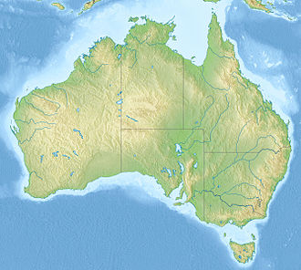
Australia relief map.jpg
Red pog.svg
Great Australian Bight Marine Park
Coordinates 31°36′53″S130°07′23.9″E / 31.61472°S 130.123306°E / -31.61472; 130.123306 Coordinates: 31°36′53″S130°07′23.9″E / 31.61472°S 130.123306°E / -31.61472; 130.123306

Great Australian Bight Marine Park is the name given to a group of marine protected areas which are located together within both Australian and South Australian jurisdictions in the Great Australian Bight and which has been in use as recently as 2005. The constituent protected areas are the Great Australian Bight Marine National Park and the Great Australian Bight Marine Park Whale Sanctuary within the coastal waters of South Australia, and the Great Australian Bight Commonwealth Marine Reserve in waters within the Australian Exclusive economic zone. [1] [2] It was listed on the now-defunct Register of the National Estate. [3]
Contents

See also

Related Research Articles

Protected areas of Australia Protected areas in Australia

Protected areas of Australia include Commonwealth and off-shore protected areas managed by the Australian government, as well as protected areas within each of the six states of Australia and two self-governing territories, the Australian Capital Territory and the Northern Territory, which are managed by the eight state and territory governments.

Protected areas of South Australia Areas protected by legislation in South Australia

Protected areas of South Australia consists of protected areas located within South Australia and its immediate onshore waters and which are managed by South Australian Government agencies. As of March 2018, South Australia contains 359 separate protected areas declared under the National Parks and Wildlife Act 1972, the Crown Land Management Act 2009 and the Wilderness Protection Act 1992 which have a total land area of 211,387.48 km2 (81,617.16 sq mi) or 21.5% of the state's area.

Great Australian Bight Open bay off southern Australia

The Great Australian Bight is a large oceanic bight, or open bay, off the central and western portions of the southern coastline of mainland Australia.

A marine park is a designated park consisting of an area of sea set aside to achieve ecological sustainability, promote marine awareness and understanding, enable marine recreational activities, and provide benefits for Indigenous peoples and coastal communities. Most marine parks are managed by national governments, and organized like 'watery' national parks, whereas marine protected areas and marine nature reserves are often managed by a subnational entity or non-governmental organization, such as conservation authority.

Neptune Islands Conservation Park Protected area in South Australia

Neptune Islands Conservation Park is a protected area occupying most of the Neptune Islands in South Australia about 55 km (34 mi) south-south east of Port Lincoln. It was established in 1967 principally to protect a New Zealand fur seal breeding colony. The conservation park was subsequently expanded to include the adjoining waters in order to control and manage berleying activities used to attract great white sharks. As of 2002, the conservation park is the only place in Australia where shark cage diving to view great white sharks is legally permitted.

Pelorus Islet

Pelorus Islet is an islet in the Australian state of South Australia located in Great Australian Bight off the south coast of Kangaroo Island approximately 7 kilometres east south-east of Cape Gantheaume. It was named by Captain Francis Harding, RN after HMS Pelorus.

Great Australian Bight Marine National Park Protected area in South Australia

Great Australian Bight Marine National Park is a marine protected area in the Australian state of South Australia located 918 km (570 mi) west of the state capital of Adelaide.

Anxious Bay

Anxious Bay is a bay in the Australian state of South Australia located on the west coast of Eyre Peninsula about 275 kilometres west north-west of Adelaide. It was named by Matthew Flinders on 21 February 1802. It is one of four ‘historic bays’ located on the South Australian coast.

Nuyts Reef Conservation Park Protected area in South Australia

Nuyts Reef Conservation Park is a protected area in the Australian state of South Australia associated with Nuyts Reef, which is located off the state's west coast in the Great Australian Bight about 29 kilometres west south-west of Fowlers Bay.

Coffin Bay Peninsula Place in South Australia

Coffin Bay Peninsula is a peninsula located at the south west end of Eyre Peninsula in South Australia. It extends in a north westerly direction from its connection to Eyre Peninsula and is bounded by Coffin Bay, Port Douglas and Yangie Bay to the north, the Great Australian Bight to the west and Avoid Bay to the south. Its extremities are Point St Isaac in the north, Point Whidbey in the south west, Point Longnose in the north east and Point Avoid in the south east. Its name is derived from Coffin Bay which was named by Matthew Flinders on 16 February 1802, after Sir Isaac Coffin, 1st Baronet. While parts of its surface have been cleared and used for agricultural purposes in the past, it is currently occupied by the protected area, the Coffin Bay National Park.

Great Australian Bight Marine Park (2017) Marine protected area in the Great Australian Bight off South Australia

Great Australian Bight Marine Park is a marine protected area located in the Great Australian Bight south of South Australia in waters within the Australian Exclusive economic zone.

Great Australian Bight Marine Park Whale Sanctuary Protected area in South Australia

Great Australian Bight Marine Park Whale Sanctuary was a marine protected area in the Australian state of South Australia located immediately off the coastline of the Great Australian Bight in waters about 790 km (491 mi) west-northwest of the state capital of Adelaide.

Murat Marine Park Protected area in Australia

Murat Marine Park is a marine protected area located in the Great Australian Bight south of South Australia in waters within the Australian Exclusive economic zone to the west of the island group known as the Nuyts Archipelago and ranging in depth from 15 metres to 70 metres.

Western Kangaroo Island Marine Park Marine protected area south-west of Kangaroo Island in Australia

Western Kangaroo Island Marine Park is a marine protected area located south of South Australia in waters within the Australian Exclusive economic zone to the south-west of Kangaroo Island and ranging in depth from 15 metres to 165 metres.

Southern Kangaroo Island Marine Park Marine protected area south of Kangaroo Island in South Australia

Southern Kangaroo Island Marine Park is a marine protected area located south of South Australia in waters within the Australian Exclusive economic zone to the south of Kangaroo Island and ranging in depth from 15 metres to 100 metres.

Sleaford, South Australia Suburb of District Council of Lower Eyre Peninsula, South Australia

Sleaford is a locality in the Australian state of South Australia located at the southern tip of the Eyre Peninsula overlooking the Great Australian Bight about 260 kilometres west of the state capital of Adelaide and about 17 kilometres west of the municipal seat of Port Lincoln.

Western Eyre Marine Park Marine protected area in the Great Australian Bight, off South Australia

Western Eyre Marine Park is a marine protected area located in the Great Australian Bight south of South Australia in waters within the Australian Exclusive economic zone.

Point Labatt Aquatic Reserve Protected area in South Australia

Point Labatt Aquatic Reserve is a marine protected area in the Australian state of South Australia located in the waters of the Great Australian Bight adjoining the west coast of Eyre Peninsula at the headland of Point Labatt.

Australian marine parks are marine protected areas located within Australian waters and are managed by the Australian government. These waters generally extend from three nautical miles off the coast to the outer limit of Australia’s Exclusive Economic Zone at 200 nautical miles while marine protected areas located closer in-shore are the responsibility of the states or the Northern Territory.

Investigator Group Conservation Park Protected area in South Australia

.

References

  1. Great Australian Bight Marine Park (Commonwealth Waters) Management Plan 2005-2012. Director of National Parks, Commonwealth of Australia. 2005. pp. iii & 3. ISBN   0 642 550794.
  2. Edyvane, K. (1998b). Great Australian Bight Marine Park Management Plan, Part B, Resource Information (PDF). Department for Environment, Heritage and Aboriginal Affairs, South Australia. pp. v & 3.
  3. "Great Australian Bight Marine Park and Commonwealth Waters, Eyre Hwy, Yalata, SA, Australia (Place ID 19759 )". Australian Heritage Database . Australian Government.