Protected areas of Australia

Last updated

Protected areas of Australia include Commonwealth and off-shore protected areas managed by the Australian government, as well as protected areas within each of the six states of Australia and two self-governing territories, the Australian Capital Territory and the Northern Territory, which are managed by the eight state and territory governments.

Contents

Commonwealth and off-shore protected areas in the Australian Capital Territory, the Northern Territory, the Christmas Island Territory, the Cocos (Keeling) Islands Territory, the Norfolk Island Territory and the Australian Antarctic Territory are managed by Director of National Parks, an agency within the Department of the Environment and Energy, with the exception of the Great Barrier Reef Marine Park, which is managed by the Great Barrier Reef Marine Park Authority, a separate body within the department.

As of February 2022 protected areas cover 1,518,814.69 km2 (586,417.63 sq mi) of Australia's land area, or about 19.75% of the total land area. The Australian Capital Territory has the highest level of protection at nearly 56% of its territory, followed by Tasmania with 42% and South Australia with 30%. The lowest level of protection is in Queensland and New South Wales with 8.71% and 9.61% respectively. [1] Of all protected areas, two-thirds are considered strictly protected (IUCN categories I to IV), and the rest is mostly managed resources protected area (IUCN category VI).[ citation needed ] Over 43% of the protected area in Australia is publicly owned and managed by the Australian government or state and territory governments. The second-largest component of protected areas are the Indigenous Protected Areas, at over 44% and growing as of February 2022. [1]

Protected areas managed by the Australian government

The following list shows only the Commonwealth and off-shore protected areas that are managed by the Australian government which represents a small portion of all protected areas located in Australia. Each state and territory is responsible for the management of the protected areas under its jurisdiction with exception to protected areas such as the Uluru-Kata Tjuta National Park in the Northern Territory. The majority of Australian protected areas are managed by the state and territory governments.

National Parks

The following protected areas which are designated as national parks are managed by the Australian government and in some instances in conjunction with indigenous land owners: [2]

Australia's first national park - and the second in the world - is Royal National Park in New South Wales, established in 1879. [5]

National Heritage List

The National Heritage List is a heritage register, a list of national heritage places deemed to be of outstanding heritage significance to Australia, established in 2003. [6] The list includes natural and historic places, including those of cultural significance to Indigenous Australians. Once on the National Heritage List the provisions of the Environment Protection and Biodiversity Conservation Act 1999 apply. [7] Some of these also form part of the World Heritage Sites listed in a separate section below.

Botanical Gardens

Antarctic Specially Protected Areas

As of 2014 there are 12 Antarctic Specially Protected Areas [10]

Antarctic Specially Managed Areas

As of 2014 there is 1 Antarctic Specially Managed Area [10]

Commonwealth Marine reserves

The Australian Government manages an estate of marine protected areas known as Commonwealth marine reserves (CMR) which was established under the Environment Protection and Biodiversity Conservation Act 1999 (EPBC Act). These marine reserves are in Australian waters, but not state or territory waters. [11] [12] A majority of the reserves are not in effect until new managements plans are released following a review of reserves established in 2012. [13] [14]

In addition to the Coral Sea CMR [15] and the Heard Island and McDonald Islands CMR, [16] there are a further 57 Commonwealth marine reserves grouped into 5 geographical regions called Commonwealth marine reserve networks:

Calperum and Taylorville Stations

Calperum and Taylorville Stations are pastoral leases located next to each other near Renmark in South Australia and which were purchased for conservation purposes using both private and Australian government funds. Calperum Station was purchased by the Chicago Zoological Society in 1993 while Taylorville Station was purchased by the Australian Landscape Trust in 2000 with the ownership of both leases being deeded to the Director of National Parks. Both properties are managed by the Australian Landscape Trust. [22] [23]

Protection arising from Australian government policy and international obligations

World Heritage listed areas

As of April 2020, the following sites are listed by UNESCO as World Heritage Sites: [24]

Indigenous protected areas

An Indigenous Protected Area (IPA) is a class of protected area formed by agreement with Indigenous Australians and formally recognised by the Australian government as being part of the National Reserve System. As of April 2020 there are 75 IPAs occupying about 67,000,000 hectares (170,000,000 acres) and comprising more than 44% of the National Reserve System. [25]

Biosphere reserves

The following biosphere reserves belonging to the UNESCO World Biosphere Reserve program are located within Australia: [26] [27]

Ramsar sites

As a contracting party to the Convention on Wetlands of International Importance (known as the Ramsar Convention), Australia is encouraged "to nominate sites containing representative, rare or unique wetlands, or that are important for conserving biological diversity, to the List of Wetlands of International Importance". [28] As of March 2014, the Australian Government has nominated 65 Ramsar sites. [29]

Protected areas managed by Australian states and territories

Refer:

See also

Related Research Articles

Protected areas of the Northern Territory

The protected areas of the Northern Territory consists of protected areas managed by the governments of the Northern Territory and Australia and private organisations with a reported total area of 335,527 square kilometres (129,548 sq mi) being 24.8% of the total area of the Northern Territory of Australia.

Protected areas of South Australia Areas protected by legislation in South Australia

Protected areas of South Australia consists of protected areas located within South Australia and its immediate onshore waters and which are managed by South Australian Government agencies. As of March 2018, South Australia contains 359 separate protected areas declared under the National Parks and Wildlife Act 1972, the Crown Land Management Act 2009 and the Wilderness Protection Act 1992 which have a total land area of 211,387.48 km2 (81,617.16 sq mi) or 21.5% of the state's area.

Uluṟu-Kata Tjuṯa National Park Protected area in the Northern Territory, Australia

Uluṟu-Kata Tjuṯa National Park is a protected area in the Northern Territory of Australia. The park is home to both Uluru and Kata Tjuta. It is located 1,943 kilometres (1,207 mi) south of Darwin by road and 440 kilometres (270 mi) south-west of Alice Springs along the Stuart and Lasseter Highways. The park covers 1,326 square kilometres (512 sq mi) and includes the features it is named after: Uluru and, 40 kilometres (25 mi) to its west, Kata Tjuta. The location is listed as a UNESCO World Heritage Site for natural and cultural landscape.

Conservation in Australia

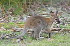
Conservation in Australia is an issue of state and federal policy. Australia is one of the most biologically diverse countries in the world, with a large portion of species endemic to Australia. Preserving this wealth of biodiversity is important for future generations.

Uluru Large sandstone isolated mount in Australia

Uluru, also known as Ayers Rock and officially gazetted as Uluru / Ayers Rock, is a large sandstone formation in the southern part of the Northern Territory in Australia. It lies 335 km (208 mi) southwest of the nearest large town: Alice Springs.

Booderee National Park and Botanic Gardens Protected area in the Jervis Bay Territory, Australia

Booderee National Park and Botanic Gardens, formerly Jervis Bay National Park and Jervis Bay Botanic Gardens, are located in the Jervis Bay Territory of Australia. The reserve is composed of two sections:

Marine protected area Protected areas of seas, oceans, estuaries or large lakes

Marine protected areas (MPA) are protected areas of seas, oceans, estuaries or in the US, the Great Lakes. These marine areas can come in many forms ranging from wildlife refuges to research facilities. MPAs restrict human activity for a conservation purpose, typically to protect natural or cultural resources. Such marine resources are protected by local, state, territorial, native, regional, national, or international authorities and differ substantially among and between nations. This variation includes different limitations on development, fishing practices, fishing seasons and catch limits, moorings and bans on removing or disrupting marine life. In some situations, MPAs also provide revenue for countries, potentially equal to the income that they would have if they were to grant companies permissions to fish. The value of MPA to mobile species is unknown.

Ewaninga Rock Carvings Conservation Reserve Protected area in the Northern Territory, Australia

The Ewaninga Conservation Reserve is a protected area in the Northern Territory of Australia consisting of an area of low sand dunes, rocky outcrops and a claypan about 35 kilometres (22 mi) south of Alice Springs. It is significant because of a large number of Aboriginal rock carvings.

Riverland Biosphere Reserve Protected area in South Australia

The Riverland Biosphere Reserve, formerly the Bookmark Biosphere Reserve, is a 9,000 square kilometres area of land in eastern South Australia, adjoining the states of New South Wales and Victoria. It is one of 14 biosphere reserves in Australia and is part of the World Network of Biosphere Reserves, being officially recognized and listed by UNESCO in 1977.

Indigenous Protected Area

An Indigenous Protected Area (IPA) is a class of protected area used in Australia; each is formed by voluntary agreement with Indigenous Australians, and declared by Aboriginal Australians and Torres Strait Islander representative organisations. Each is formally recognised by the Australian Government as being part of its National Reserve System. The areas may comprise land and sea, and are managed by Indigenous groups for the conservation of biodiversity. Managing IPAs also helps to protect the cultural values of their country for future generations, and has benefits for Indigenous health, education, economic and social cohesion.

Murat Marine Park Protected area in Australia

Murat Marine Park is a marine protected area located in the Great Australian Bight south of South Australia in waters within the Australian Exclusive economic zone to the west of the island group known as the Nuyts Archipelago and ranging in depth from 15 metres to 70 metres.

Western Kangaroo Island Marine Park Marine protected area south-west of Kangaroo Island in Australia

Western Kangaroo Island Marine Park is a marine protected area located south of South Australia in waters within the Australian Exclusive economic zone to the south-west of Kangaroo Island and ranging in depth from 15 metres to 165 metres.

Southern Kangaroo Island Marine Park Marine protected area south of Kangaroo Island in South Australia

Southern Kangaroo Island Marine Park is a marine protected area located south of South Australia in waters within the Australian Exclusive economic zone to the south of Kangaroo Island and ranging in depth from 15 metres to 100 metres.

Taylorville Station (reserve) Protected area in South Australia

Taylorville Station is a protected area located in the east of the Australian state of South Australia about 35 kilometres north west of the town of Renmark and about 250 kilometres east of the state capital of Adelaide. It is a protected area which is under the control of the Australian government rather than the Government of South Australia and which is managed by a private organisation under contract. Taylorville Station is part of an area whose habitat has been listed as "critical" for the survival of the bird species, black-eared miner. It is also part of a larger reserve system known as the Riverland Biosphere Reserve.

Calperum Station (reserve) Protected area in South Australia

Calperum Station, also known as Calperum Reserve, is a nature reserve located in the east of the Australian state of South Australia about 10 kilometres north-west of the town of Renmark and about 250 kilometres east of the state capital of Adelaide. Calperum Station consists of three separate pastoral leases - Calperum, Calperum Road and Yubalia.

Australian marine parks are marine protected areas located within Australian waters and are managed by the Australian government. These waters generally extend from three nautical miles off the coast to the outer limit of Australia’s Exclusive Economic Zone at 200 nautical miles while marine protected areas located closer in-shore are the responsibility of the states or the Northern Territory.

Director of National Parks is a government-owned corporation of the Australian government responsible for the management of a portfolio of terrestrial and marine protected areas proclaimed under the Environment Protection and Biodiversity Conservation Act 1999. The agency is a corporation sole.

The Macquarie Island Marine Park is an Australian marine park near Macquarie Island in the southwest Pacific. The marine park covers an area of 162,000 km2 (63,000 sq mi) and is assigned IUCN category IV. It is the largest of the 14 parks managed under the South-east Marine Parks Network.

The Ashmore Reef Marine Park is an Australian marine park that covers the Ashmore Reef, which is located about 630 km (390 mi) north of Broome and 110 km (68 mi) south of the Indonesian island of Rote. The marine park covers an area of 583 km2 (225 sq mi) and is assigned IUCN category Ia. It is one of 13 parks managed under the North-west Marine Parks Network.

NDhala Gorge Nature Park Protected area in the Northern Territory, Australia

N'Dhala Gorge Nature Park is a protected area in the Northern Territory of Australia consisting of an area of low sand dunes, rocky outcrops, about 90 kilometres (56 mi) east of Alice Springs. It is significant principally because of thousands of Indigenous rock carvings.

References

  1. 1 2 "Ownership of protected areas". Department of Water, Agriculture and the Environment . Australian Government. Retrieved 6 February 2022.
  2. "National Parks". Commonwealth of Australia. Retrieved 14 June 2015.
  3. 1 2 "Welcome to Booderee National Park". Commonwealth of Australia. Retrieved 5 February 2020.
  4. 1 2 "Our history". Parks Australia. Retrieved 5 February 2020.
  5. Australian Government: National Reserve System, retrieved 2009-09-22
  6. "Australia's National Heritage List". Australian Government. Dept of Energy and the Environment. Retrieved 30 January 2020.
  7. "Environment Protection and Biodiversity Conservation Act 1999, Section 324A". Australasian Legal Information Institute. Retrieved 28 June 2015.
  8. "Welcome to the Australian National Botanic Gardens". Commonwealth of Australia. Retrieved 14 June 2015.
  9. "Norfolk Island Botanic Garden". Parks Australia. Retrieved 30 April 2016.
  10. 1 2 "CAPAD 2014 Commonwealth Summary". Australian Government - Department of the Environment. Retrieved 30 April 2016.
  11. "Commonwealth marine reserves". Parks Australia, Department of the Environment. Retrieved 18 March 2015.
  12. "Environment Protection and Biodiversity Conservation (Commonwealth Marine Reserves) Proclamation 2012 - F2012L02188". Commonwealth of Australia, Comlaw. Retrieved 17 March 2015.
  13. "About the Commonwealth Marine Reserves Review". environment.gov.au. Commonwealth of Australia. Retrieved 2 May 2017.
  14. Smail, Stephanie (6 September 2016). "Conservationists critical of plan to reduce Coral Sea marine park protection". abc.net.au. Australian Broadcasting Corporation . Retrieved 2 May 2017.
  15. "Coral Sea Commonwealth Marine Reserve". Parks Australia, Department of the Environment. Retrieved 18 March 2015.
  16. "Marine reserve". Australian Antarctic Division, Department of the Environment. Retrieved 18 March 2015.
  17. "North Commonwealth Marine Reserves Network". Parks Australia, Department of the Environment. Retrieved 18 March 2015.
  18. "North-west Commonwealth Marine Reserves Network". Parks Australia, Department of the Environment. Retrieved 18 March 2015.
  19. "Temperate East Commonwealth Marine Reserves Network". Parks Australia, Department of the Environment. Retrieved 18 March 2015.
  20. "South-east Commonwealth Marine Reserves Network". Parks Australia, Department of the Environment. Retrieved 18 March 2015.
  21. "South-west Commonwealth Marine Reserves Network". Parks Australia, Department of the Environment. Retrieved 18 March 2015.
  22. "Calperum and Taylorville Stations". Australian government, Department of the Environment. Retrieved 2 November 2014.
  23. "Danggali Wilderness Protection Area and Conservation Park Management Plan 2011" (PDF). Department of Environment and Natural Resources. p. 2. Retrieved 3 November 2014.
  24. Centre, UNESCO World Heritage (11 October 2017). "World Heritage List". UNESCO World Heritage Centre. Retrieved 5 April 2020.
  25. "Indigenous Protected Areas". Department of Agriculture, Water and the Environment. 18 February 2019. Retrieved 5 April 2020.
  26. "Australia's Biosphere Reserves". Parks Australia. Retrieved 3 November 2014.
  27. "Australia". Man and the Biosphere Programme. UNESCO. Retrieved 5 November 2016.
  28. "Australia's Ramsar Sites". Department of the Environment (Australia). Retrieved 27 March 2014.
  29. "Australia's Ramsar Sites" (PDF). Department of the Environment (Australia). Retrieved 27 March 2014.