Mornington Peninsula and Western Port Biosphere Reserve

Last updated

Mornington Peninsula and Western Port Biosphere Reserve
Victoria
UNESCO Western Port Biosphere logo.png
Australia Victoria location map.svg
Red pog.svg
Mornington Peninsula and Western Port Biosphere Reserve
Coordinates 38°20′S145°20′E / 38.333°S 145.333°E / -38.333; 145.333
EstablishedNovember 2002 [1]
Area2,142.00 km2 (827.0 sq mi) [2]
Visitation400,000 (annual estimate) (in 2016) [2]
Managing authoritiesWestern Port Biosphere Reserve
Website Mornington Peninsula and Western Port Biosphere Reserve
FootnotesCoordinates [2]

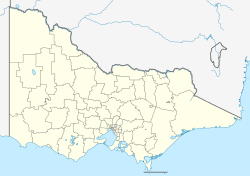
Mornington Peninsula and Western Port Biosphere Reserve is a biosphere reserve in the Australian state of Victoria located on land and coastal waters associated both with the Mornington Peninsula and the bay known as Western Port. [2] [3]

Contents

The biosphere reserve was described by UNESCO in 2016 as: [2]

The Mornington Peninsula and Western Port Biosphere Reserve includes the whole of Mornington Peninsula Shire and parts of the City of Frankston, as well as coastal areas of the municipalities of Casey, Cardinia and Bass Coast including Phillip and French Islands. Western Port, which is also a Ramsar Site, consists of a coastal embayment incorporating vast and relatively undisturbed mudflats with salt marsh vegetation. It is considered an internationally important feeding and roosting area for numerous species of summering waders, many of which are listed under the bilateral Migratory Birds Agreements (with China and Japan). The site periodically supports over 10,000 waders and 10,000 ducks and swans, and a rich invertebrate fauna of some 1,380 species.

The biosphere reserve was established in November 2002. [1]

The managing authority is the Mornington Peninsula and Western Port Biosphere Reserve Foundation Ltd which trades under the name of the Western Port Biosphere Reserve. [2] [4]

See also

Related Research Articles

<span class="mw-page-title-main">Shire of Mornington Peninsula</span> Local government area in Victoria, Australia

The Shire of Mornington Peninsula is a local government area in southeastern Metropolitan Melbourne, Victoria, Australia. It is located to the south of the Melbourne City Centre. It has an area of 724 square kilometres and in June 2018 it had a population of 165,822.

<span class="mw-page-title-main">Protected areas of Australia</span> Protected areas in Australia

Protected areas of Australia include Commonwealth and off-shore protected areas managed by the Australian government, as well as protected areas within each of the six states of Australia and two self-governing territories, the Australian Capital Territory and the Northern Territory, which are managed by the eight state and territory governments.

<span class="mw-page-title-main">Croajingolong National Park</span> Protected area in Victoria, Australia

The Croajingolong National Park is a coastal national park located in the East Gippsland region of the Australian state of Victoria. The 88,355-hectare (218,330-acre) national park is situated approximately 450 kilometres (280 mi) east of Melbourne and 500 kilometres (310 mi) south of Sydney.

<span class="mw-page-title-main">Mornington Peninsula National Park</span> Protected area in Victoria, Australia

The Mornington Peninsula National Park is a national park located in the Greater Melbourne region of Victoria, Australia. The 2,686-hectare (6,640-acre) national park is situated approximately 90 kilometres (56 mi) south of Melbourne on the Mornington Peninsula.

<span class="mw-page-title-main">Port Phillip</span> Bay in Victoria, Australia

Port Phillip or Port Phillip Bay is a horsehead-shaped enclosed bay on the central coast of southern Victoria, Australia. The bay opens into the Bass Strait via a short, narrow channel known as The Rip, and is completely surrounded by localities of Victoria's two largest cities — metropolitan Greater Melbourne in the bay's main eastern portion north of the Mornington Peninsula, and the city of Greater Geelong in the much smaller western portion north of the Bellarine Peninsula. Geographically, the bay covers 1,930 km2 (750 sq mi) and the shore stretches roughly 264 km (164 mi), with the volume of water around 25 km3 (6.0 cu mi). Most of the bay is navigable, although it is extremely shallow for its size — the deepest portion is only 24 m (79 ft) and half the bay is shallower than 8 m (26 ft). Its waters and coast are home to seals, whales, dolphins, corals and many kinds of seabirds and migratory waders.

<span class="mw-page-title-main">Mornington Peninsula</span> Peninsula and region of Victoria, Australia

The Mornington Peninsula is a peninsula located south of Melbourne, Victoria, Australia. It is surrounded by Port Phillip to the west, Western Port to the east and Bass Strait to the south, and is connected to the mainland in the north. Geographically, the peninsula begins its protrusion from the mainland in the area between Pearcedale and an area north of Frankston. The area was originally home to the Mayone-bulluk and Boonwurrung-Balluk clans and formed part of the Boonwurrung nation's territory prior to European settlement.

<span class="mw-page-title-main">Pearcedale, Victoria</span> Town in Victoria, Australia

Pearcedale is a township and coastal rural locality in Victoria, Australia, 49 km south-east of Melbourne's Central Business District, located within the City of Casey and the Shire of Mornington Peninsula local government areas. Pearcedale recorded a population of 3,867 at the 2021 census.

<span class="mw-page-title-main">Crib Point, Victoria</span> Town in Victoria, Australia

Crib Point is a town on the Mornington Peninsula in Melbourne, Victoria, Australia, 64 km (40 mi) south-east of Melbourne's Central Business District, located within the Shire of Mornington Peninsula local government area. Crib Point recorded a population of 3,343 at the 2021 census.

<span class="mw-page-title-main">Shoreham, Victoria</span> Town in Victoria, Australia

Shoreham is a seaside surfing town located on the shore of Western Port bay on the Mornington Peninsula in the Australian state of Victoria. It lies within the Shire of Mornington Peninsula local government area, about 68 km (42 mi) south-east of the central business district of Melbourne. Shoreham recorded a population of 679 at the 2021 census.

<span class="mw-page-title-main">Western Port</span> Bay in Victoria, Australia

Western Port, commonly but unofficially known as Western Port Bay, is a large tidal bay in southern Victoria, Australia, opening into Bass Strait. It is the second largest bay in the state. Geographically, it is dominated by two large islands; French Island and Phillip Island. At the time it was renamed, its position was west of other known ports and bays, but Western Port has become something of a misnomer as it lies just to the east of the larger Port Phillip and the city of Melbourne. It is visited by Australian fur seals, whales and dolphins, as well as many migratory waders and seabirds. It is listed under the Ramsar Convention as a wetland of international significance.

<span class="mw-page-title-main">Mamungari Conservation Park</span> Protected area in South Australia

Mamungari Conservation Park is a protected area located in South Australia within the southern Great Victoria Desert and northern Nullarbor Plain about 200 kilometres west of Maralinga and 450 kilometres northwest of Ceduna. It is about 1,000 kilometres (620 mi) north-west of Adelaide and abuts the Western Australia border

<span class="mw-page-title-main">Devilbend Natural Features Reserve</span> Nature reserve park in Australia

Devilbend Natural Features Reserve is a 1,005 ha natural reserve park in the rural locality of Tuerong on the Mornington Peninsula in central southern Victoria, Australia, 55 km (34 mi) southeast of the state capital Melbourne's city center.

<span class="mw-page-title-main">Lake Victoria (Victoria)</span>

Lake Victoria is a 139-hectare (340-acre) shallow saline lake on the Bellarine Peninsula, Victoria in Australia, close to the township of Point Lonsdale and part of the Lonsdale Lakes Nature Reserve administered by Parks Victoria.

<span class="mw-page-title-main">Port Phillip Heads Marine National Park</span> Protected area in Victoria, Australia

The Port Phillip Heads Marine National Park is a marine protected area located in the vicinity of the bay of Port Phillip, between the Bellarine and Mornington Peninsulas, in Victoria, Australia. The 3,580-hectare (8,800-acre) marine national park comprises six separate sites located approximately 60 kilometres (37 mi) south-west of Melbourne and stretches along 40 kilometres (25 mi) of coastline of Victoria.

<span class="mw-page-title-main">Lake Connewarre</span> Estuarine lake in Victoria, Australia

Lake Connewarre, a shallow estuarine 880-hectare (2,200-acre) lake on the Barwon River, is located on the Bellarine Peninsula southeast of Geelong in the Australian state of Victoria.

Under UNESCO's Man and Biosphere Reserve Programme, there are 142 biosphere reserves recognized as part of the World Network of Biosphere Reserves in Asia and the Pacific as of April 2016. These are distributed across 24 countries in the region.

The Port Phillip Bay and Bellarine Peninsula Ramsar Site is one of the Australian sites listed under the Ramsar Convention as a wetland of international importance. It was designated on 15 December 1982, and is listed as Ramsar Site No.266. Much of the site is also part of either the Swan Bay and Port Phillip Bay Islands Important Bird Area or the Werribee and Avalon Important Bird Area, identified as such by BirdLife International because of their importance for wetland and waterbirds as well as for orange-bellied parrots. It comprises some six disjunct, largely coastal, areas of land, totalling 229 km2, along the western shore of Port Phillip and on the Bellarine Peninsula, in the state of Victoria. Wetland types protected include shallow marine waters, estuaries, freshwater lakes, seasonal swamps, intertidal mudflats and seagrass beds.

<span class="mw-page-title-main">Swan Bay and Port Phillip Bay Islands Important Bird Area</span>

The Swan Bay and Port Phillip Bay Islands Important Bird Area comprises a cluster of disparate sites centred at the eastern end of the Bellarine Peninsula, and the southern end of Port Phillip, in Victoria, south-eastern Australia. As well as providing core wintering habitat for orange-bellied parrots, it is important for waders, or shorebirds, and seabirds.

<span class="mw-page-title-main">Hattah-Kulkyne and Murray-Kulkyne Biosphere Reserve</span> Protected area in Victoria, Australia

Hattah-Kulkyne and Murray-Kulkyne Biosphere Reserve is a biosphere reserve in the Australian state of Victoria located to the southern bank of the Murray River to the south-east of the city of Mildura on land occupied by the following protected areas - the Hattah-Kulkyne National Park and the Murray-Kulkyne Park.

<span class="mw-page-title-main">Ría Celestun Biosphere Reserve</span>

Ría Celestun Biosphere Reserve is a biosphere reserve in Mexico. It is located on the northwestern Yucatán Peninsula in the states of Yucatán and Campeche. The reserve is home to extensive mangrove wetlands, and rich in birds and other wildlife.

References

  1. 1 2 "Biosphere Reserves". Government of Victoria. August 2014. Retrieved 5 November 2016.
  2. 1 2 3 4 5 6 "Mornington Peninsula and Western Port". Man and the Biosphere Programme. UNESCO. Retrieved 5 November 2016.
  3. "Australian Biosphere Reserves". Australian Government, Department of Environment. August 2014. Retrieved 5 November 2016.
  4. "Biosphere Reserves". Western Port Biosphere Reserve. Retrieved 6 November 2016.