Mornington Peninsula Shire | |||||||||||||
|---|---|---|---|---|---|---|---|---|---|---|---|---|---|
 | |||||||||||||
 | |||||||||||||
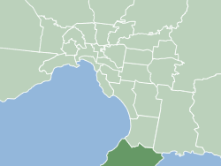
 Interactive map of Mornington Peninsula Shire | |||||||||||||
| Country | Australia | ||||||||||||
| State | Victoria | ||||||||||||
| Region | Greater Melbourne | ||||||||||||
| Established | 1994 | ||||||||||||
| Council seat | Rosebud | ||||||||||||
| Government | |||||||||||||
| • Mayor | Cr Anthony Marsh | ||||||||||||
| • State electorates | |||||||||||||
| • Federal divisions | |||||||||||||
| Area | |||||||||||||
• Total | 724 km2 (280 sq mi) | ||||||||||||
| Population | |||||||||||||
| • Total | 168,948 (2021) [2] (40th) | ||||||||||||
| • Density | 233.35/km2 (604.4/sq mi) | ||||||||||||
| Website | Mornington Peninsula Shire | ||||||||||||
| |||||||||||||
The Mornington Peninsula Shire is a local government area in southeastern metropolitan Melbourne, Victoria, Australia. Located to the south of the Melbourne city centre, it covers its namesake Mornington Peninsula, and is headquartered in the suburb of Rosebud. It has an area of 724 square kilometres (280 sq mi) and at the 2021 census it had a population of 168,948. [2]


