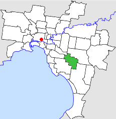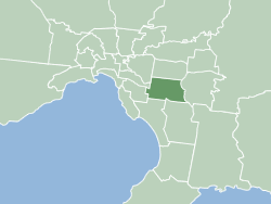
The City of Monash is a local government area in Melbourne, Victoria, Australia in the south-eastern suburbs of Melbourne with an area of 81.5 square kilometres and a population of 200,077 people in 2016.
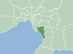
The City of Kingston is a local government area in Victoria, Australia in the south-eastern suburbs of Melbourne, its northern boundary lying approximately 15 km from the Melbourne city centre along the north-eastern shorelines of Port Phillip. It covers an area of 91 km² and has an estimated population of 163,431 people.
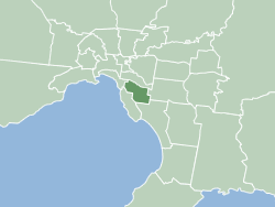
The City of Glen Eira is a local government area in Victoria, Australia. It is located in the south-eastern suburbs of Melbourne. It has an area of 39 square kilometres (15.06 sq mi) and has an estimated population of 153,858.
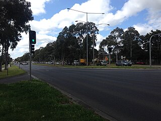
Mulgrave is a suburb in Melbourne, Victoria, Australia, 25 km south-east of Melbourne's Central Business District, located within the City of Monash local government area. Mulgrave recorded a population of 19,889 at the 2021 census.
Notting Hill is a suburb in Melbourne, Victoria, Australia, 19 km south-east of Melbourne's Central Business District, located within the City of Monash local government area. Notting Hill recorded a population of 2,895 at the 2021 census.

Clayton railway station is a commuter railway station located in the suburb of Clayton, in the south-eastern suburbs of Melbourne, Victoria, Australia. The station originally opened in 1880 as "Clayton's Road". It did not receive its current name until 1890. The station consists of a single island platform connected to the station concourse on Clayton Road via escalators, lifts and a staircase.
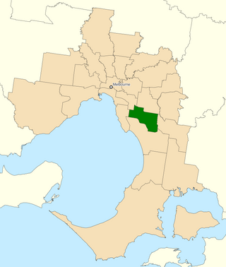
The Division of Hotham is an Australian Electoral Division in Victoria. It is located in the south-eastern suburbs of Melbourne. Hotham covers an area of approximately 83 square kilometres from Oakleigh in the north to Dingley Village in the south. The division includes the suburbs of Bentleigh East, Clarinda, Clayton, Clayton South, Coatesville, Huntingdale, Mulgrave, Notting Hill, Oakleigh, Oakleigh East, Oakleigh South, Waverley Park, Westall, and Wheelers Hill in their entirety; as well as parts of Bentleigh, Chadstone, Glen Waverley, Heatherton, McKinnon, Mount Waverley, Ormond, Springvale, Springvale South and Syndal.
The City of Monash was created on 15 December 1994 when the Kennett Liberal government amalgamated local councils all over Victoria, merging a substantial portion of the former City of Oakleigh with the whole of the former City of Waverley.

The Scotchmans Creek Trail is a shared use path for cyclists and pedestrians, which follows Scotchmans Creek through the eastern suburbs of Melbourne, Victoria, Australia.

The City of Brighton was a local government area about 10 kilometres (6.2 mi) south of Melbourne, the state capital of Victoria, Australia. The city covered an area of 13.48 square kilometres (5.20 sq mi), and existed from 1859 until 1994.
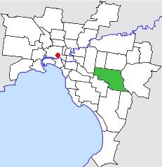
The City of Waverley was a local government area about 20 kilometres (12 mi) east-southeast of Melbourne, the state capital of Victoria, Australia. The city covered an area of 60.86 square kilometres (23.50 sq mi), and existed from 1857 until 1994.

The City of Croydon was a local government area about 30 kilometres (19 mi) east of Melbourne, the state capital of Victoria, Australia. The city covered an area of 34.32 square kilometres (13.25 sq mi), and existed from 1961 until 1994.
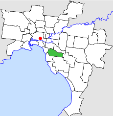
The City of Caulfield was a local government area about 10 kilometres (6 mi) southeast of Melbourne, the state capital of Victoria, Australia. The city covered an area of 21.97 square kilometres (8.48 sq mi), and existed from 1857 until 1994.

The City of Chelsea was a local government area about 30 kilometres (19 mi) south of Melbourne, the state capital of Victoria, Australia, on the eastern side of Port Phillip. The city covered an area of 12.23 square kilometres (4.72 sq mi), and existed from 1920 until 1994.

The City of Mordialloc was a local government area about 20 kilometres (12 mi) south of Melbourne, the state capital of Victoria, Australia, on the eastern side of Port Phillip. The city covered an area of 13.57 square kilometres (5.24 sq mi), and existed from 1920 until 1994.
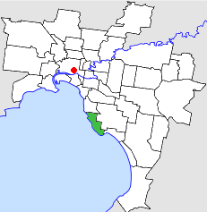
The City of Sandringham was a local government area about 20 kilometres (12 mi) south of Melbourne, the state capital of Victoria, Australia, on the eastern side of Port Phillip. The city covered an area of 14.97 square kilometres (5.78 sq mi), and existed from 1917 until 1994.

The City of Moorabbin was a local government area about 20 kilometres (12 mi) southeast of Melbourne, the state capital of Victoria, Australia. The city covered an area of 53.13 square kilometres (20.51 sq mi), and existed from 1862 until 1994.

The City of Springvale was a local government area about 30 kilometres (19 mi) southeast of Melbourne, the state capital of Victoria, Australia. The city covered an area of 97.60 square kilometres (37.68 sq mi), and existed from 1857 until 1994.
Waverley Football Club, nicknamed the Panthers, were an Australian rules football club which played in the Victorian Football Association (VFA) from 1961 until 1987. Waverley wore red and black as their club colours and was based at Central Reserve in the Melbourne suburb of Glen Waverley.

Kingsway is a shopping, dining and entertainment precinct at the town centre of Glen Waverley, a southeastern suburb of Melbourne, Victoria, Australia. It starts off at the northern end from High Street, and runs north-south parallel to Springvale Road before curving east at its southern end to join the latter as a T-intersection.
