This article is about the current local government area. For a former local government area with the same name, see City of Frankston (former). For the suburb, see Frankston, Victoria.
The City of Frankston (officially known as Frankston City Council) is a local government area (LGA) in Victoria, Australia in the southern suburbs of Melbourne. It has an area of 130 square kilometres, and in August 2021, the City of Frankston recorded a population of 139,281.[1]
Despite its similar area and name, the City of Frankston is a different entity to the former City of Frankston which existed from 1966 until 1994, which was a continuation of the former Shire of Frankston and was abolished under state government reforms. This is similar to the situation for the Shire of South Gippsland and Shire of Glenelg, but is unlike the City of Melbourne, City of Knox, City of Whittlesea and City of Melton, whose administrations stayed intact through the amalgamations of the early 1990s.[2]
Geography
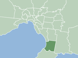
The city is located on the eastern shores of Port Phillip, and is bounded on the north by the City of Kingston and the City of Greater Dandenong, on the east by the City of Casey, and on the south by the Shire of Mornington Peninsula. The boundaries of the city are defined largely on the north by Eel Race Road and Thompsons Road, on the east by the Dandenong-Hastings Road, and on the south by a complex boundary featuring Baxter-Tooradin Road, Golf Links Road and Humphries Road.[3]
The City's predecessor LGAs (green) as they were in 1994
The major part of the city was first incorporated in 1860 as the Mornington Roads District, which became a shire in 1871 and was renamed Shire of Frankston and Hastings in 1893, losing its western riding to form the Shire of Mornington, which has since been amalgamated into the Shire of Mornington Peninsula.[2] On 19 October 1960, the Shire of Frankston and Hastings split in two, with the western part remaining as the Shire of Frankston, and the eastern part being incorporated as the Shire of Hastings.[5]
Frankston was officially proclaimed as a city on 24 August 1966, to be known as the City of Frankston in a ceremony attended by Queen Elizabeth II.[5]
In 1993 the state government announced a major statewide program of local government amalgamations, most of which took effect on 15 December 1994. Most councils and their LGA's were abolished with new ones being created to replace them.[2]
Some changes occurred between the release of the Local Government Board report in July and the actual amalgamation – the original plan was to merge with the City of Chelsea and take Braeside and Carrum Downs from the City of Springvale. However, Frankston City Council submitted that it should expand eastwards instead, as well as taking Mount Eliza and Baxter.[6] By October, the present boundaries had been agreed upon, but the new entity was to be known as the City of Nepean. This appeared in the Board's final report in November 1994.[7][8] Despite this recommendation, the State Government ultimately decided to retain a variation of the historical name, designating the new entity as Frankston City.[9]
Council
2024 ward boundaries. Expand the map and click on a ward to see the ward name
The current council, as of November 2024, in order of wards, is:[10][11]
Ward
Party
Councillor
Notes
Ballam
Independent
Kris Bolam
Mayor
Centenary
Liberal
Michael O'Reilly
Derinya
Labor
Brad Hill
Elisabeth Murdoch
Independent
Cherie Wanat
Kananook
Greens
Emily Green
Lyrebird
Liberal
Steffie Conroy
Deputy Mayor
Pines
Independent
Sue Baker
Wilton
Independent
David Asker
Yamala
Independent
Nathan Butler
Mayors
The following Frankston councillors have served as mayor since the inaugural elections in 1997:[12]
Robinsons Park; the home ground of the Frankston Softball Association and the Frankston Tomatoes Baseball Club located in Frankston South.[16]
Jubilee Park; a 13 hectare park in Frankston with Australian rules football ovals, cricket pitches, netball courts, and a stadium. The 1000-seat stadium is the home ground of the Frankston & District Netball Association, the Frankston Peninsula Premier Cricket Club, and the Peninsula Waves Netball Club.[17]
Ballam Park; a 30 hectare park with open areas and sporting fields including a premier athletics track which is home to the Frankston Little Athletics Club, AFL, soccer and cricket.[18] The Park is also home to Ballam Park Homestead, an historic home and museum from the 1850s run by the Frankston Historical Society.[19]
Frankston Arts Centre; a purpose-built 800 seat performing and visual arts venue designed by renowned Australian Architect, Daryl Jackson, it was opened in 1995 by then Prime Minister, the Hon. Paul Keating.
Pines Forest Aquatic Centre; an outdoor pool in Frankston North.[20]
Wedge Road Reserve; a park in northern Carrum Downs with Aussie rules football ovals, tennis courts and a playground. This park is the home ground of Skye Football Club, an Australian rules team in the Southern Football Netball League.
Centenary Park Golf Course; a council-run public golf course in Langwarrin North.
Libraries
Frankston City Libraries operates three council-run libraries. The facilities include a seed library and a library of things in addition to books. Membership is free to anyone, regardless of residency within the City of Frankston.[21]
Branches:
Frankston Library
Carrum Downs Library
Seaford Library
Friendship & Sister Cities
Susono, in Shizuoka, Japan (established in 1982, re-affirmed in 2011 and 2025)[22]
This page is based on this Wikipedia article Text is available under the CC BY-SA 4.0 license; additional terms may apply. Images, videos and audio are available under their respective licenses.